The best places to go birding and see Himalayan birds in Pakistan are the Margalla Hills in winter and the Kaghan Valley in summer. Birds that have spent the winter in the Margalla Hills, the Punjab Plains, and even in places as far away as southern India and Sri Lanka, come to the Kaghan Valley around May to breed and spend the summer. They reside in the valley’s moist temperate Himalayan forests (comprised mostly of evergreen conifers with some deciduous trees), which span an area of around 2,000~2,800 m.
The following is a record of my birding experience in the Kaghan Valley in late May. Many places in the Kaghan Valley, including Narang, have undergone development to accommodate domestic tourists (if I am to be honest, overtourism has left them in a terrible state), and birdwatchers are advised to avoid visiting during peak season or on weekends.
We walked along the slopes of a coniferous forest with giant pine trees and explored the streams and cultivated areas. During this visit, in addition to birds, we were able to observe two species of flying squirrels (the Kashmir flying squirrel and the red giant flying squirrel), as well as a rare species of Kashmir langur.
Here are some of the birds we encountered during our three days and two nights of birding.

This is a species I have encountered many times. The great barbet is widely distributed in Southeast Asia and South Asia, but is found only in limited areas in Pakistan, such as the Kaghan Valley and Murree. Being of 32~35 cm in length, it is the largest bird in the barbet family.
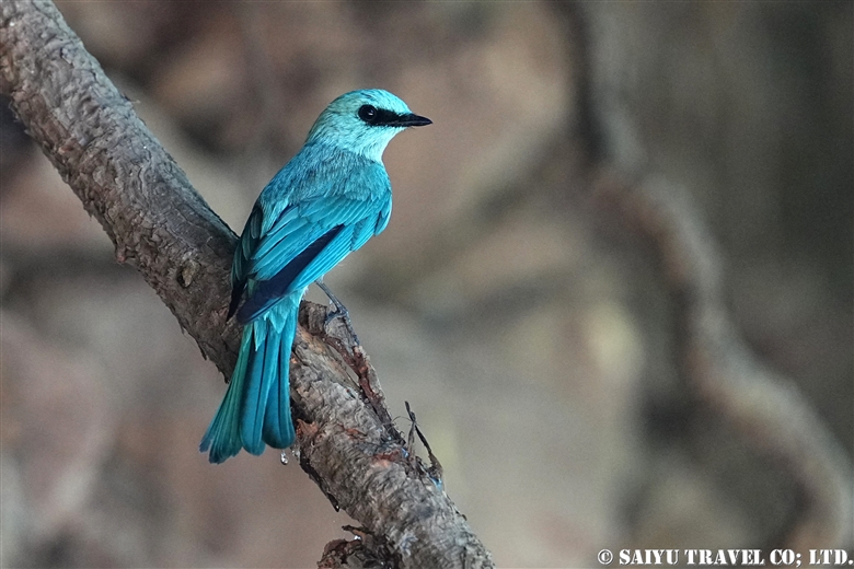
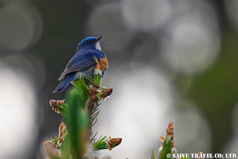
A verditer flycatcher (male). This summer bird is easy to observe as it often perches on top of tall trees.
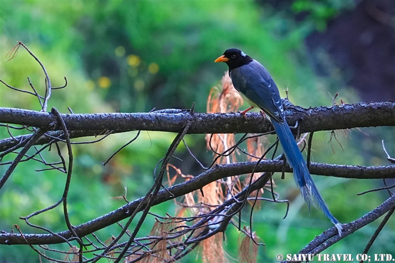
Yellow-billed blue magpie are omnivores and can be encountered in a variety of situations. This family of corvids can be seen year-round in the Himalayan foothills.
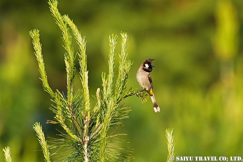
A Himalayan bulbul. This is a species of bulbul found year-round in the area from Swat Valley to Chitral, and from Margalla Hills to Kaghan Valley.
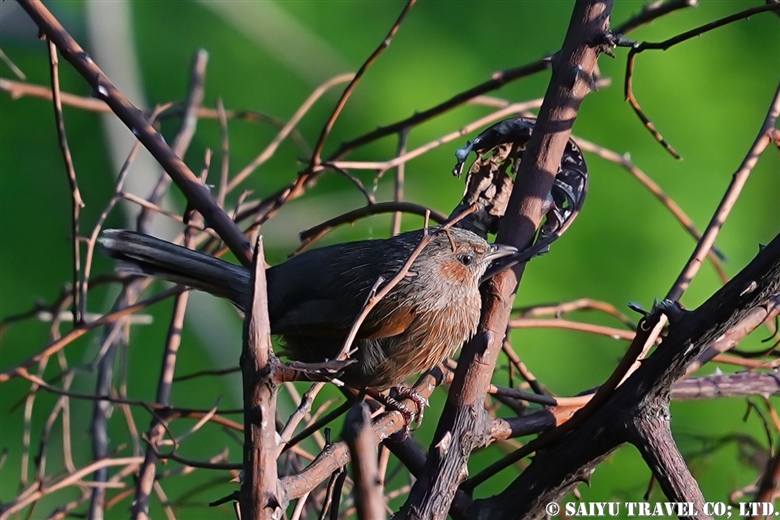
A streaked laughingthrush. This bird is found year-round in northern Pakistan and could be observed daily in the Kaghan Valley.

A grey bushchat (male). This species makes short migrations (between 1900 m~3000 m) in the Himalayas and can be seen everywhere in the Kaghan Valley in summer. Females are buff (cream to light brown) in color.
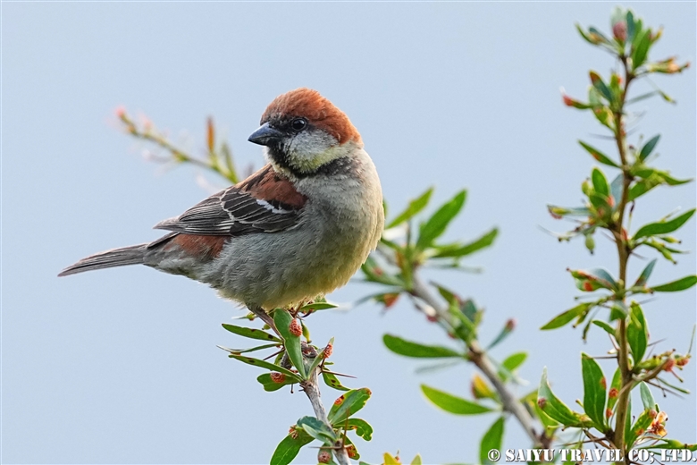
A russet sparrow (male). This species seems to be seen year-round in the Kaghan Valley, but also migrates to the Punjab region in winter.
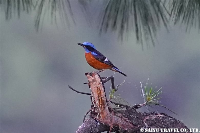
A blue-capped rock thrush (breeding male). A summer bird in northern Pakistan. They migrate to southern India in winter. It would be great to get a picture of the breeding males!
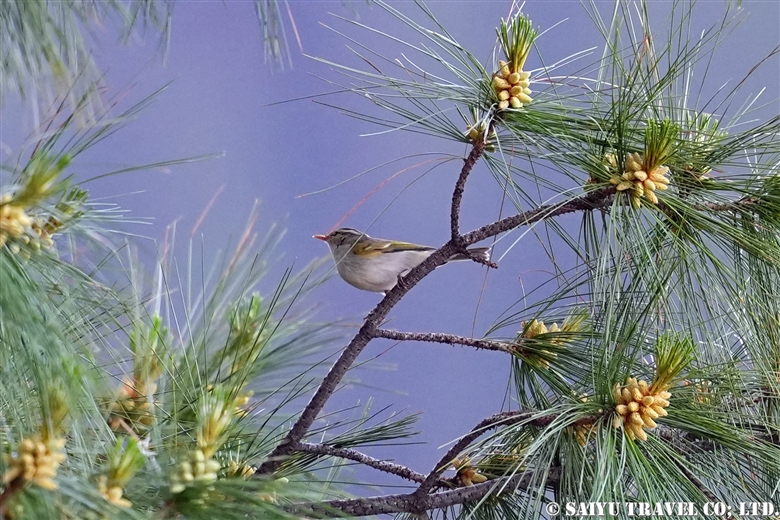
A lemon-rumped warbler. This bird makes short winter and summer migrations in the Himalayan foothills.
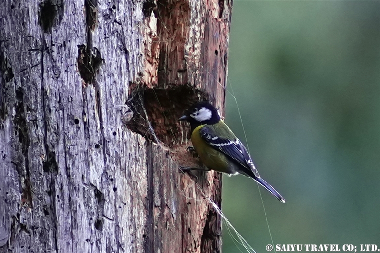
A green-backed tit breeding in a hole in a large dead pine tree. They can be seen year-round, but some migrate down to the Margalla Hills in winter.
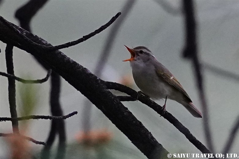
A western crowned warbler, a summer bird of northern Pakistan that migrates to peninsular India for the winter.
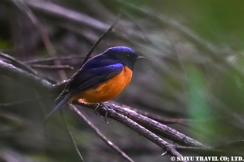
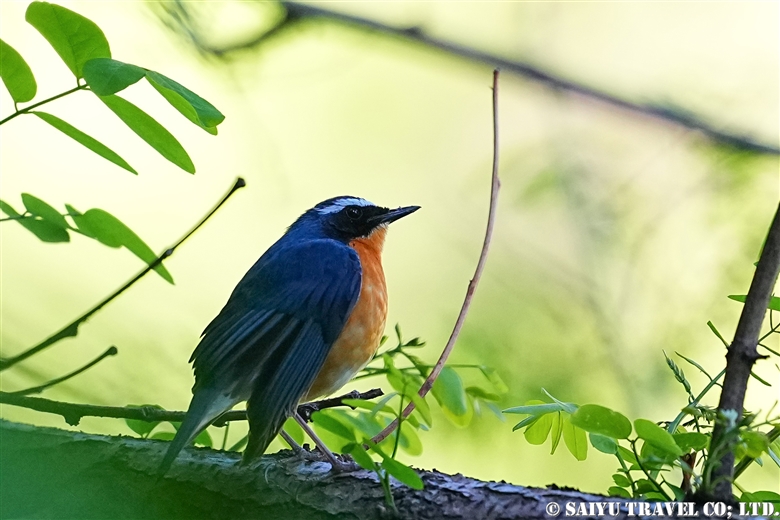
A rufous-bellied niltava. This summer bird is observed in limited areas such as Murree and Kaghan Valley.
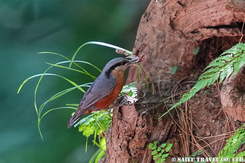
A chestnut-bellied nuthatch. A deciduous forest bird that is seen year-round in limited areas of Pakistan such as Murree and the Kaghan Valley.

A long-tailed minivet (male). Migrates to the foothills of the Himalayas in summer and along the Indus system to the central Punjab Plain in winter. Females have gray backs and yellow bellies.
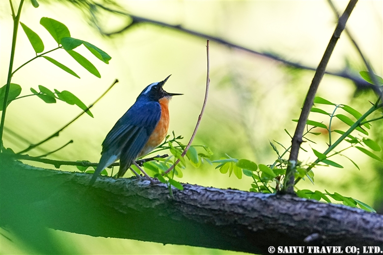
An Indian blue robin (male). A summer bird of the temperate Himalayan forests. Its beautiful chirping echoed in the forest while we were observing it. In winter, it migrates to peninsular India and Sri Lanka, where it can be seen not only in forests but also in tea plantations.
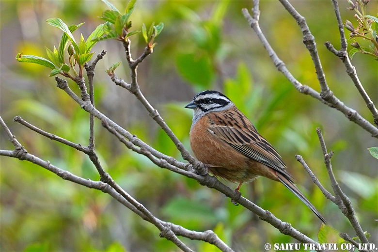
A rock bunting, a summer bird of northern Pakistan that migrates to the Punjab plains and northern Balochistan in winter.
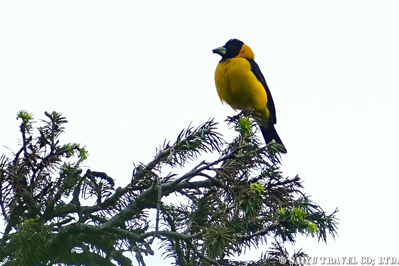
A black-and-yellow grosbeak (male). Found year-round in temperate Himalayan forests.。
A Himalayan bluetail. This summer bird of northern Pakistan migrates to the Himalayan foothills in winter. It used to be treated as a subspecies of the red-flanked bluetail, but due to differences in migration distance and the darker blue coloration of the adult male, it became an independent species.
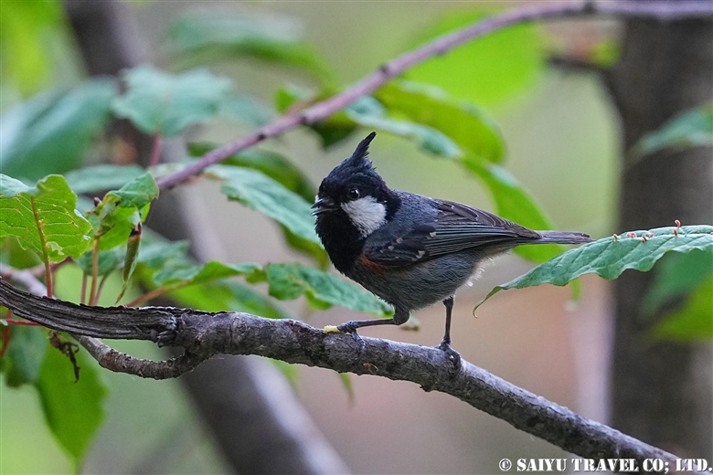
The spot-winged tit or black-crested tit, a bird found year-round in the Himalayan coniferous forest zone, used to be treated independently as a species, but is now considered a subspecies of the coal tit.
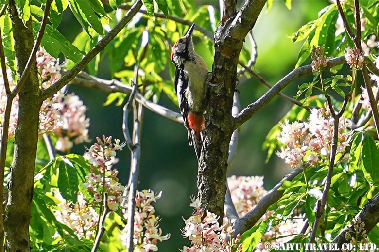
A Himalayan woodpecker (male). This woodpecker is found year-round in the Himalayan forests of northern Pakistan.

Eurasian jackdaws observed from the parking lot of the Balakot restaurant where we had lunch. Their white eyes are very distinctive. We were also able to observe an Asian paradise-flycatcher in Balakot.
On a related note, I would like to share with you some of the other wildlife we encountered besides birds. My encounter with a rare Kashmir langur was so engrossing that I briefly forgot to keep looking for birds. At night, we observed two species of flying squirrels. Thanks to these activities, we had a very busy three days from early morning to midnight.
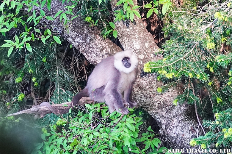
This animal is listed as endangered by the ICUN due to habitat loss. It is a member of the langur family, which is difficult to encounter due to its large migratory distance.
Flying squirrels start their activities at night, when they are no longer targeted by birds of prey, and we got the chance to observe two species, the red giant flying squirrel and the Kashmir flying squirrel, over the course of two evenings.

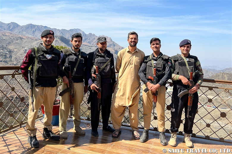
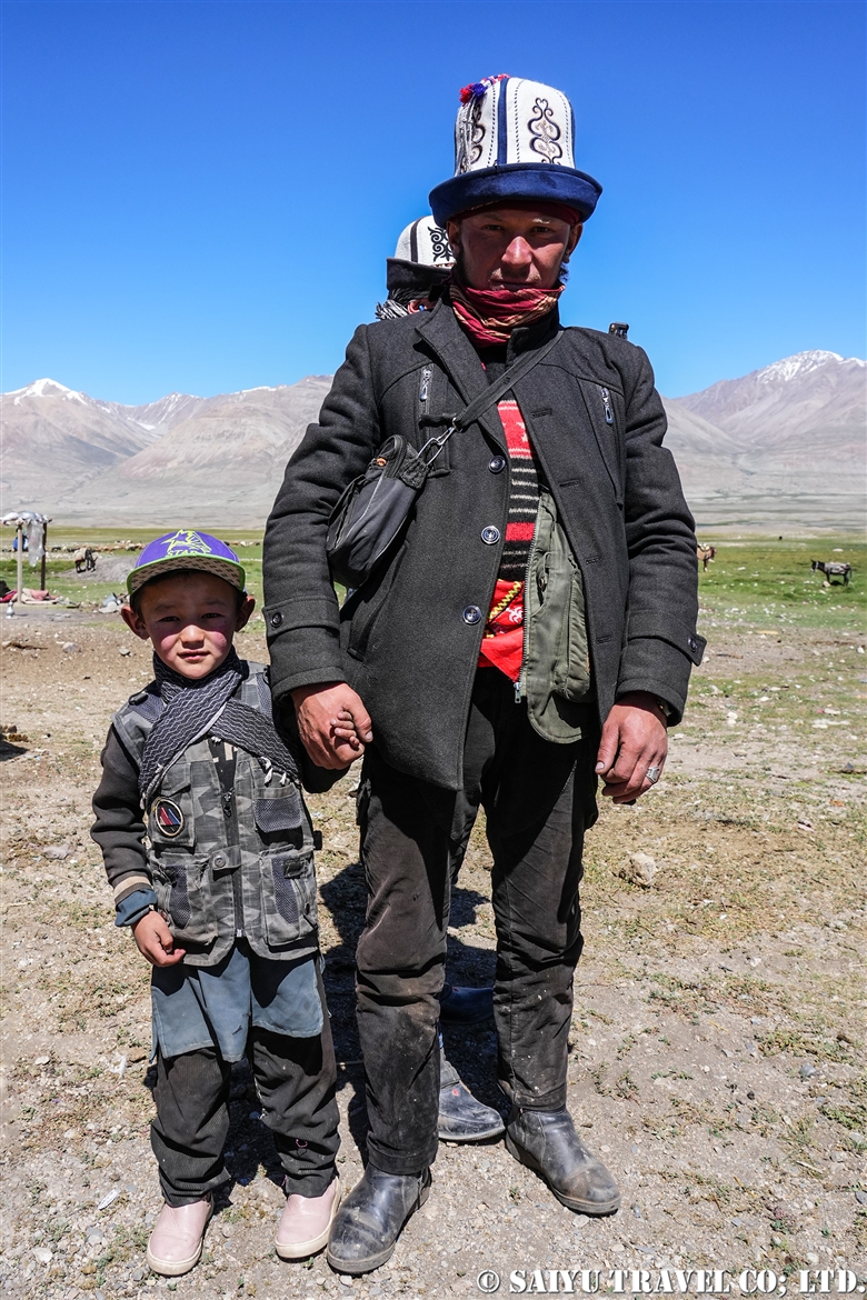
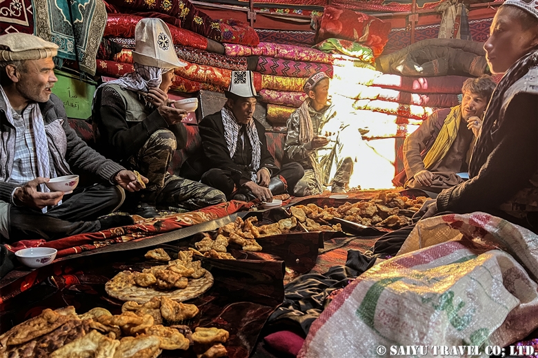
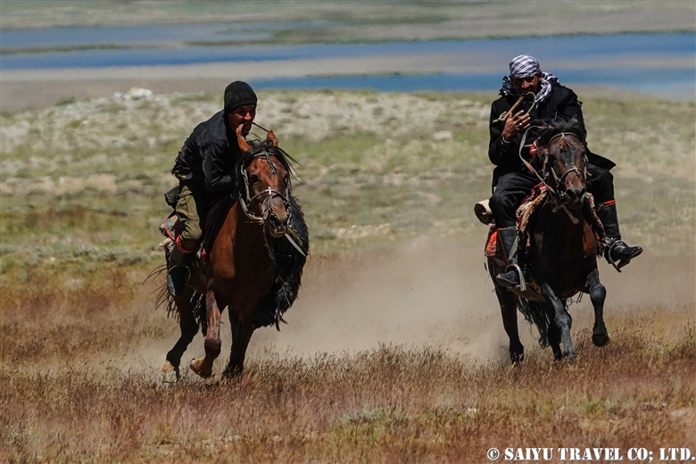
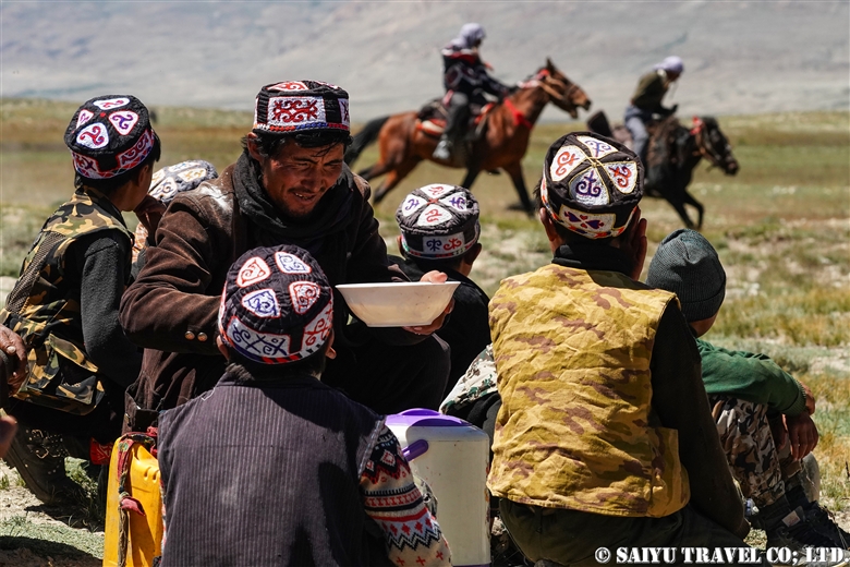
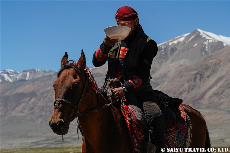
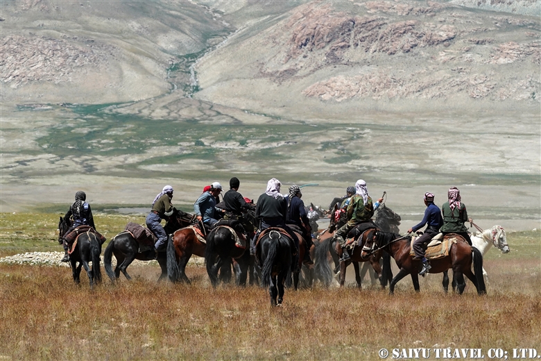
Finally, a photo of some other group members who enjoyed birding together. The birder population in Pakistan seems to be increasing!
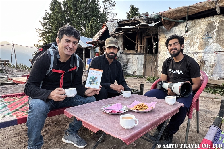
Photo & Text : Mariko SAWADA
*Contact us, Indus Caravan for more information or to make arrangements for birding in Pakistan. >> Visit : Wildlife of Pakistan.
*Please follow us on Youtube, Instagram & Facebook
Category : - Kaghan valley > ◇ Birds of PakistanTag : Birds of Pakistan , Wildlife Tour Pakistan , Pakistan Blog , Birding in Pakistan , Pakistan Travel Blog , Kaghan valley , Travel Pakistan Blog , Kaghan , Wildlife of Pakistan , Himalayan Birds , Indus Caravan , Bird watching tour Pakistan , Pakistan Travel company , Pakistan tour operator , Pakistan Photography Tour , Bird watching in Pakistan , Wildlife Photography Pakistan