
“Bamiyan? There are no more big Buddha statues there, right?”
In March 2001, two huge Buddha statues, one 55 meters and the other 38 meters high, were cruelly destroyed by the Taliban of the time. It was an eye-opening event that made the world aware of the Taliban and the situation in Afghanistan at that time.
Though the Great Buddha has been lost and many of the caves destroyed, the valley of Bamiyan has much more to offer than that. Nowadays, the bazaar has expanded, more hotels have been built, and Bamiyan now attracts domestic tourists from Kabul and other urban areas on weekends as well as foreign tourists. Those who knew the old Bamiyan will be surprised at its changes.
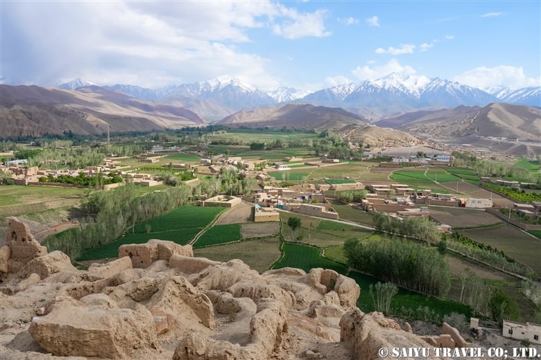
There are two routes from the capital Kabul to Bamiyan. One is the so-called ”northbound route over the Shibar Pass“ and the other is the ”southbound route over the Hajigak Pass“. Both routes lead to the Shahr-i-Zohak, which stands in front of the checkpoint at the entrance to the Bamiyan Valley.

Shahr-i-Zohak
Shahr-i-Zohak is the remains of a fortress located at the confluence of the Bamiyan and Kalu Rivers, 17 kilometers east of the town of Bamiyan. The present ruins of the fort are said to date back to the reign of the Shansabani kings in the 12th century (during the Genghis Khan invasion), but in fact it was used as a natural fortress from around the 6th century. It is said that remains from the Buddhist period were also found. It was also used in modern warfare during the civil war. In the evening sun, Shahr-i-Zohak glows red, giving it the nickname ”Red City.“ From the top of the fort, you can see the beautiful valley along the Kar River.

Passing Shahr-i-Zohak, you can continue to Bamiyan. On your left, you will see the ruins of an old caravanserai, followed by the village of the Hazara people. Soon you will see a group of caves ahead. These are the Bamiyan Caves.
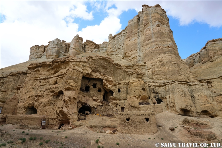
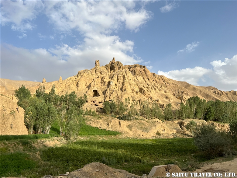
Bamiyan Caves
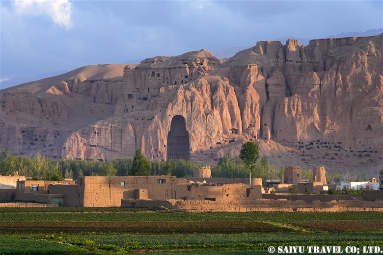
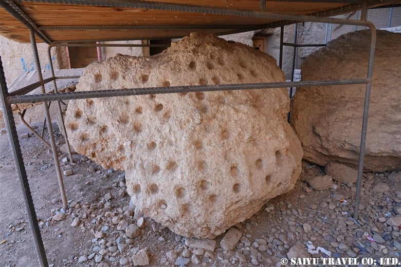
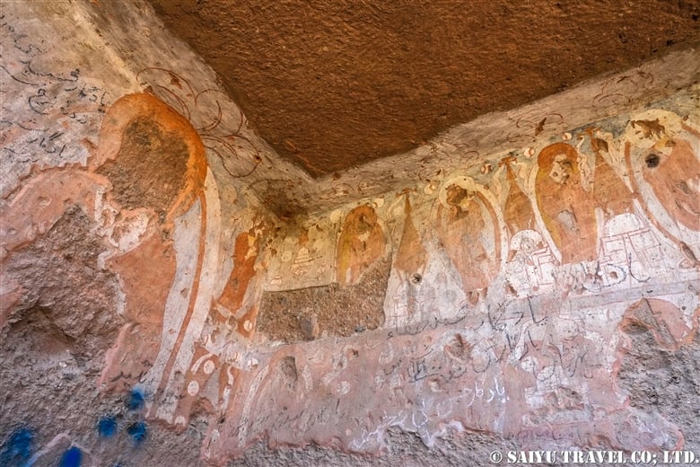
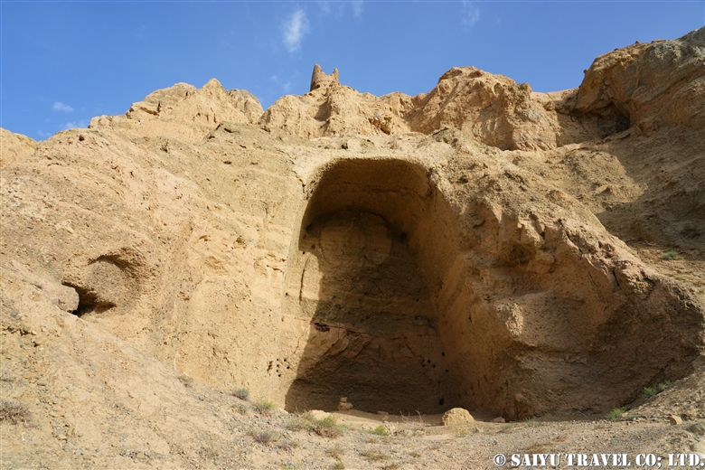
The Bamiyan Caves are comprised of approximately 750 caves built over a length of 1,300 m on the northern cliffs of the Bamiyan Valley. Located on the east and west sides of the caves are the Western Buddha (55 m high) and Eastern Buddha (38 m high), both of which were destroyed by the Taliban in 2001. In 2003, the site was registered as a UNESCO World Heritage Site as the ”Cultural Landscape and Archaeological Remains of the Bamiyan Valley“. In the past, UNESCO and archaeologists from various countries were working to restore and preserve the site, but conservation work has been suspended since the new Taliban regime came to power.
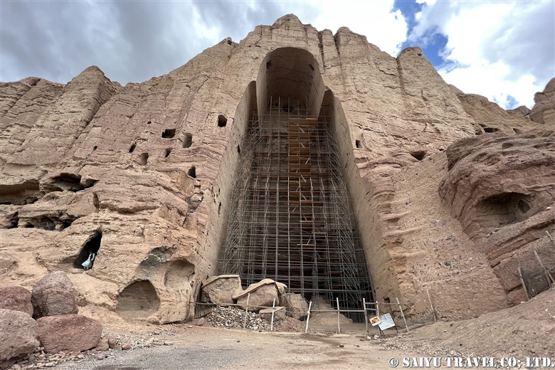
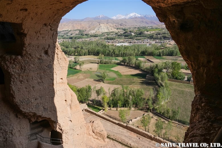
As of 2024, visitors can walk from the West Buddha to the East Buddha and climb the stairs to the interior of the East Buddha. The caves with remaining murals are often locked to protect them from destruction by local tourists.
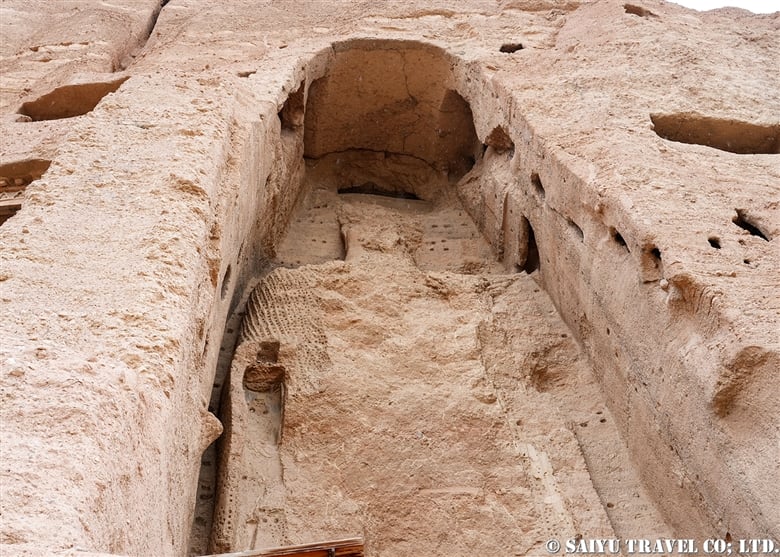
As you go up inside the East Buddha, you can see a view of the Bamiyan Valley from the terraced caves and the terrace near where the head of the Buddha used to be. The area between the Bamiyan Caves and the bazaar has been preserved without development as a UNESCO Scenic Area, but after the new Taliban regime, this has not been followed and new gas stations and stores have begun to be built.
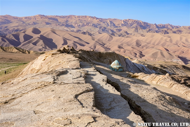
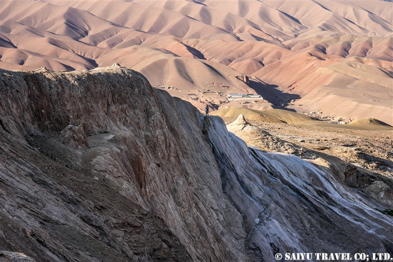
The large hill at the edge of town is Shahr-i-Gholghola.
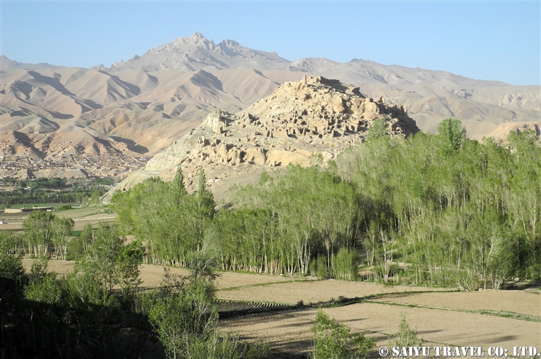
Shahr-i-Gholghola
Shahr-i-Gholghola is the ruins of a fort, which was also known as the ”City of Screams“. 12th century Bamiyan was a prosperous city of the Shansabani dynasty, the successor to the Ghurid dynasty, but it was turned into a ghost town after Genghis Khan’s army attacked the city in 1221. The screams of those slaughtered at that time were the reason for the fort’s name. Although part of the ruins have been renovated and renewed with international aid, some people say that it has been cleaned up too much and was more impressive in the past. From the top of the fort, you can enjoy a panoramic view of the Bamiyan Valley.
In addition to the famous Bamiyan Caves, there are two other cave complexes in Bamiyan: the Foladi Caves and the Kakrak Caves. Both caves are located by the river and are accessible by a short walk. Tourists who visited here before the Soviet invasion used to visit the Kakrak Caves in the evening and call the standing Buddha statue “Sunset Buddha,” because of the view when the setting sun shone on it.
Foladi Caves
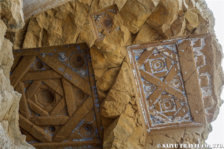
This is a group of about 50 caves built along the Foladi River, which runs along the west side of the Bamiyan Valley. Although the caves are damaged because villagers continue to use them as livestock pens and dwellings, ceiling decorations such as those of the Laternendecke can still be seen. It is a peaceful place where visitors can see glimpses of village life.
Kakrak Caves
A group of caves built along the Kakrak River, which runs along the eastern side of the Valley. These caves are the site of the famous red-toned mural paintings that are kept in the Guimet Museum in France and the Kabul Museum. There was a 6.4-meter-high standing Buddha statue, but it was destroyed by the former Taliban regime in 2001, along with two Great Buddha statues. The ruins of an Islamic watchtower can be seen on top of the caves. Although nothing remains, visitors can enjoy a typical view of Bamiyan Valley while walking through the farmland.
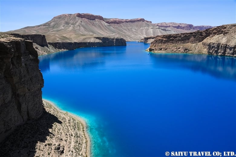
Dragon Valley
The valley is located 9 km southwest of Bamiyan. According to legend, when a village girl was about to be sacrificed to a dragon, a brave man (Hazrat Ali) confronted the dragon and cut it in two. The dragon cried tears of regret. The dragon’s split back is the cleft in the rock, and the ”tears” still flow as a mineral spring. After the civil war, this valley, which had been empty, has grown into a new residential area.
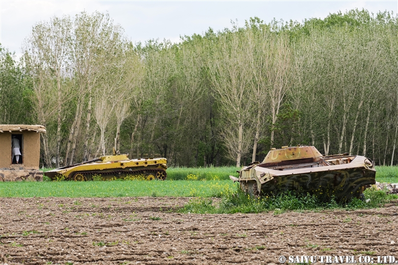
This has been a brief introduction to the highlights of the Bamiyan Valley, but since the topic of our discussion is Afghanistan, some of you may be wondering whether there are still any remnants from the civil war. In Bamiyan and the surrounding area, mine clearing began at an early stage. For a while after the civil war, tanks were seen here and there on the road from Kabul to Bamiyan and in the valley, but they are long gone now.
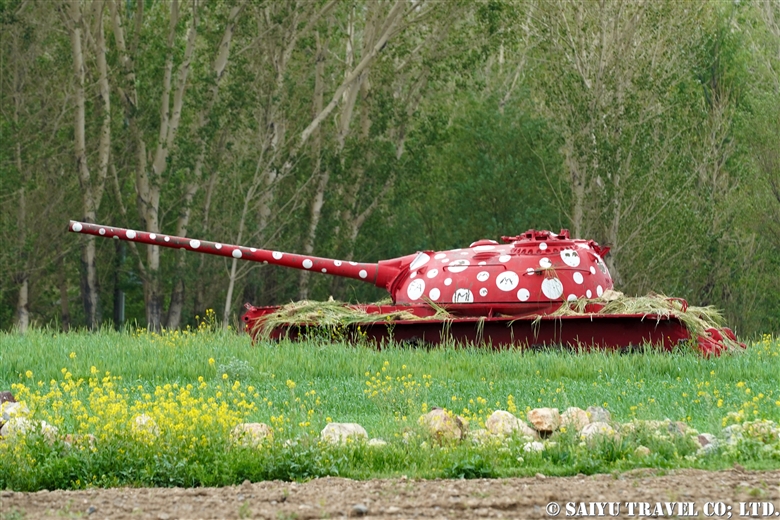
This is surprising, isn’t it? It was painted by an Iranian artist.
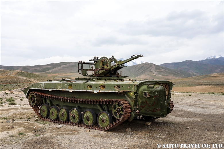
Perhaps the best-preserved tank in the vicinity of Bamiyan is the one on top of Shibar Pass.
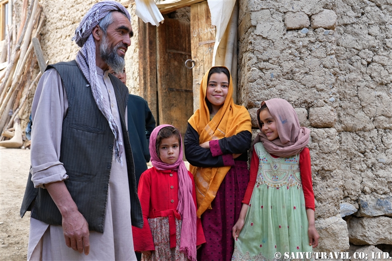
Here we have an everyday scene from the bazaar in Bamiyan.
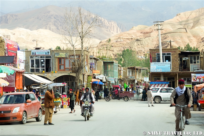
Bamiyan is famous for growing potatoes. Walking around the village, you will encounter many people.


The valley of Bamiyan is photogenic and inspiring enough just for its scenery surrounded by the Hindu Kush mountains and the seasonal life of the Hazara people.
Photo & text : Mariko SAWADA
*Contact us, Indus Caravan for more information or to make arrangements for visiting Afghanistan. >> Our Afghanistan tour .
*Please follow us on Youtube, Instagram & Facebook
Category : ◆Afghanistan > - Bamiyan & aroundTag : Bamiyan , Afghanistan Travel Blog , Indus Caravan , Afghanistan Guide , Saiyu Travel , Afghanistan tour operator , Silkroad Bamiyan , Afghanistan , Hotel Silkroad Bamiyan , Shahr-i-Zohak , Bamiyan valley , Bamiyan Caves , Bamiyan buddha , Shahr-i-Gholghola , Foladi Caves , Kakrak Caves , Dragon Valley