English / Japanese

Pakistan International Airlines, take off from Skardu! The full picture of Nanga Parbat!
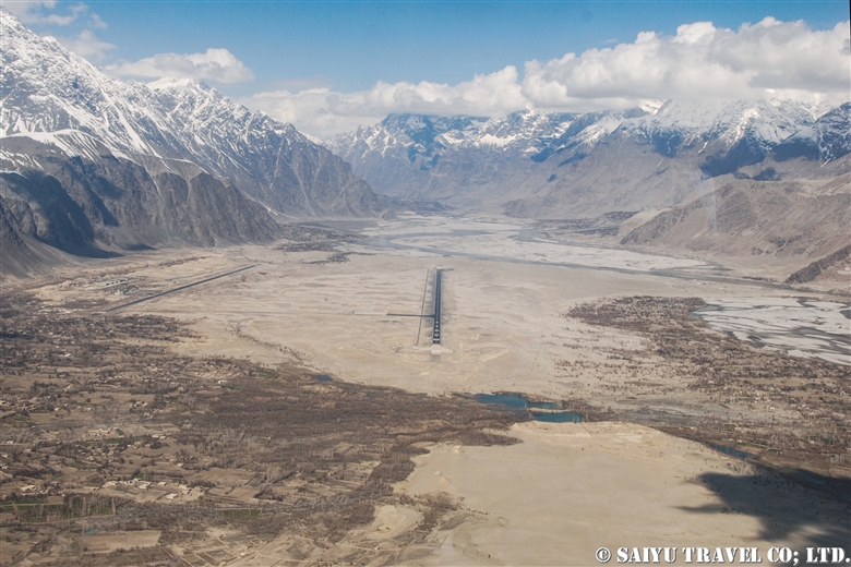
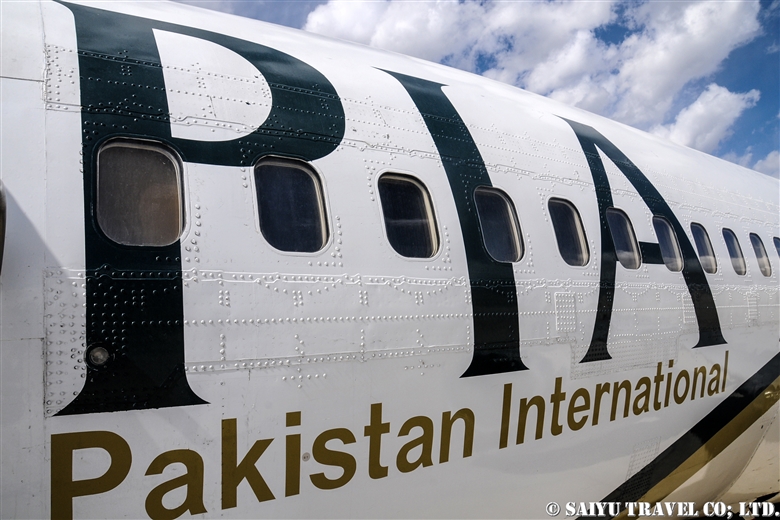
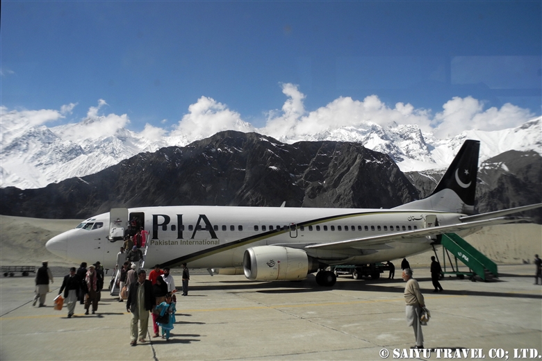
This is a description of my flight from Skardu to Islamabad using Pakistan International Airlines.
The Gilgit flight is usually very early in the morning, and due to the sunrise from behind the Nanga Parbat, everything looks white. However, the Skardu flight takes off a little later, when the sun is higher up in the sky. So it means the mountains are beautifully illuminated, although it may be a little cloudier when compared to the early morning hours.


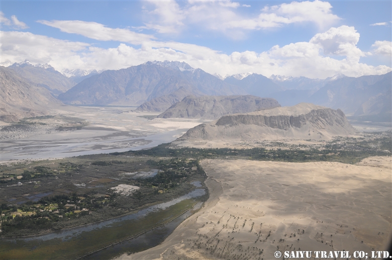
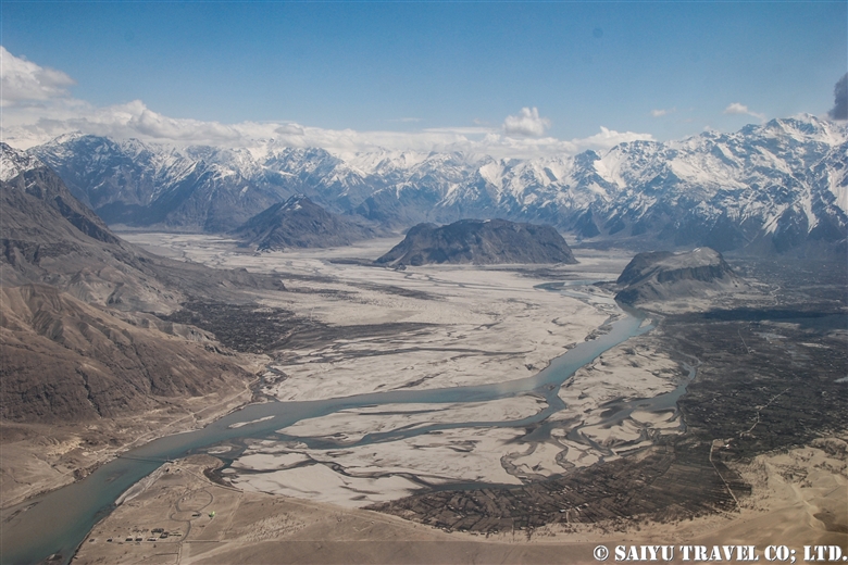
When you take off from the Skardu Airport, you will see the outlying villages on the edges the city, poplar-lined streets, the Indus River, and boundary of the Katpana Desert.


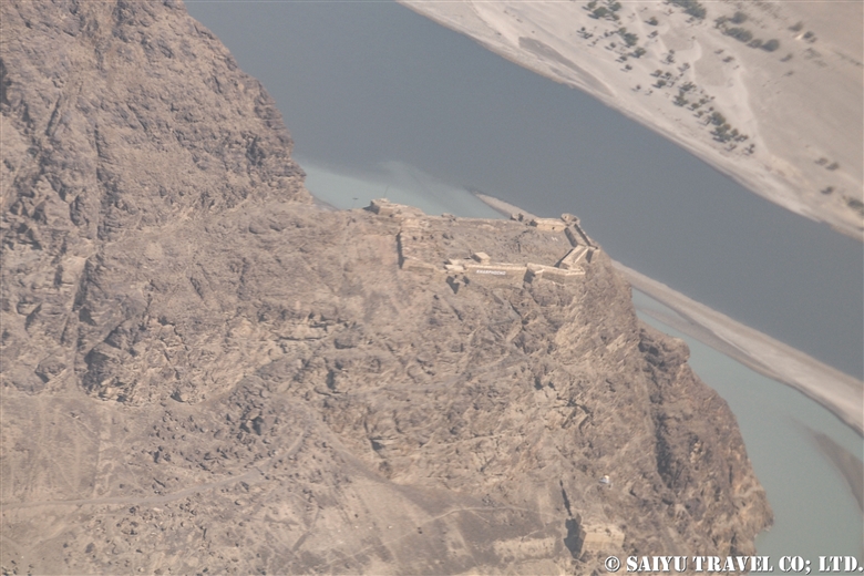
The Skardu Fort, also known as Kharpocho, was built on a cliff along the Indus River in the 16th century.


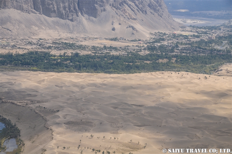
Sand dunes in the Cold Desert can be seen stretching from the Skardu Valley to the Shigar Valley. It is a rare desert at a high altitude of about 2,500 m, which is quite unique in the world. The sand dunes are small and scattered from Ladakh, India’s Nubra Valley to Skardu but the dunes get bigger and more beautiful in the area from Skardu to Shigar.


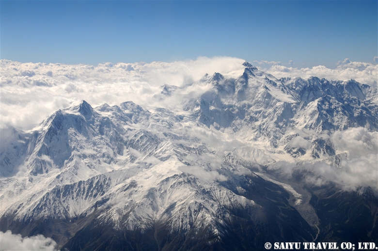
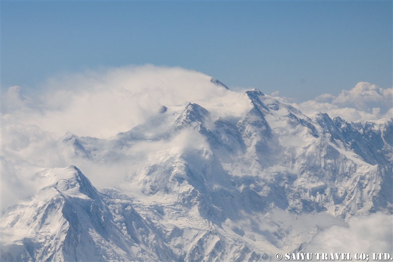
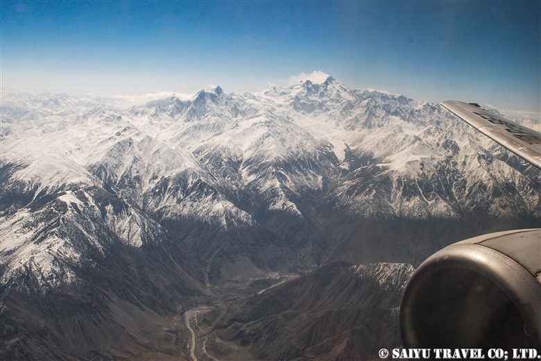
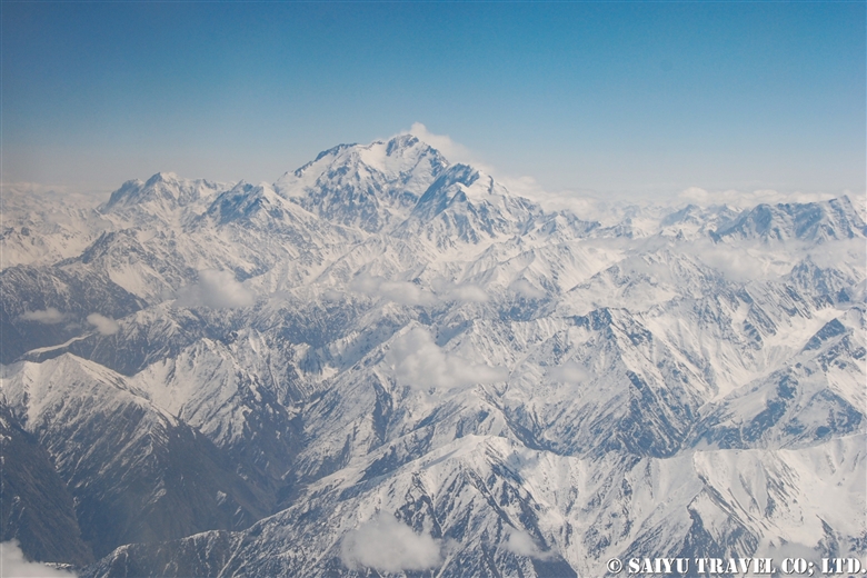
This is Nanga Parbat, the 9th highest peak in the world. When I left Skardu, I thought it would be too cloudy and we wouldn’t be able to see it, but the southwestern side was clear.


The summit looked to be very windy, blowing the snow off the peak.


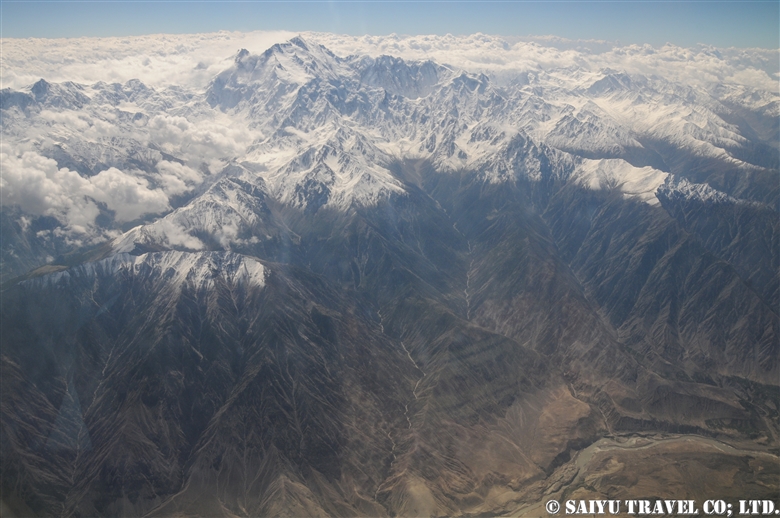
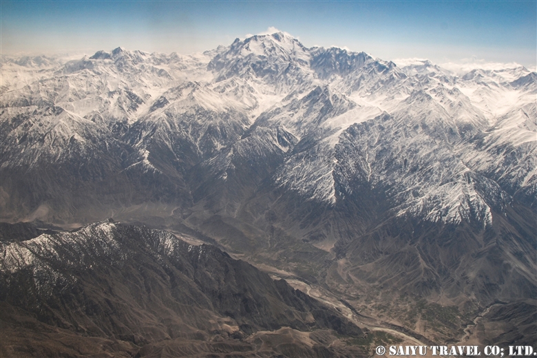
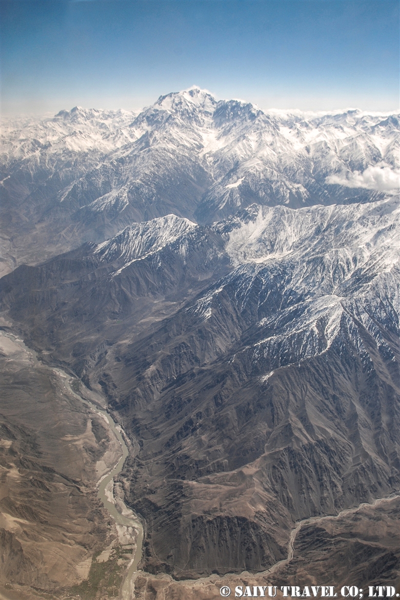
The main peak of Nanga Parbat is at an elevation of 8,126m, and the banks of the Indus River are at about 1,100m. So from the window of the plane, you can see the topography with a height difference of 7,000 m! It’s a really rare opportunity to be able to see 23 kilometers straight down and be able to compare the height of the mountains.


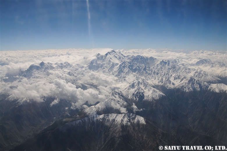
And this is the whole picture of the Nanga Parbat massif. The north side Chongra Peak, Raikot Peak, and the Main Peaks.


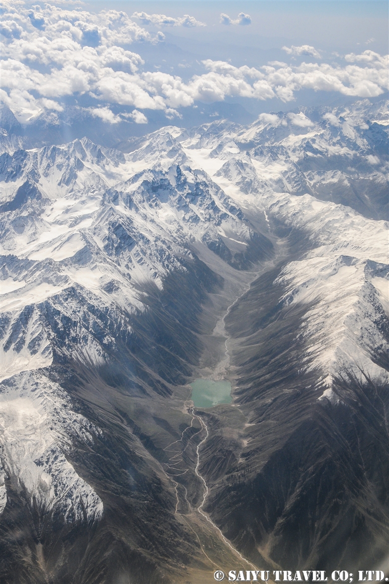
This is deep in the Naran Valley, Saiful Maluk Lake. It used to be such a pristine place, but regrettably, it has become a sad example of a tourist destination that has become full of garbage, due to the increase in visitors in recent years.

Well, we are coming back to reality now, and soon we’ll enter the Punjab Plain and touchdown at Islamabad.


Photo & Text : Mariko SAWADA
※These photos were taken on a September flight from Skardu to Islamabad on Pakistan International Airlines.
Category : ◆ Gilgit-Baltistan > - Skardu Valley > - Nanga Parbat / Himalaya Range
Tag : , , , , , , , , , , , , , ,

Best Views of Nanga Parbat! PIA Pakistan International Airlines ★ Skardu Flight

A panoramic view of the Nanga Parbat massif from a flight from Islamabad to Skardu

These mountain flights in northern Pakistan are often canceled. The reason is, of course, the quickly changing weather in the mountains. Considering that, in the last few years, the flight rate has improved considerably. In particular, if you were to try to move by car the distance of the Skardu flight, it would take two full days by land. But taking this “picturesque flight” it only takes one hour to travel the same distance.
You should really see this scenery from the Skardu flight! For the Skardu line, if taking the regular route (depending on the weather), you will see Nanga Parbat on the right and K2 on the left (if you are lucky!) just before arriving in Skardu. K2 is often hidden by the clouds and is only visible a little at the very end of the flight. So sitting on the Nanga Parbat side will give you more time to enjoy the mountainous view.

When you take off from Islamabad, you will increase altitude while slowly circling up in the Punjab Plain. Soon, you start to see the mountainous view at the western end of the Himalayas. If you look closely below, you can also see the Indus River and the Karakoram Highway running alongside it.


Nanga Parbat is seen as a gigantic mass of mountain. It is 8,126m, the 9th highest peak in the world.


My personal favorite is to see both the Indus River and Nanga Parbat. It’s hard to see in the photo, but below you can see the Indus River and the Karakoram Highway. The Indus River is a large river that crosses the border from Ladakh, India, and enters Pakistan passing through Skardu, and flows beyond that into the Arabian Sea.
This great mountainous region of Pakistan borders the Indus River. The Himalayas to the south of the great river and the Karakorum Mountains to the north of it. This is where the ancient Indian Plate and the Eurasian Plate collided to form these vast mountain ranges.
 

And in this photo, at the bottom, the altitude of the riverbank of the Indus River is 1,100-1,200m, while at the top, the summit of Nanga Parbat is 8,126m. If you draw a straight line, there is a height difference of 7,000m in a distance of about 23km!


Shortly after the view of Nanga Parbat disappears, you enter the Skardu Valley. Surrounded by the mountains of Karakorum, the open valley of Skardu contrasts so much. It is a magnificent view shaped by the Indus River.


Pakistan International Airlines circles around the town of Skardu, which is like an oasis lined with poplar trees. You will see Satpara Lake and finally land at the airport in Skardu.
 

Arrived safely in Skardu.

Can you see the mountains if you can’t get the window side? ···Nope!  There is no choice but to take turns looking out the small airplane windows. And…should your flight be cancelled, you have to stay flexible and just be content to enjoy the views of the Karakoram Highway and the mighty Indus River from the car!


Photo & text: Mariko SAWADA

*The photo is taken from the right seat of the actual Pakistan Airlines Skardu flight.

Category : ◆ Gilgit-Baltistan > - Skardu Valley > ◇ Mountain of Pakistan > - Nanga Parbat / Himalaya Range
Tag : , , , , , , , , , , , , , , ,

Crossing the Gondogolo La Pass from the Baltoro Glacier

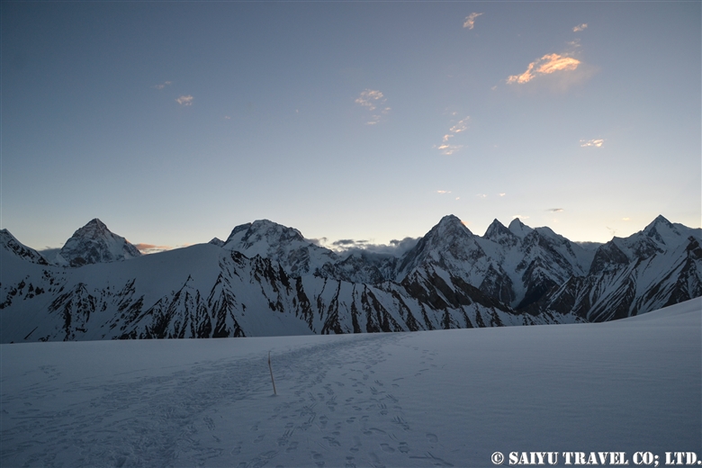
The quiet peak of Karakorum before dawn seen from Gondogolo La (pass). From the left, K2, Broad Peak, G4, G3, G2, G1.


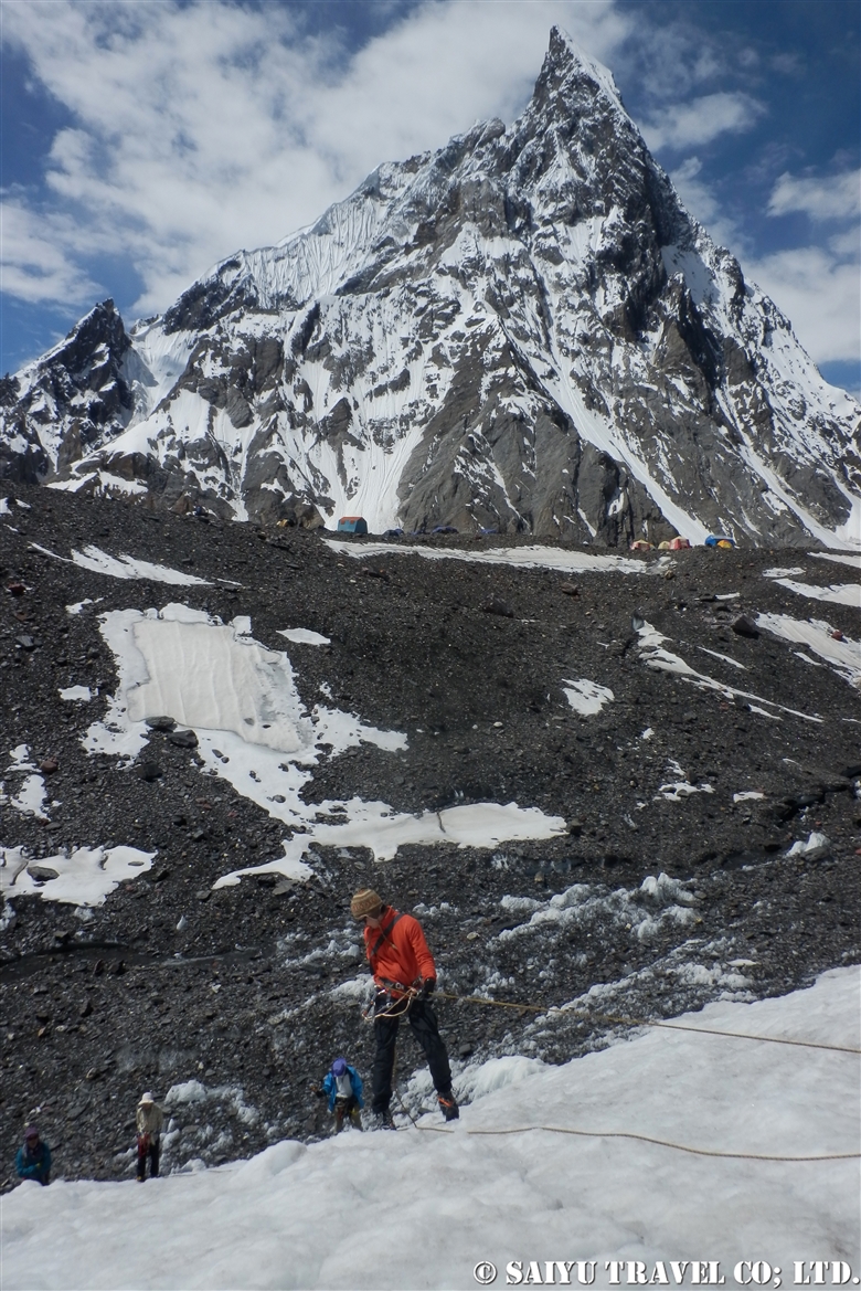
The route over Gondogoro La (at 5,680m), considered to be the ultimate trekking route to see K2, the second highest mountain in the world. As it requires snow wall climbing gear, make sure to check the rope work skill  thoroughly.


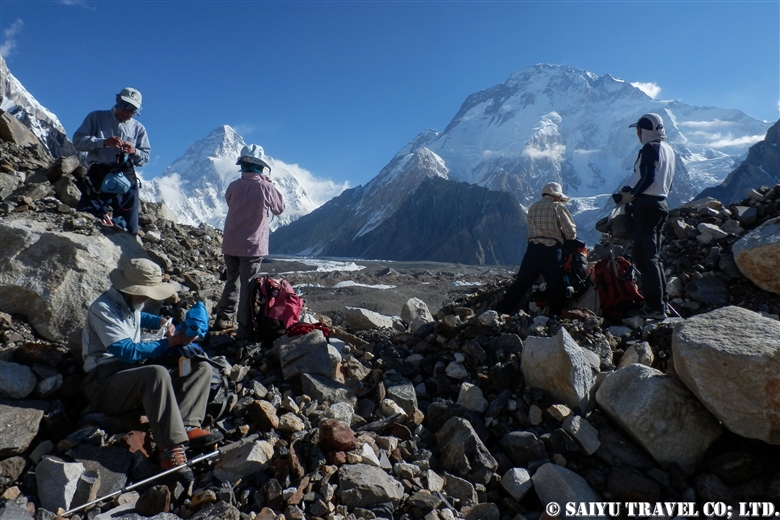
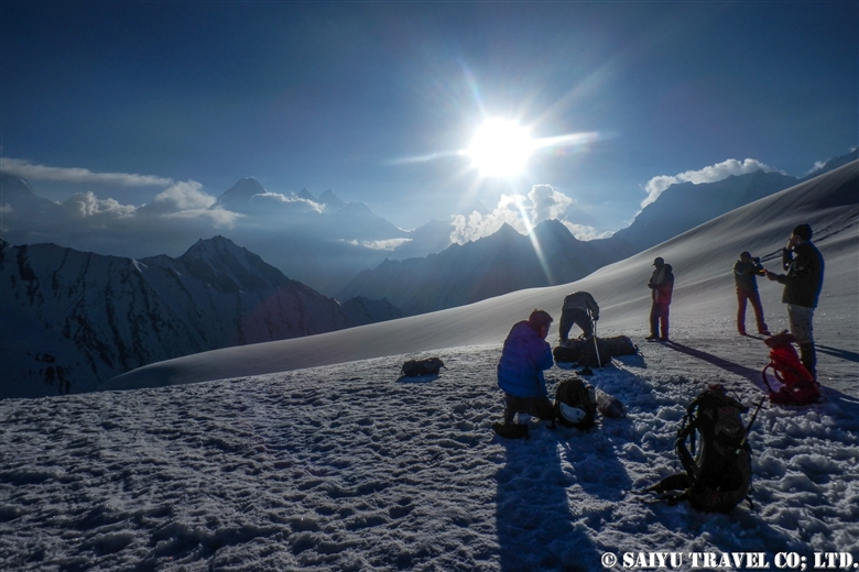
Taking glimpses behind us at K2 and Broad Peak, every now and then, we head toward  our base camp, Ali Camp (5,010m), to get over Gondogoro La. Checking in with the Islamabad office by satellite phone, we get the weather report. Fortunately, it will be clear tonight, so without hesitation, we decide to make our climb before dawn.


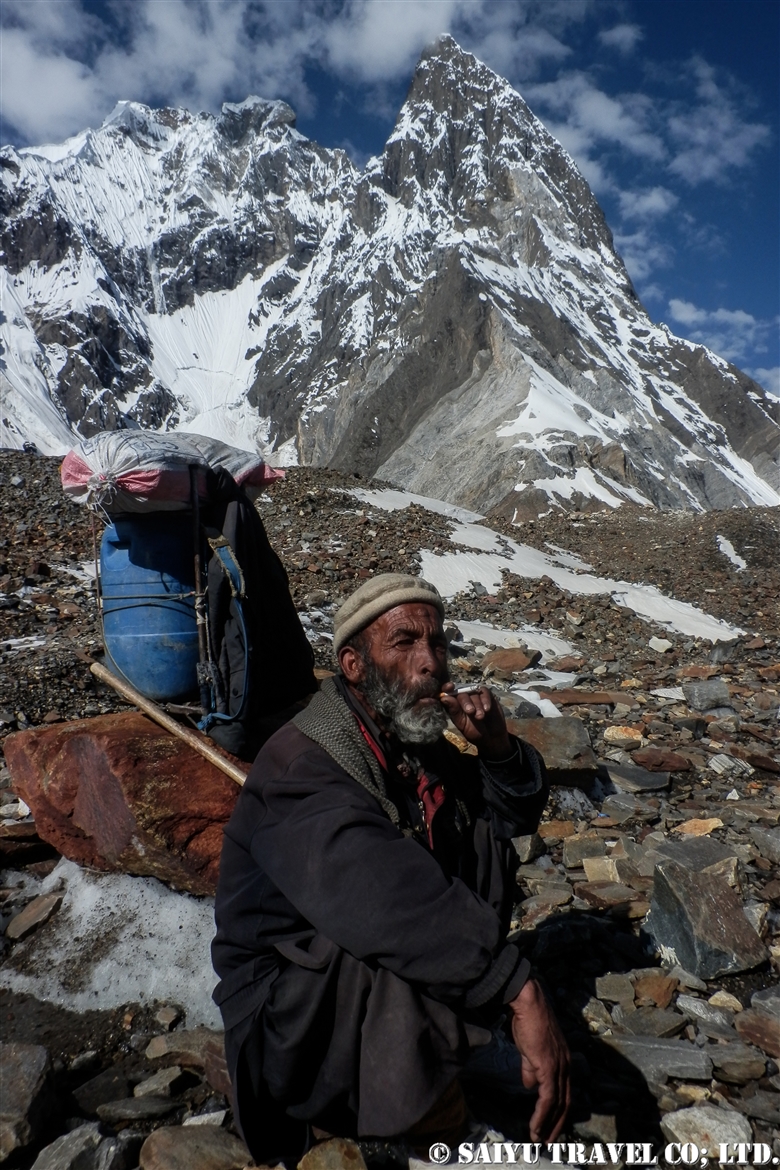
Our porters always carry the heavy equipment that we all use. This elderly man passed us quickly as we all crossed the Gondogoro La Pass, without much difficulty and waited for our mountain descent back at the camp. The local staff are always amazing through it all. Hats off to them for sure.


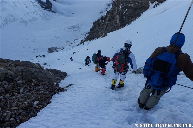
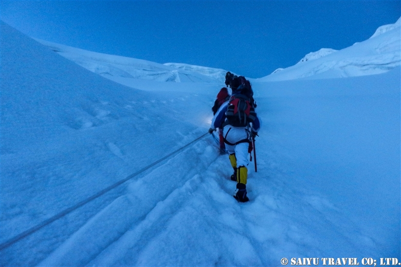
1am: Head out from base camp. Climbing up a snow wall using jumar, with an average slope of 50 degrees.


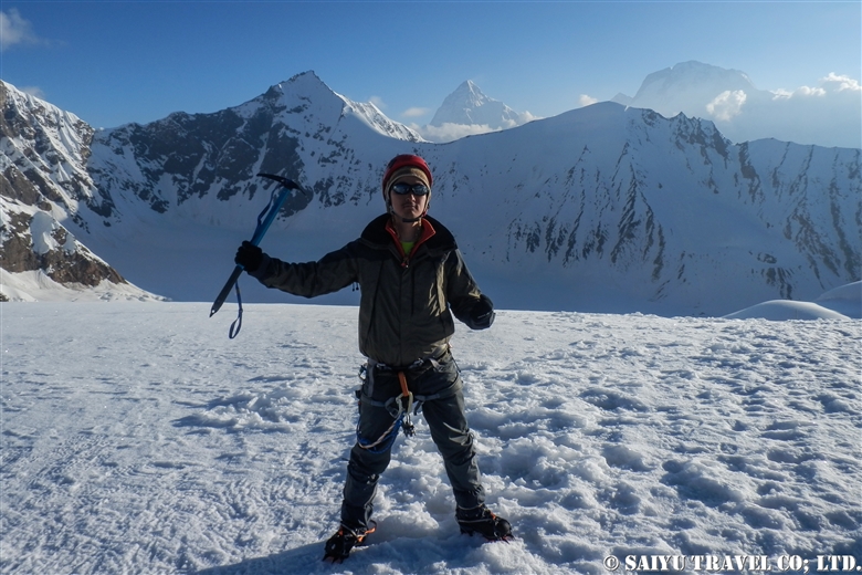
At last, 5:20 on July 6, 2012, we arrived at top of Gondogoro La!
A photo of my youthful self and the ridgeline behind me are K2 and Broad Peak.


As the sun rises, the down slope becomes a little loose and the risk of avalanche and rockfall increases. We rushed to get down the mountain.


A long, steep descent is more difficult than the climb up.


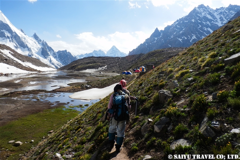
We arrived in a totally different world from the snow and ice world we just left high above. Camping in Khuspang, a lush campsite where so many alpine plants bloom.

I could finally let go of all the tension I was storing until now, and I slept like a log.


Photo & text :  Tomoaki  TSUTSUMI  from the expedition in Jun-July 2012


Category : ◆ Gilgit-Baltistan > ◇ Mountain of Pakistan > - Karakorum Range
Tag : , , , , , , , , , , , , , ,

”Kuch”, a summer in Shimshal Pamir

In northern Pakistan, near the border with China, we spent time with the women of Shimshal village as they take their livestock to the ‘Pamir’ in a migration called “Kuch”. This is about our Kuch experience, which took place in June 20, 2011.

In 2010, due to the traffic restrictions around Attabad Lake on the Karakoram Highway, I was unable to participate in the Kuch. In 2011, our   “Shimshal Pamir” tour became a kind of event with participants who wait for a year. For the Shimshal Village, it ended up being the biggest ever ‘Yak Safari’ group since they started tours to the most difficult Shopodin Pass at 5,346m. It was made up of 52 yaks and 61 people, making it the “Big Kuch” including our group.
These photos show the state of Kuch in 2011. The number of women joining Kuch has drastically reduced in 2018 and 2019, making this tradition a thing of the past, unfortunately.


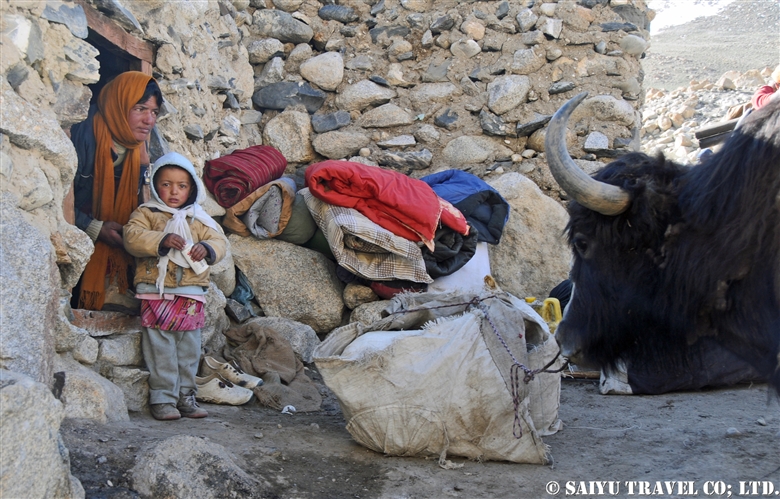
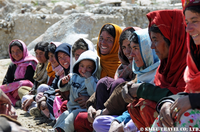
On the morning of Kuch, we left the camp where shimshal’s women  had been staying at from May 20 to June 20. As we shut the door behind us, we said goodbye to our life in the summer village of Shuizherav (or Shuizerav). The elderly women, give us all a traditional send-off, with their cupped hands turned up, as a sign of respect.


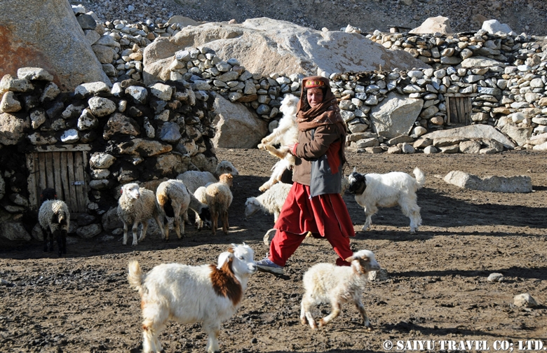
The corral of the sheep and goats was opened, and the large group climbed up to the first pass. The local woman, walks while holding the fragile things like a lantern and even a newborn goat that is still unable to walk.


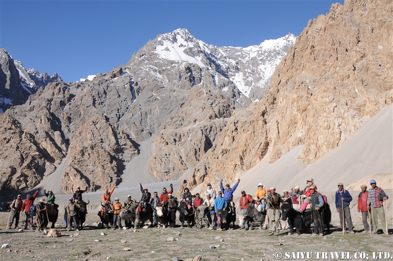
They made time for us to take a commemorative photo together just up the Shuizherav Hill. The Kuch tradition can only be carried out with the close cooperation of the whole family and good friends of their fellow villagers.


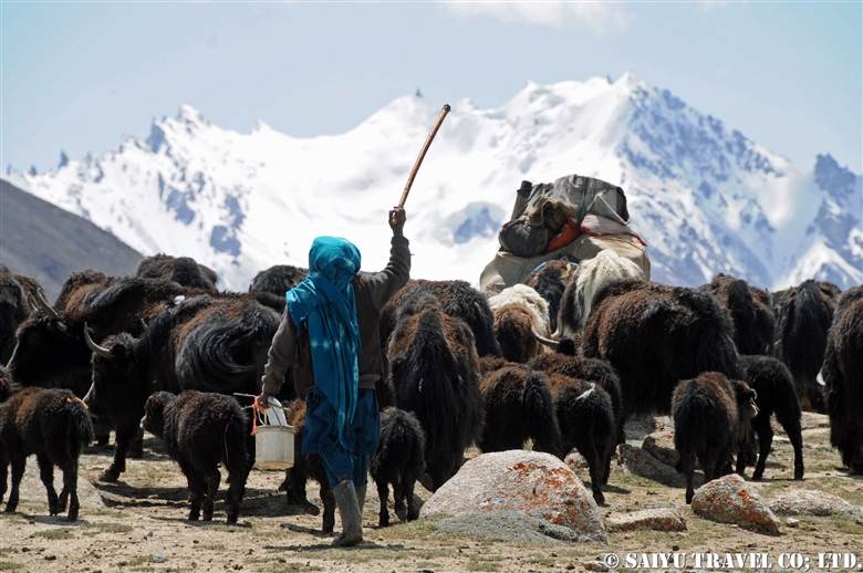
Shimshal women carrying children and goat kids in their arms. The goats and sheep walk slower, so the women take care of them as a separate group.


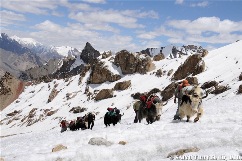
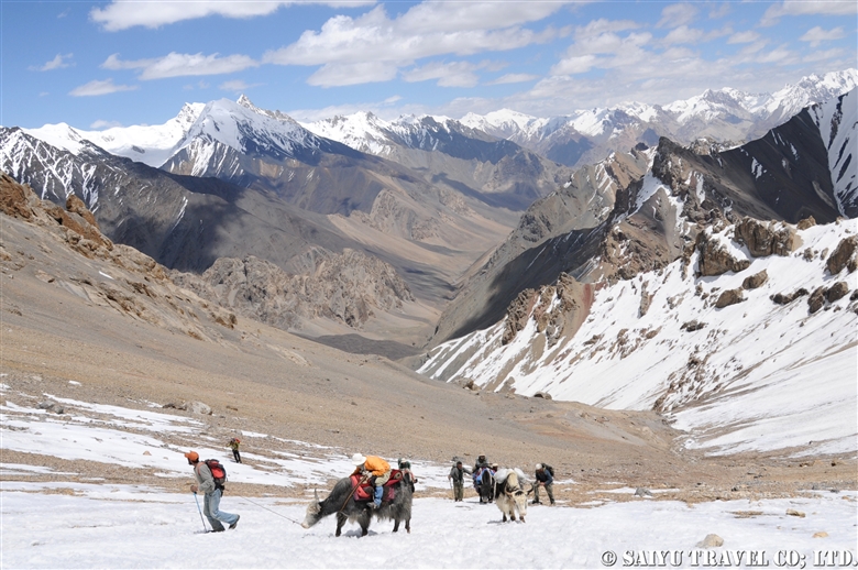
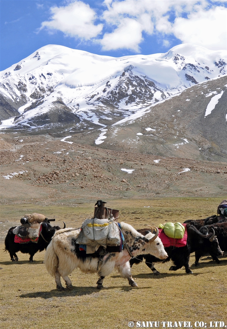
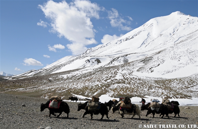
Our group was riding along on the yak, together with the female yaks and the group of calves. During the Kuch, the Yaks are being pushed along from behind, so they tend to walk a little faster paced then normal. I was simply blown away by the powerful women of Shimshal, as they power walked at such high elevations of around 4,500m.


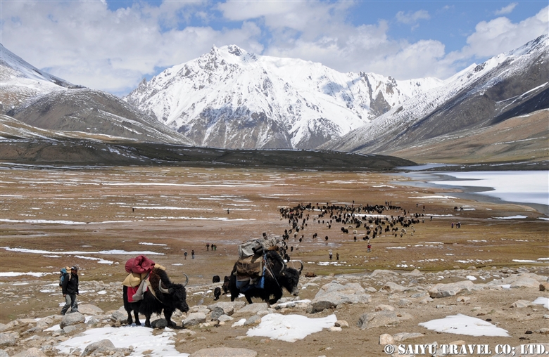
As I looked behind me, the herd was coming up from behind us. From the Shimshal Pass (4,735m) with female yaks and calves group along with the villagers, we aim toward our destination of Shuwerth. I was so overcome by excitement, that I forgot about the high altitude.


The Shuwerth summer village (4,670m) is where the women will live from June 20 for three months. Called the ‘Pamir’ by the Shimshal villagers, it is a rich field where humans and livestock live close together. I was invited to take part in the ceremony to give thanks to their God for our safe arrival in the ‘Pamir’, and then ate some Shimshal cheese together with the everyone.
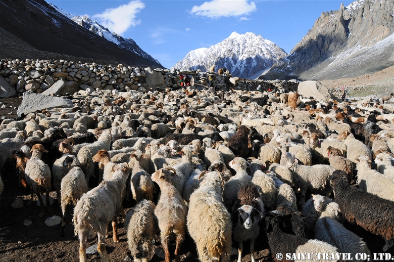
So many goats, sheep and yaks…too many for me to count. In the midst of the baa-baas (crying sounds of the goats and sheep) and the moo-moos (crying sounds of the yak calves), there is a shared sense of presence as we are making our way together towards ‘Pamir’. It will be my treasured memory forever.


Photo & text: Mariko SAWADA
Visit: Jun 2011, Shimshal Pamir, Shimshal, Gilgit-Baltistan

※This article is updated and based on the blog “Salaam Pakistan” which was first uploaded in July 2011. The Shimshal kuch tradition is rapidly waning. I have heard that you can no longer see many women from the villages in 2018 & 2019.


Category : ◆ Gilgit-Baltistan > - Shimshal
Tag : , , , , , , , , , , , , , , ,

Shimshal Pamir : Getting Over the Shopodin Pass(5,346m)with 52 Yaks and 61 People

This entry is about the the Shimshal Pamir journey in June 2011. In this trip, I was focused on the ‘yak route’. In 1993, the ‘Tang route’ was created because the Yaks could not pass there.  This ‘yak route’ allowed the Shimshal people to connect to the meadows, passes and villages together during their seasonal passage. One of the most daunting, as well as a highlight of the route, is going over the Shopodin Pass (5346m/ 17,540ft).

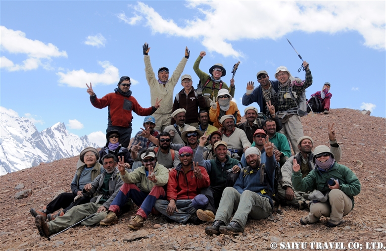
This time, as a record in the history of Shimshal, 52 yaks, and 61 people (11 Japanese, 3 Saiyu Travel staff of Pakistan [Pakistanis] and 47 Shimshal villagers) challenged the pass.


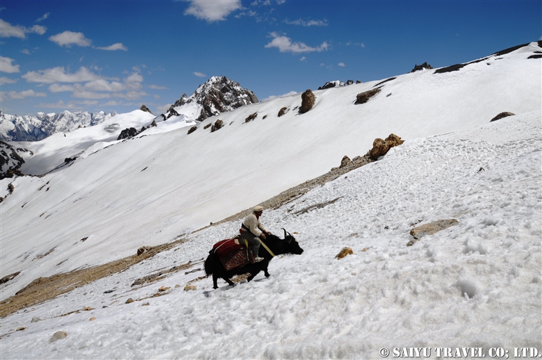
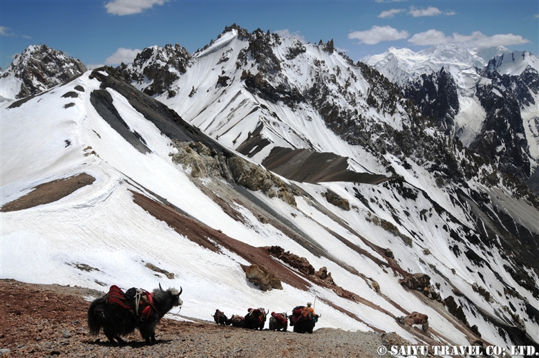
Climbing the Shopodin Pass. At the end of June, after over 5,000m elevation, there were pockets of remaining snow, and the melting snow water created muddy waterfalls. I climbed over a 150m of rocky terrain and from there on, rode on a yak directly to the top of the pass.


Nearing the top of the pass soon. This is Mr. Qazi, who is known as the Shimshal village ‘Yak Master’. In his youth, he had climbed high peak in the past, but today, he rode his own yak over the pass.


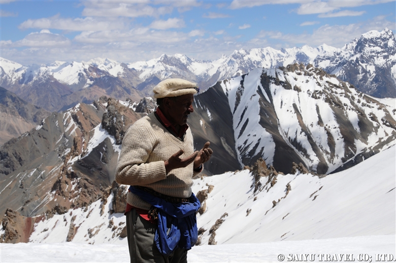
Just before reaching the top of pass, we offered our prayers of gratitude.


At the top of Shopodin Pass. Blessed with good weather, the view of the pass where we reached with the yak and the villagers was utterly breathtaking. From the cliff edge of Shopodin Pass at 5,346m, the even taller ranges of the Upper Hunza Passu’s Sispare and beyond to the Hisper Mustagh mountain range’s Distaghil Sar, Adver Sar, etc. a panorama of 7,000m peaks, an amazing landscape spreads out before us.

Later, there was a celebratory dance on the top of Shopodin Pass. When you are happy, you dance…that is the culture of the Pakistanis in the city as also, for the Pakistanis in the mountains. In this Shimshal mountain trip, I heard many times, the songs by the elders, ‘Pamir means a rich pasture where humans and livestock living together’. I was deeply touched by this song which celebrates living with nature and giving thanks to the beauty of it.


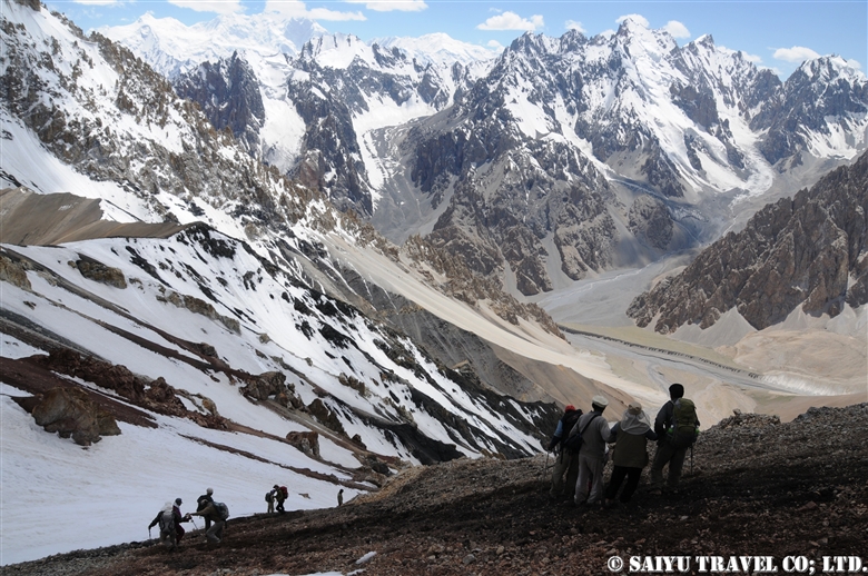
So the difficult thing about the Shopodin Pass, is not uphill but the downhill climb. The dry 35-degree inclination downwards opposite the snow slope is the hardest section of the pass. Some paths are muddy with the snow water, and some are slippery rocky ledges.


It took about 2 intense hours of downhill paths, until we could reach the destination of the Zargarben – Shopodin camp site. Of course, the yaks could make their way down quickly and were already there eating grass when we arrived.


The next day, we arrived at Shimshal village. It would be the last day where I would walk together with the yaks and villagers. There was only a few more hours to be together with the team, that had challenged the journey for the last 12 days.

I offer my deep gratitude to the Shimshal villagers, the yaks and their handlers, the mountain guides, porters and everyone who participated in this tour.


Photo & text: Mariko SAWADA
Visit: Jun 2011, Shopodin Pass, Shimshal, Gilgit-Baltistan

※This article is an updated version of the blog posted in ‘Salam Pakistan’ in July 2011.

Category : ◆ Gilgit-Baltistan > ◇ Mountain of Pakistan > - Shimshal
Tag : , , , , , , , , , , , , , , , , , ,

Shimshal Pamir: Will you try the Kuch? I did!

Shimshal Pamir’s summer KUCH, a Summer migration
If you know anything about summer in Shimshal, then you know there is a big part of life the “Pamir.” This is the tradition of  KUCH, where the villagers move their livestock from Shimshal Village at the end of May. They first go to the summer village of Shuizherav and then at the end of June, make their way to the second summer village of Shuwerth.


Will you try the kuch? I will kuch!
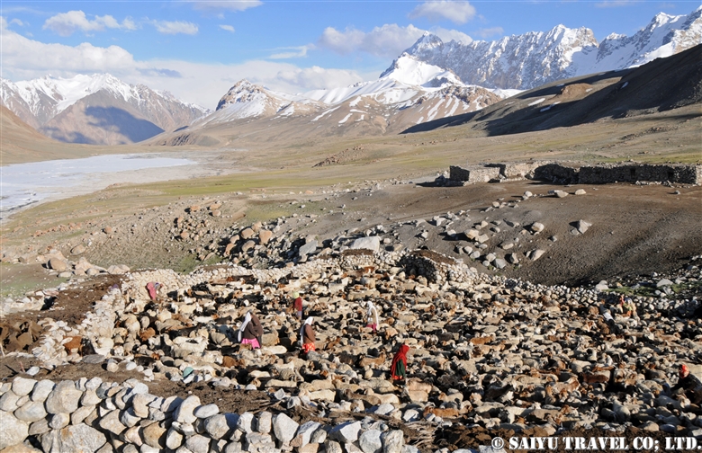
It happened one day in June 2009. I walked along the Yak road to Shuizherav. My slow pace meant that I was overtaken by the Shimshal villagers. Everyone who passed uttered “Kuch” again and again. In order to help out with this great migration, everyone from men to the youth return from the city and gathered in the Shuizherav village. The exhausted goats and sheep had already started to gather in large numbers by the time we reached Shuizherav. As we all waited for the day of kuch, amongest the flocks of sheep and goats all surrounding my tent, day and night, I could participate in milking the sheep and goats. This was an amazing chance to experience summertime in the Shimshal life.


Heading towards the Pamir
It was decided last night, as I was told “Tomorrow is the kuch.”

Securing the household goods to the male yak, the house was cleaned up, and by 9 am the first group of yaks depart. Then the yak’s enclosure was opened and everyone started heading towards Pamir. The sheep and goats walk a little slower and arrive a little later. On the plateau, at the foot of Minglik Sar, you will pass the beautiful lake Lup Zoi, then eventually you will cross Shimshal Pass.


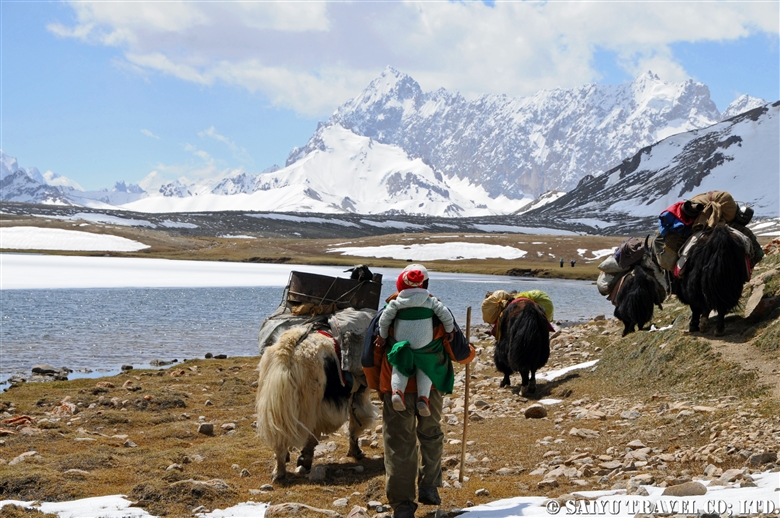
The yaks carry the load of household goods and pass in front of the 6,000m (19,685 ft) peak of Minglik Sar, in Shimshal. The yak carries a stove that has inside a baby goat that cannot walk.


Looking back from here, there is a panoramic scene of the yaks moving in. Forgetting that we are at an altitude of 4,900m (16,076ft), we are happily walking with the yaks to the summer village of Shuwerth in Pamir.


The herd of female yaks and the children as they cross Shimshal Pass.


The special ceremony to celebrate the kuch and summer life.

Start of the Summer for Shuwerth
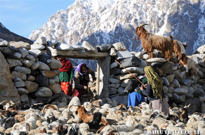
The villager women of Shimshal live in Shuwerth for three months, grazing the animals and making dairy products. As soon as the kuch is over, a ceremony is held to pray for the safety of the villagers and a good harvest for the summer. People prepare their homes and take care of the livestock. In the evening, the usual practice of milking the animals takes place.


The paddock of Shuwerth. The scene of milking the animals every morning and evening.

I was so sad to say goodbye to the people who took care of me while I was there in Shuwerth, and as I left, I kept looking back at the view many times, as not to forget.


Photos & Text: Mairko SAWADA

Visit: June 2009, Shimshal Pamir, Shimshal, Gilgit-Baltistan

※This article is updated and based on the blog “Salaam Pakistan” first uploaded in March 2011. The Shimshal Kuch tradition is rapidly waning. I have heard that since my visit, you can no longer see the women from the villages in 2018 & 2019.


Category : ◆ Gilgit-Baltistan > - Shimshal
Tag : , , , , , , , , , , , , , ,

Where is Shimshal Pamir?

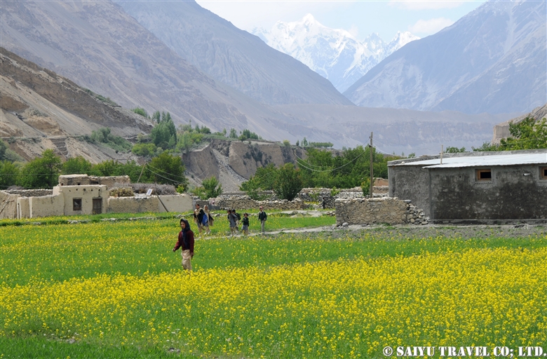
I have been travelling to Shimshal Pamir, located beyond Shimshal village, since 2009. It is not at all easily accessible and the lodging is located at altitudes exceeding 4,700m (15,420 ft). The mountain scenery and expansive natural vista is amazing but also, the traditional life of the Wakhi  people is fascinating as well. Shimshal is well known for their KUCH, the great migrations with their cattle, which you can also experience when you go to this special place.


Where is Shimshal Village?

Shimshal village was only recently connected by jeep road in 2003, in the upper Hunza valley. Located just near the boarder between Pakistan and China, it is just east of the Khunjerab Pass. If you take the Karakoram Highway north, passing through the heart of Hunza, Kalimabad, then you take the Attabad Lake tunnel, and on to Passu Village through 60 kilometers of dirt road…then you reach Shimshal Village. Prior to 2003, you would have had to walk the long trek, but now you can access this road with 4WD vehicle. Nonetheless, this road was once a trekking route with very steep canyons and great views of the Mulungutti Glacier, which extends out from Shimshal Village.


Shimshal Village

The village is located in a valley at an altitude of 3,000m (9843 ft). Until 1973 the Mir of Hunza were taxing dairy products and livestock in this area. It became part of the Islamic Republic of Pakistan in 1973 and part of the Shimshal land was designated Khunjerab National Park. In 2003, a road was connected to the area and life became a little easier but sadly, the youth have started migrating out to the city. Several guest houses in the village and a small hydroelectric facility provides power, although not very reliably. In recent years, there are an increasing tourist population attracted usually to the opportunities for mountain trekking.


Heading to Shimshal Pamir

Following the long, snow-covered winter, the villagers will start to graze their animals in late May. Livestock is the most important thing for making their livelihood. They take their yaks, goats and sheep graze in the summer pastures. This traditional big migration is called the Kuch, when they travel long distances to the ‘Pamir’ or summer pastures.


During the summer months, the women of the village are usually responsible for caring for the livestock and making the dairy products. Unfortunately, this tradition is rapidly being lost in modern times. Men may take various work either taking cattle to even more remote locations, working in towns or as porters and mountain guides.


Travelling on the Karakoram Highway from Islamabad, it is way beyond Kalimabad and Passu far into the mountain passes. Even deeper into the mountains past Shimshal village, you will walk into Shimshal Pamir.

It may take some time to get there, but it is a place where you can get a real feel of mountain life and their traditional way of life dependent on their animals.


Photos & text: Mariko SAWADA

※Photos were taken between 2009 and 2012 at Shimshal Village & Shimshal Pamir

※This is updated based on an article first uploaded in March 2011 for the Blog “Salaam Pakistan.”


Category : ◆ Gilgit-Baltistan > - Shimshal
Tag : , , , , , , , , , , , , , ,

(video) Northern Pakistan, Autumn the Hunza Valley, a hidden paradise

Northern Pakistan, Autumn the Hunza Valley

In the past, the main tourist season of Pakistan was mainly in the  summertime, but now many people are travelling to see the apricot blossoms in the spring or to see the autumnal colors of the fall season.

And it is quite remarkable.

This drone footage is nice, but the view from the hotel terrace is indeed just as spectacular and the mountains and orchards make you feel like you are in a real hidden paradise.

The autumn comes a little later each year, due to the unfortunate effects of climate change. However, in Hunza and in the upper reaches of the Hunza, each village is at its own elevation and exposure to sunlight is different, causing just enough variety of options, to be sure to catch the beautiful scenery in one of them.

Villagers also prepare for the winter during this time. Potatoes are distributed and the livestock return from the highland pastures back down to the villages.


Video & text : Mariko SAWADA

Visit : Oct 2018, Hunza, Upper Hunza,  Gilgit-Baltistan

Category : = Video Clip Gilgit-Baltistan > ◆ Video Breathtaking Views of Pakistan > ◆ Gilgit-Baltistan > - Hunza Valley > - Gojar > - Morkhun > - Passu
Tag : , , , , , , , , , , , , , , , , , , ,

Himalayan Brown Bear in Summer – Deosai National Park

The Deosai Plateau – Land of the Giants – on the border with India is known as a habitat for the Himalayan brown bears.

However, it is not something you can see easily if you go to the Deosai Plateau. In addition, It has been a target of hunting for many years. They are very timid and run away quickly.
Furthermore, there are too many tourists in summer, and Himalayan brown bears go deep in the valley. So you have to walk a lot to meet them.

From a camp at altitude of about 4,000m, we went up to a valley where the altitude rises a little and countless creeks flow.


Suddenly the accompanying ranger shouted with surprise, “Bear!”

I quickly took out tripod and snapped the picture with the best possible zoom.
Two bears! A Mother bear and its cub. Wait… The mother bear is observing something.


It was a male Himalayan brown bear that the mother bear was looking at.
Mother bear and cub walked towards us in the grass along the creek avoiding this male.

Luckily, we were downwind and were able to come to a relatively closer position for observation of the Himalayan brown bear without being noticed by the bear.


Oh, bear cub found us, looking at us how cute!


Mother bear also found us, standing upright and staring at us.


Finally both of them looking at us. A dreamy camera angle. After this, unfortunately the two headed away.


Afterwards, Mommy bear and cub appeared a little away. They were moving while searching various things in the grassland.


When a cub was doing strange actions on the rock, they were observing another female Himalayan brown bear.
The other female bear completely ignored them and passed across them.


After that, the cub bear had a little sleep and played in the pastures.


At last, the mommy bear and cub went over the hill. It was really a beautiful, unforgettable sight.


Photo & Text : Mariko SAWADA
Observation : Jul 2017, Deosai National Park, Gilgit-Baltistan
Reference : Mr. Ghulman Raza – Deosai National Park, Mr. Zahoor Salmi (late)

Category : - Himalayan Brown Bear > ◆ Gilgit-Baltistan > - Deosai National Park
Tag : , , , , , , , , , , , , ,

Shimshal village in Autumn

This is the wonderful scenery of Shimshal village in late October, enveloped in the golden, yellow, red shades of Autumn. Livestock have returned from Pamir and the village is ready for a tough winter ahead.


The yaks who returned from Pamir were in the field. Large males and some females remain in the Pamir over winter. It is a tradition to survive the cold and tough winter with limited food.


A sunny day, good for washing! Shimshal village on a warm sunny day.


Karun Koh seen from the Shimshal valley. The altitude of Karun Koh peak is 6,977m, 7,164m, or 7,350m depending on the documents.


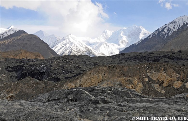
Just outside the Shimshal village, there are Molonguti Glacier and Disthagil Sar 7,885m.  From here we drive off the valley for 3 hours to reach the mighty Karakoram Highway near Passu.

Visit beautiful village of Shimshal – One step off from Karakoram Highway !


Photo & Text: Mariko Sawada

Visit: Oct 2014, Shimshal, Gilgit-Baltistan


Category : ◆ Gilgit-Baltistan > - Shimshal
Tag : , , , , , , , , , , , , , ,

TOP