English / Japanese

Over the Khyber Pass

The Khyber Pass is located between Peshawar and the border with Afghanistan. Since ancient times, it has been an important pass on the trade route between the Central Asian and Indian cultural regions. The mountain where the pass is located is called Spin Ghar (in the Pashto language) and was crossed by Alexander the Great’s army in the 4th century B.C., as well as by Xuanzang in the 7th century. During the Mughal period, it developed as part of the Grand Trunk Road, the main road from Agra, India to Kabul, Afghanistan. In modern times, it was a battlefield in the Afghan War during the British colonial period. After independence, it became an autonomous region of the Pashto tribe called the Federally Administered Tribal Areas (FATA), but that system was abolished in 2018. Foreigners visiting the area must have prior permission and be accompanied by security. When tourists talk about going to the Khyber Pass, it generally means visiting the area from the Khyber gate to the Michini check post.

Bab-e-Khyber and Jamrud Fort

This monumental gate was built in 1963 and is located 18 km from the center of Peshawar city. There is a small park next to the gate where the history of the Khyber Pass is inscribed on a stone tablet. Khyber Gate also appears on the Pakistani 10-rupee bill.

Just past the Khyber Gate, on the right, is Jamrud Fort. It was built by the Sikhs in 1823 on top of an old fort. General Hari Singh Nalwa, a hero of the Sikhs, was killed and buried at Jamrud Fort while fighting Afghans. The fort is manned by the Pakistani army and entry is not allowed.
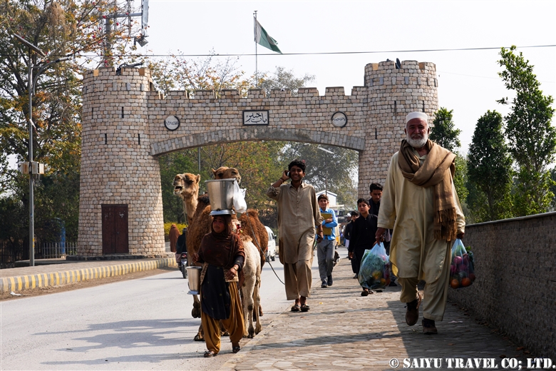
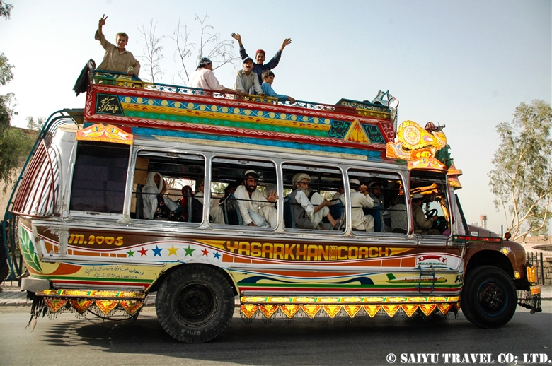
A camel milk vendor from Punjab walking through Khyber Gate
Until 2007, there was a large Afghan refugee camp (Kacha Garhi refugee camp) near the Khyber gate; many refugees came and went through this gate from the Soviet invasion in 1979 until the end of the Afghanistan war.


Khyber Pass Viewpoint

The photo of the Khyber Pass shown in the guidebook features a view looking back toward Peshawar from the road on the way to the border. The road is now newly widened and is lined with transport trucks coming and going from the border, but it must have once provided a dramatic sight of the Gandhara Plain spread out in front of the caravans coming from Afghanistan.

View toward Peshawar from Khyber Pass Viewpoint


Shagai Fort

The fortress was built by the British in the 1920s to monitor the Khyber Pass route. It is currently manned and monitored by the Pakistani Army. On the other side of the fort there is a new monument and a lookout tower.
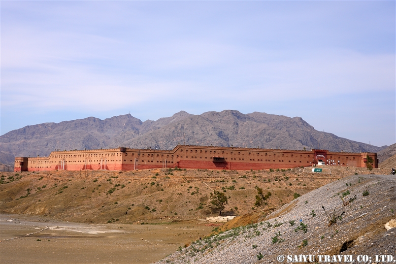
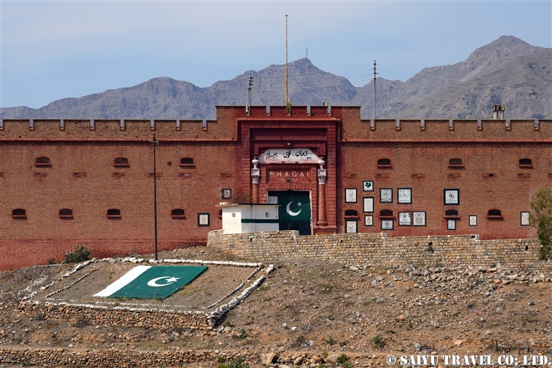
Distant view of Shagai Fort
Entrance to Shagai Fort

Ali Masjid

This is the narrowest part of the Khyber Pass road, flanked by mountains on both sides. It was originally so narrow that two loaded camels could just barely pass each other. Because of its strategic importance, it was the site of fierce battles in past wars. The road has been gradually widened, but even today, the lanes are separated, with the lane heading toward Peshawar being built on a cliff.

The small Ali Masjid (a mosque), as well as a madrasa can be found along the road. The Ali Masjid Fort, where the Pakistani army is stationed, is located on top of the hill.

The Ali Masjid mosque along the road. A larger mosque is currently under construction.
Ali Masjid Fort overlooking the narrow road

Palatial Residence (Fort) of Ayub Afridi

Ayub Afridi is a well-known drug lord and tribal politician, known for the many interesting stories about his contacts with the United States, among other topics. Along the road is a wall of mansions with more than 100 rooms.

Sphola Stupa

The stupa dates back to the 2nd-3rd century Kushan period and is built on a three-tiered platform. Excavations in the early 20th century unearthed a Buddha statue, and as of 2024, the base of the temple is being restored. It is the only Gandhara Buddhist site in the Khyber Pass area.

Sphora Stupa and Khyber Railway tracks

Emblem of the Military Corps

The troops of various time periods who passed through the area carved their military emblems into the rock face as a commemoration of their passage.

Emblem of the Military Corps

Khyber Railway

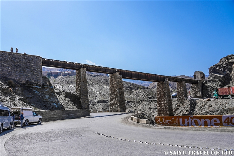
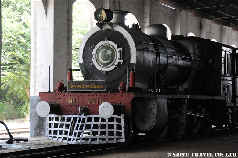
There was a time when a steam locomotive operated once a month for tourists between Peshawar and Landi Kotal. The Khyber railway has a long history, having opened in 1926 during British rule era for the purpose of transporting military supplies. The railway runs from Peshawar to Landi Kotal, a distance of 40 km with a height difference of 600 m, crossing 34 tunnels and 92 railway bridges.

The area was devastated by heavy rains and flooding in 2006, and there is absolutely no hope of restoration. Currently, only the remains of damaged tracks, tunnels, steel bridges, and stations can be seen.
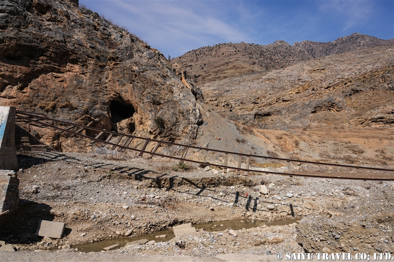
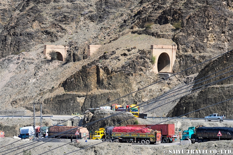
Railway tracks destroyed by flooding
The tunnel
The railway bridge
A preserved steam locomotive in Peshawar

Landi Kotal

The last town on the Pakistani side is Landi Kotal. Stores are spread out over an even lower level of the town’s main street. It was once known for its smuggled goods bazaar which dealt in arms and drugs. Today, there is still a vibrant market.

Landi Kotal’s Kabab Shop
Popular chappal kabab in town
Landi Kotal people cheerfully talking to tourists
Children on their way home from school

Michini Check Post

The last point on the Pakistan side that can be visited without an Afghanistan visa is the Michini Check Post, which overlooks the border town of Torkham. The border town of Torkham is 5 km downhill from here. The rocky mountains across the border are numbered from 1 to 3, and the border line between the two countries is the point where these lines are connected.

View of the border Torkham from Michini check post

The Michini Check Post has a viewpoint where tourists can enter. From the viewpoint, there is an old building called the Taimoor Fort or Tamerlane Fort, which according to legend was used as a prison during Timur’s invasion of India.

Taimoor Fort
A lookout with a view of the Torkham border

Torkham Border

Approaching the border there is a dry port and an immigration control building. As of 2024, the Torkham border is the only open border between Pakistan and Afghanistan.

Porters carrying luggage and money changers waiting at the border
Corridor between Pakistan and Afghanistan

The border with Afghanistan is connected by a long corridor, and from there it is 230 km to Kabul, which takes about 6 hours by car.


Photo & Text : Mariko SAWADA

*Contact us, Indus Caravan for more information or to make arrangements for visiting Khyber Pass, Border Crossing and Afghanistan. >> Our Afghanistan tour .

*Please follow us on YoutubeInstagram & Facebook

Category : - Peshawar / Khyber Pass > ◆Khyber Pakhtunkhwa > Uncategorized
Tag : , , , , , , , , , , , , , , , , ,

Re-discovering Afghanistan:Bamiyan Valley

“Bamiyan? There are no more big Buddha statues there, right?”

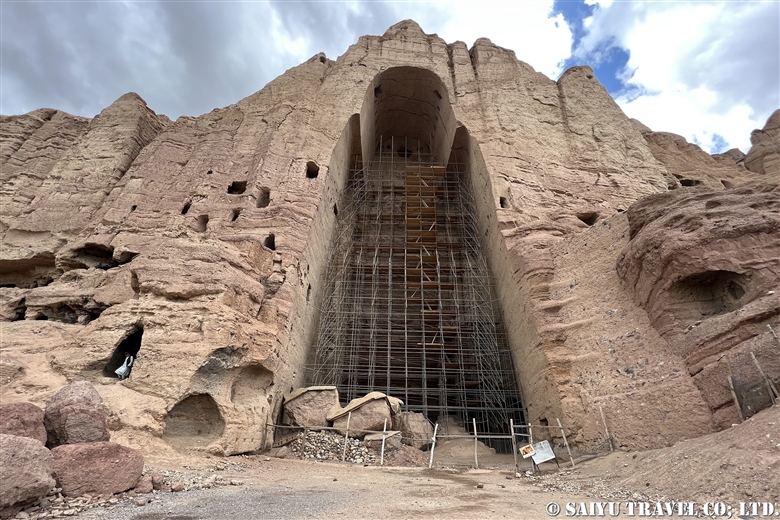
In March 2001, two huge Buddha statues, one 55 meters and the other 38 meters high, were cruelly destroyed by the Taliban of the time. It was an eye-opening event that made the world aware of the Taliban and the situation in Afghanistan at that time.

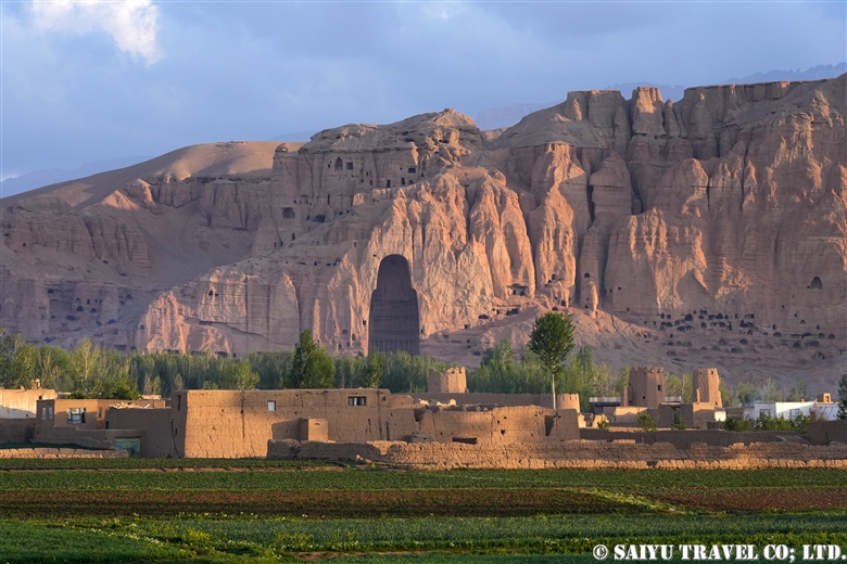
Though the Great Buddha has been lost and many of the caves destroyed, the valley of Bamiyan has much more to offer than that. Nowadays, the bazaar has expanded, more hotels have been built, and Bamiyan now attracts domestic tourists from Kabul and other urban areas on weekends as well as foreign tourists. Those who knew the old Bamiyan will be surprised at its changes.

There are two routes from the capital Kabul to Bamiyan. One is the so-called ”northbound route over the Shibar Pass“ and the other is the ”southbound route over the Hajigak Pass“. Both routes lead to the Shahr-i-Zohak, which stands in front of the checkpoint at the entrance to the Bamiyan Valley.

Shahr-i-Zohak, located at the entrance of the Bamiyan Valley

Shahr-i-Zohak

Shahr-i-Zohak is the remains of a fortress located at the confluence of the Bamiyan and Kalu Rivers, 17 kilometers east of the town of Bamiyan. The present ruins of the fort are said to date back to the reign of the Shansabani kings in the 12th century (during the Genghis Khan invasion), but in fact it was used as a natural fortress from around the 6th century. It is said that remains from the Buddhist period were also found. It was also used in modern warfare during the civil war. In the evening sun, Shahr-i-Zohak glows red, giving it the nickname ”Red City.“ From the top of the fort, you can see the beautiful valley along the Kar River.

Bamiyan valley seen from Shahr-i-Zohak

Passing Shahr-i-Zohak, you can continue to Bamiyan. On your left, you will see the ruins of an old caravanserai, followed by the village of the Hazara people. Soon you will see a group of caves ahead. These are the Bamiyan Caves.

Bamiyan Caves

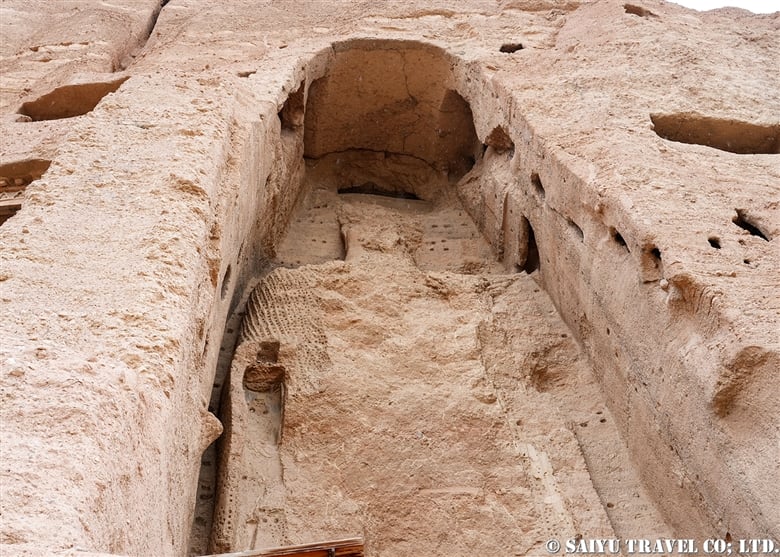
The Bamiyan Caves are comprised of approximately 750 caves built over a length of 1,300 m on the northern cliffs of the Bamiyan Valley. Located on the east and west sides of the caves are the Western Buddha (55 m high) and Eastern Buddha (38 m high), both of which were destroyed by the Taliban in 2001. In 2003, the site was registered as a UNESCO World Heritage Site as the ”Cultural Landscape and Archaeological Remains of the Bamiyan Valley“. In the past, UNESCO and archaeologists from various countries were working to restore and preserve the site, but conservation work has been suspended since the new Taliban regime came to power.

Bamiyan West Buddha

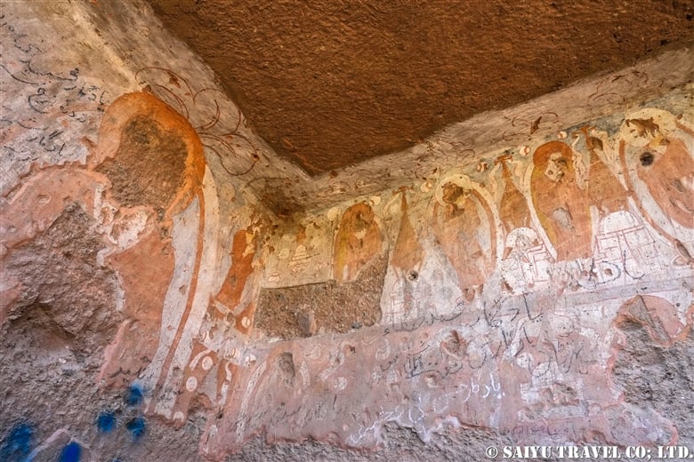
As of 2024, visitors can walk from the West Buddha to the East Buddha and climb the stairs to the interior of the East Buddha. The caves with remaining murals are often locked to protect them from destruction by local tourists.

Bamiyan East Buddha
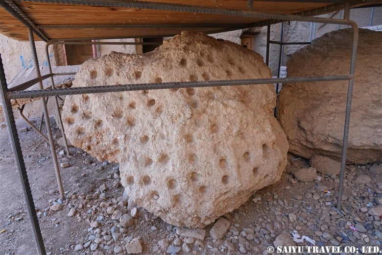
Part of the Buddha statue that was blown up and collapsed in March 2001
Mural paintings remaining on the terrace of the East Buddha

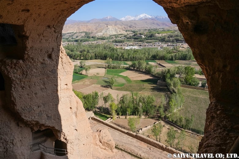
As you go up inside the East Buddha, you can see a view of the Bamiyan Valley from the terraced caves and the terrace near where the head of the Buddha used to be. The area between the Bamiyan Caves and the bazaar has been preserved without development as a UNESCO Scenic Area, but after the new Taliban regime, this has not been followed and new gas stations and stores have begun to be built.

Bamiyan Valley seen from the terrace of the East Buddha niche

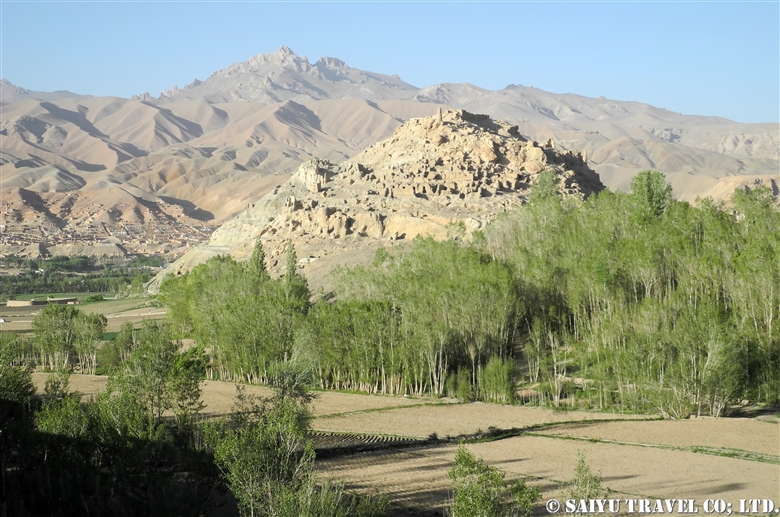
The large hill at the edge of town is Shahr-i-Gholghola.

Shahr-i-Gholghola

Shahr-i-Gholghola

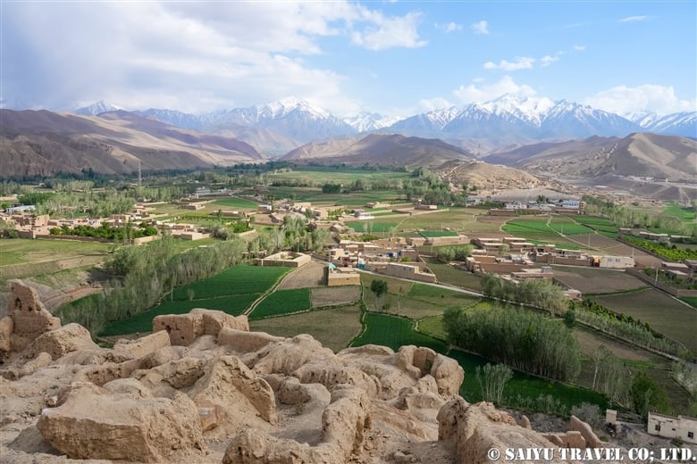
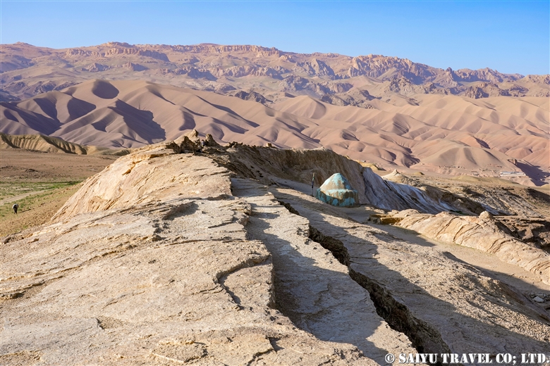
Shahr-i-Gholghola is the ruins of a fort, which was also known as the ”City of Screams“. 12th century Bamiyan was a prosperous city of the Shansabani dynasty, the successor to the Ghurid dynasty, but it was turned into a ghost town after Genghis Khan’s army attacked the city in 1221. The screams of those slaughtered at that time were the reason for the fort’s name. Although part of the ruins have been renovated and renewed with international aid, some people say that it has been cleaned up too much and was more impressive in the past. From the top of the fort, you can enjoy a panoramic view of the Bamiyan Valley.

Bamiyan valley seen from Shahr-i-Gholghola

In addition to the famous Bamiyan Caves, there are two other cave complexes in Bamiyan: the Foladi Caves and the Kakrak Caves. Both caves are located by the river and are accessible by a short walk. Tourists who visited here before the Soviet invasion used to visit the Kakrak Caves in the evening and call the standing Buddha statue “Sunset Buddha,” because of the view when the setting sun shone on it.

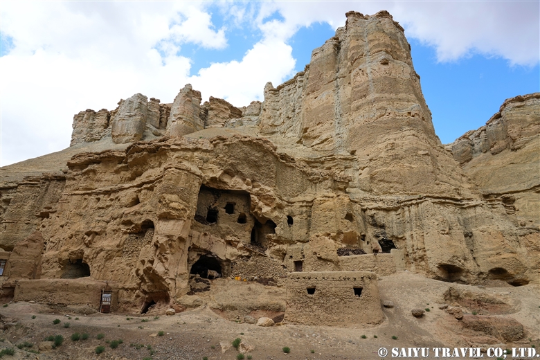
Foladi Caves

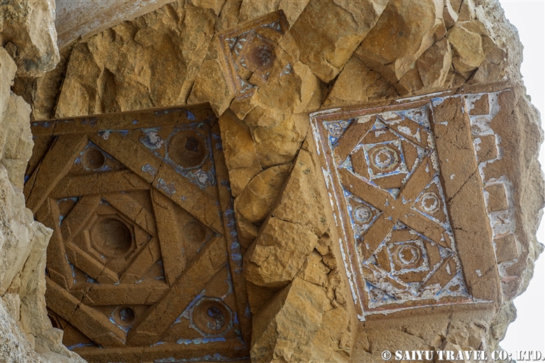
This is a group of about 50 caves built along the Foladi River, which runs along the west side of the Bamiyan Valley. Although the caves are damaged because villagers continue to use them as livestock pens and dwellings, ceiling decorations such as those of the Laternendecke can still be seen. It is a peaceful place where visitors can see glimpses of village life.

People living near Foladi Caves
People have used the grottoes as livestock pens and dwellings.
Laternendecke ceiling decoration

Kakrak Caves

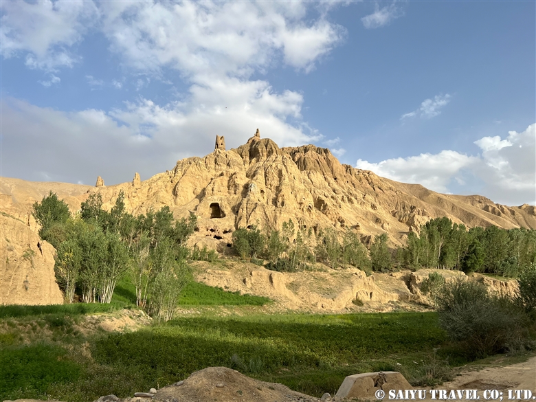
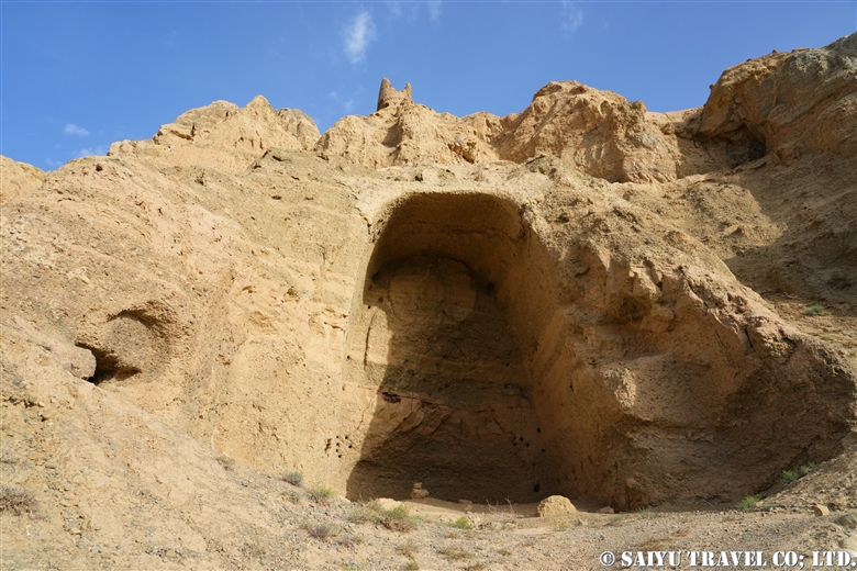
A group of caves built along the Kakrak River, which runs along the eastern side of the Valley. These caves are the site of the famous red-toned mural paintings that are kept in the Guimet Museum in France and the Kabul Museum. There was a 6.4-meter-high standing Buddha statue, but it was destroyed by the former Taliban regime in 2001, along with two Great Buddha statues. The ruins of an Islamic watchtower can be seen on top of the caves. Although nothing remains, visitors can enjoy a typical view of Bamiyan Valley while walking through the farmland.

Distant view of Kakrak Caves
A wall niche that once housed a standing Buddha, destroyed by the Taliban in 2001 along with two Great Buddha

Dragon Valley

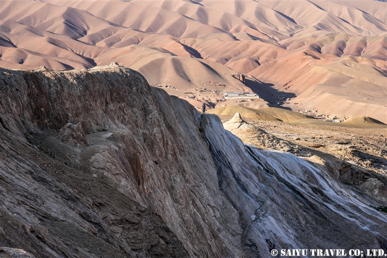
The valley is located 9 km southwest of Bamiyan. According to legend, when a village girl was about to be sacrificed to a dragon, a brave man (Hazrat Ali) confronted the dragon and cut it in two. The dragon cried tears of regret. The dragon’s split back is the cleft in the rock, and the ”tears” still flow as a mineral spring. After the civil war, this valley, which had been empty, has grown into a new residential area.

The place that corresponds to the “dragon’s back
At the bottom is “Tears of the Dragon”, a mineral spring gushing out

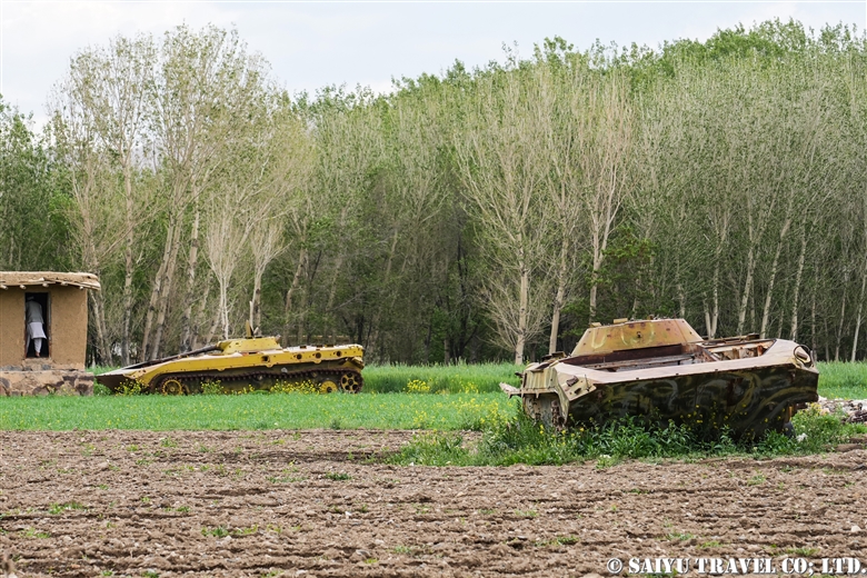
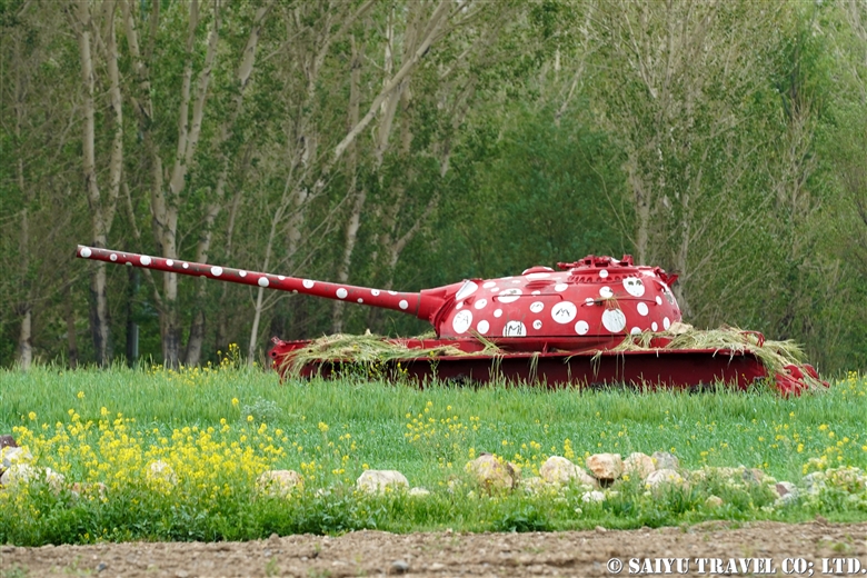
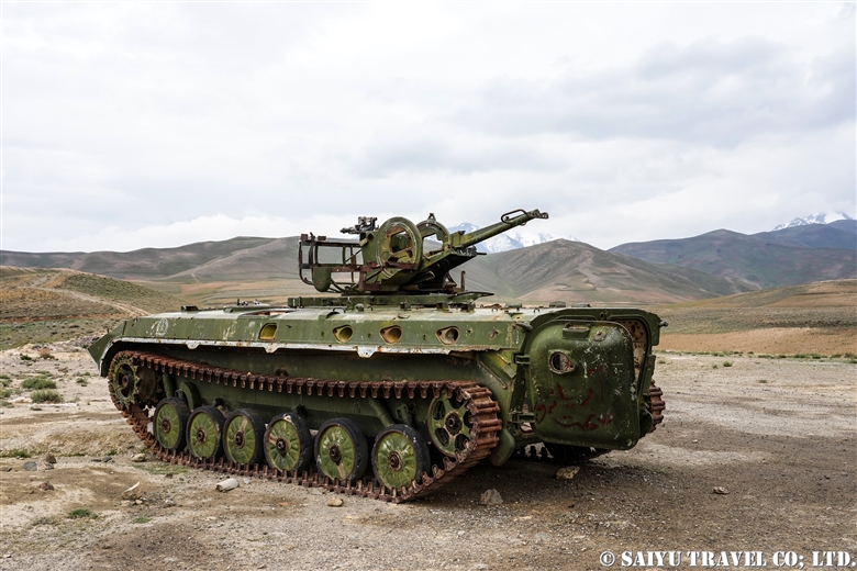
This has been a brief introduction to the highlights of the Bamiyan Valley, but since the topic of our discussion is Afghanistan, some of you may be wondering whether there are still any remnants from the civil war. In Bamiyan and the surrounding area, mine clearing began at an early stage. For a while after the civil war, tanks were seen here and there on the road from Kabul to Bamiyan and in the valley, but they are long gone now.

Remaining tanks on the hill of Bamiyan

This is surprising, isn’t it? It was painted by an Iranian artist.

Remaining self-propelled anti-aircraft gun on the Shibar Pass

Perhaps the best-preserved tank in the vicinity of Bamiyan is the one on top of Shibar Pass.
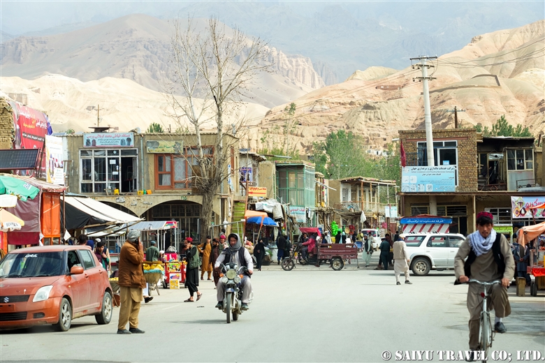
Here we have an everyday scene from the bazaar in Bamiyan.

Main Bazaar of Bamiyan

Bamiyan is famous for growing potatoes. Walking around the village, you will encounter many people.

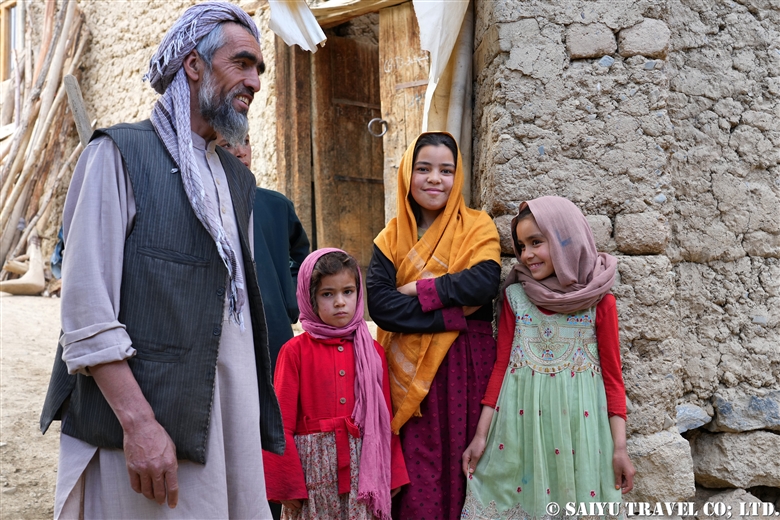
A father and kids met in a potato field in Kakrak
at Kakrak potato field
Girls I met in Foradi

The valley of Bamiyan is photogenic and inspiring enough just for its scenery surrounded by the Hindu Kush mountains and the seasonal life of the Hazara people.


Photo & text : Mariko SAWADA

*Contact us, Indus Caravan for more information or to make arrangements for visiting Afghanistan. >> Our Afghanistan tour .

*Please follow us on YoutubeInstagram & Facebook

Category : ◆Afghanistan > - Bamiyan & around
Tag : , , , , , , , , , , , , , , , ,

Re-discovering Afghanistan : The Kyrgyz Buzkashi, Wakhan Corridor

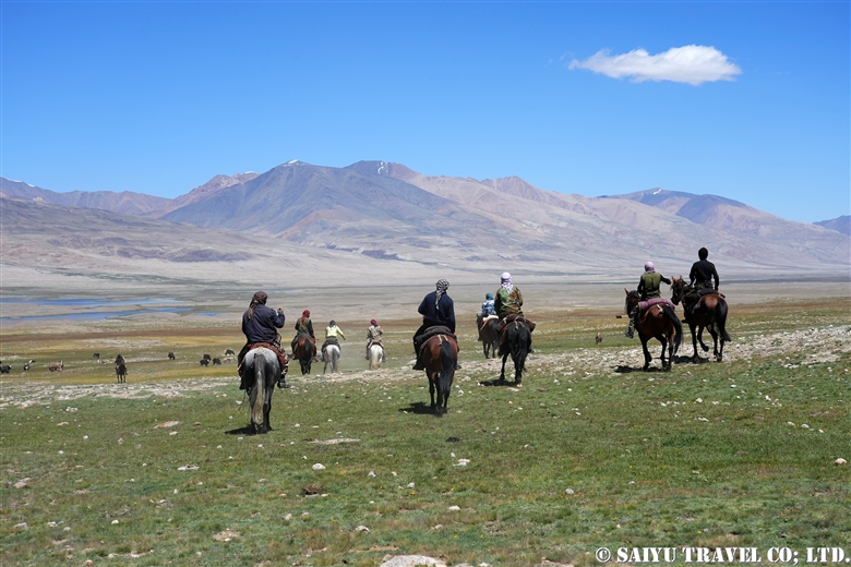
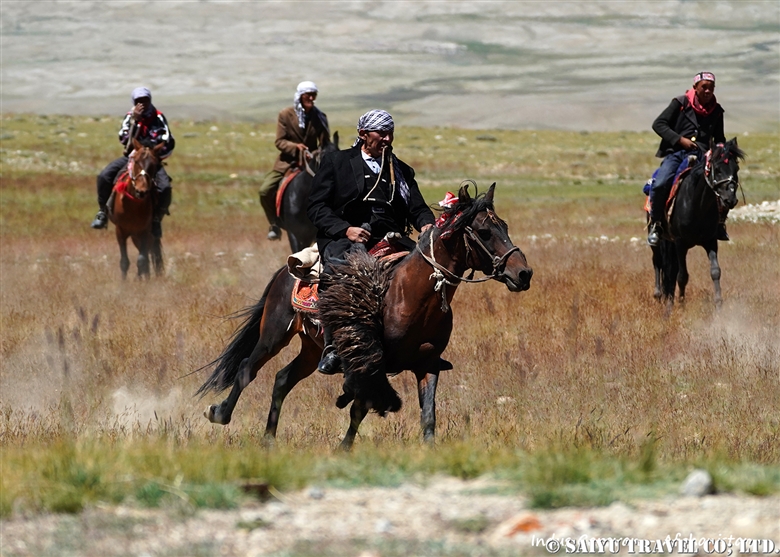
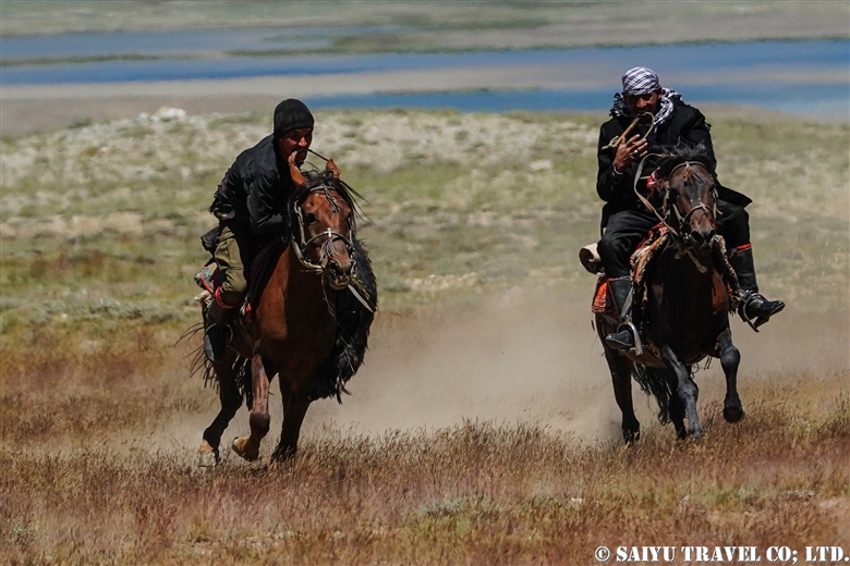
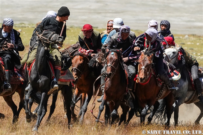
Buzkashi being held on the shores of Lake Chaqmaqtin, Wakhan corridor, in summer. It is practised among the Kyrgyz peoples of the Wakhan corridor at weddings as well as during Eid, the Islamic festival of sacrifice.

>Re-discovering Afghanistan: Wakhan Corridor, and the Kyrgyz in the Afghan Pamir


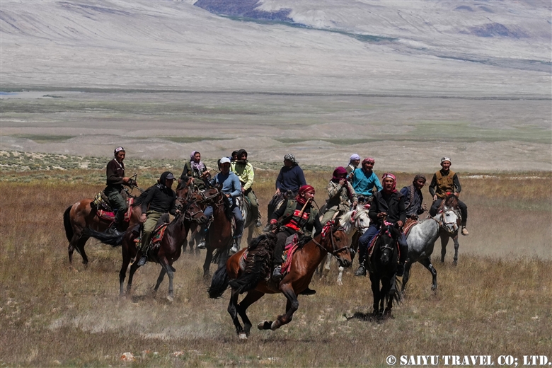
Buzkashi is the national sport of Afghanistan, in which two groups of horse riders compete for a goat. In Persian, it means exactly what it sounds like: goat = buz , pulling= kashi. I saw buz kashi on the last day of my three-days stay in a Kyrgyz camp. That was the day when the men I had seen in the camp mounted their horses and, suddenly for the first time, began to looked cool to me. To be honest, up until that point I had felt that while the women were working from the morning milking and making Qurut, the men weren’t doing much to help …

↑↑The Kyrgyz buzkashi being held amidst the spectacular scenery of the Wakhan corridor.

From 1996 to 2001, when the former Taliban (not the current Taliban regime) was in control, many entertainment activities were banned as ‘immoral’ and buzkashi was also banned. Buzkashi has since been revived and is now a major national event, with tournaments organised in each state. While in big cities buzkashi is sometimes held in stadiums in costumes with sponsors’ logos, in rural areas buzkashi is purely a traditional event for people to enjoy.

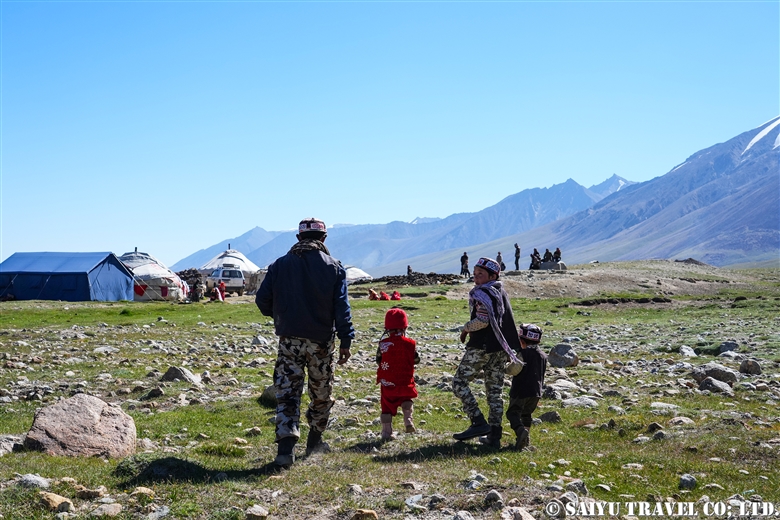
People heading to  wedding .

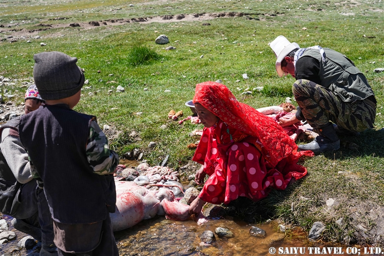
A sheep being dismembered for a wedding celebration meal.

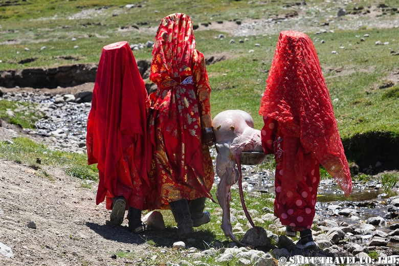
Kyrgyz girls carrying sheep meat.

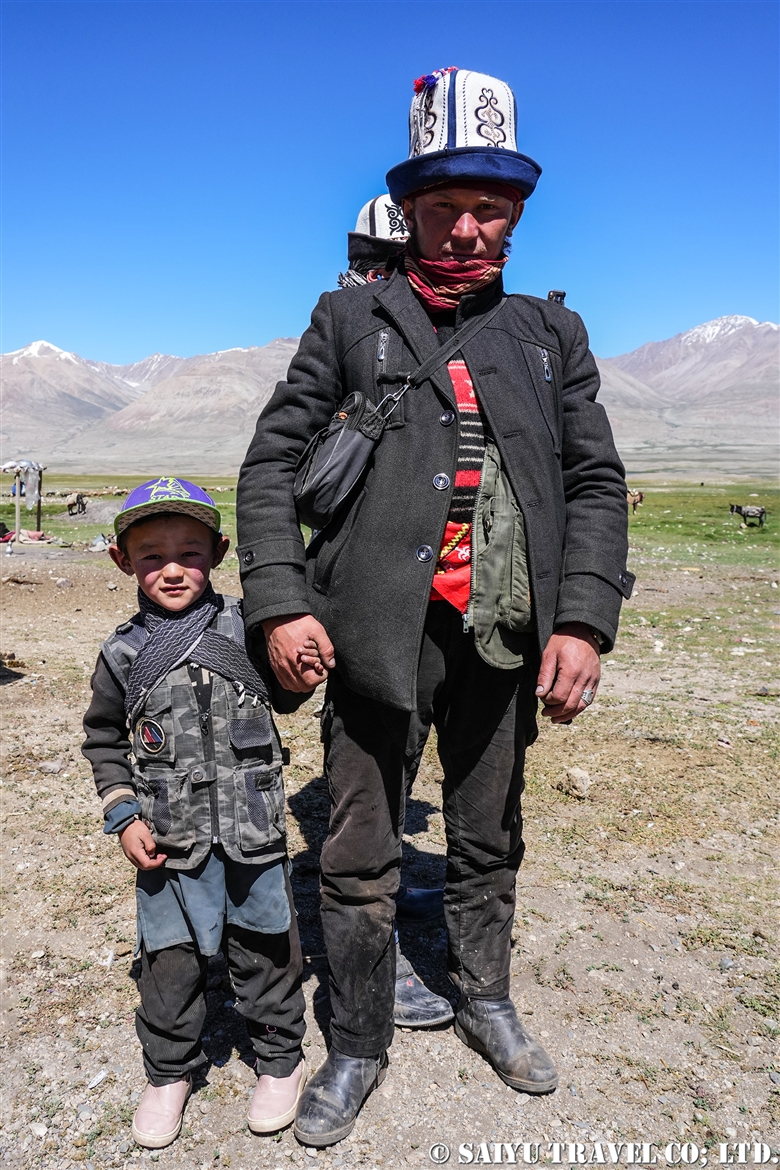
A man and his child who came to celebrate and participate in the buzkashi.

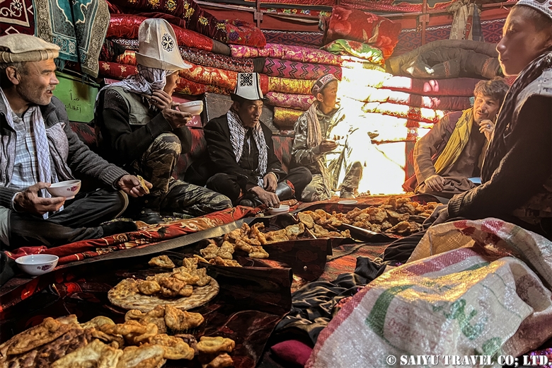
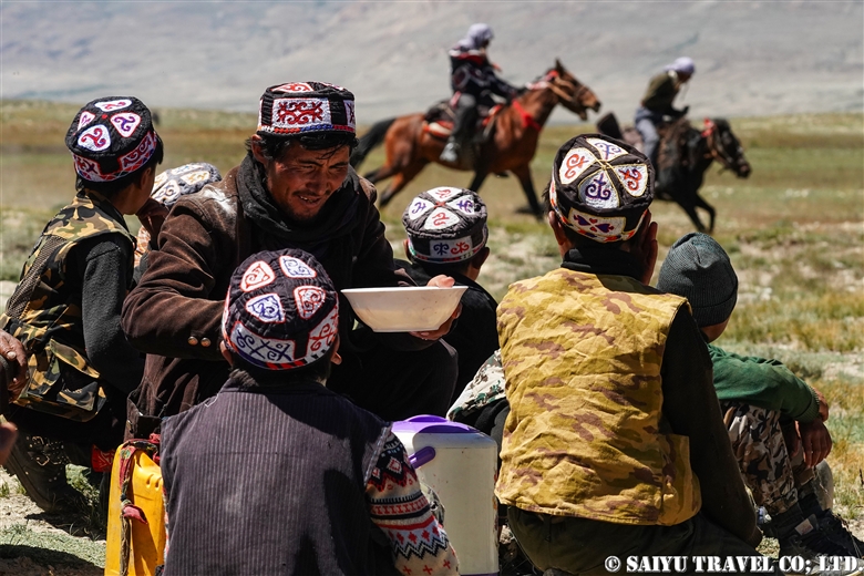
Everyone praying and offering food before the Buzkashi. Milk tea and fried bread were served.

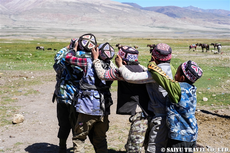
Children at play until the buzkashi starts.

A Kyrgyz boy who wants to try buzkashi.

After prayers and food offerings, the buzkashi finally begins.

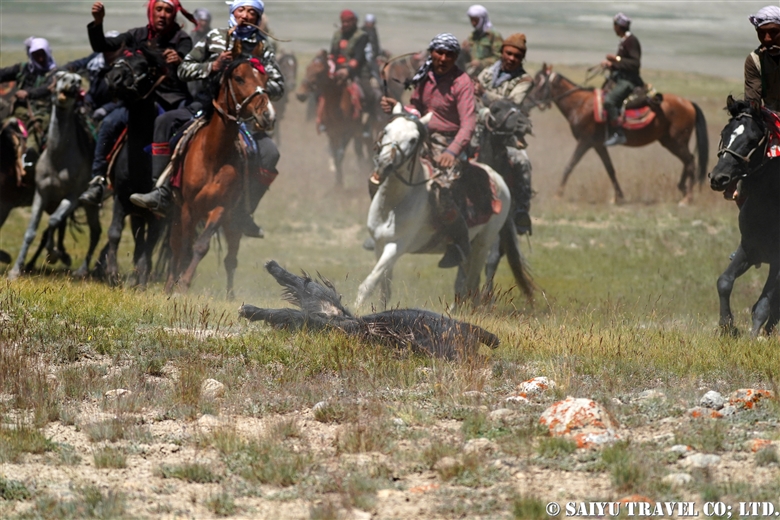
A goat with its head cut off. The goat used was not the one killed on the day, but a stuffed goat that was prepared in the village for buzkashi.

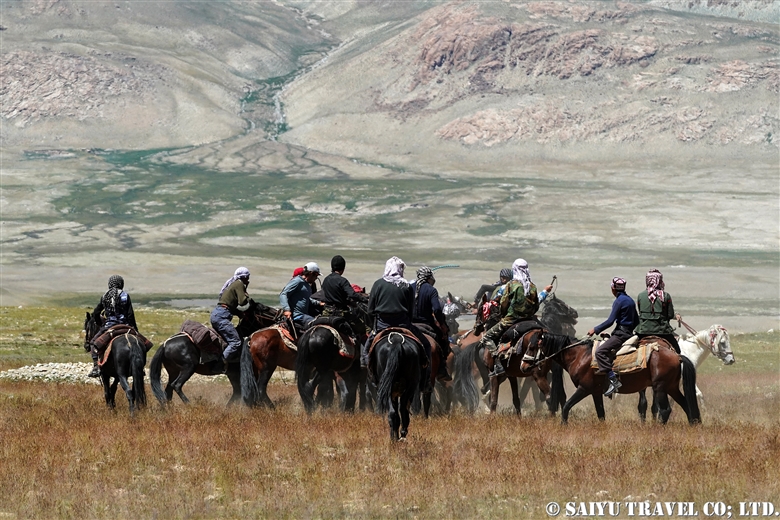
The goat is thrown down to the earth and the contest begins.

It requires strength and skill to pull this goat up from the ground with one hand and ride while holding it. During all this, the whip is held in the mouth.

Competing for the goat.

Family watching the game over a cup of tea.

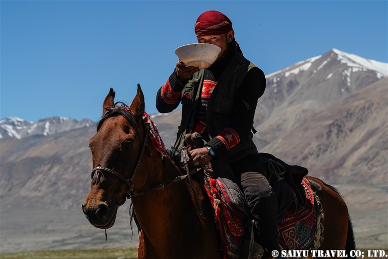
Participants also take a break, to have some milk tea.

After a break, they return to thebuzkashi.

Kyrgyz buzkashi, performed amidst the spectacular mountain scenery of the Wakhan corridor.


Image & Text : Mariko SAWADA

*Contact us, Indus Caravan for more information or to make arrangements for visiting Afghanistan, Wakhan Corridor.

*Please follow us on YoutubeInstagram & Facebook

Category : ◆Afghanistan > - Wakhan Corridor
Tag : , , , , , , , , , , , , , , , ,

Re-discovering Afghanistan: the majestic Minaret of Jam

One of the two World Heritage Sites in Afghanistan, Jam minaret and archaeological remains of Jam in the mountains of Ghor Province, the site is not easily accessible neither from Bamiyan nor Herat, and can only be reached by a long drive on rough roads.

It is called a “minaret and archaeological site,” but it is unclear if it is actually a minaret. There is no mosque (perhaps there was an open-type mosque), and there are many opinions, including that it may be a victory tower built over a pre-Islamic pagan holy site.
It could well be Firozkoh of the legendary city, according to one of hypothesis.

There were three main capitals in Ghurid dynasty, Ghazni, Bamiyan, and Firozkoh. The location of one of those three, Firozkoh, is not known, and it is speculated that the ruins near the minaret may be the site of that capital. Incidentally, Chaghcharan in Ghor Province has recently changed its name to Firozkoh and has become a gateway town for tourists visiting the Minaret of Jam from the Bamiyan side.

Remains of buildings on the rocky hill by the minaret. The watchtower is clearly visible.

The Minaret of Jam was built during the reign of the Ghurid dynasty that ruled from Afghanistan to northwestern India, reaching the peak of its power from 1150 to 1215 and reached its peak during the reign of the 12th century king, Ghiyath al-Din Muhammad (1162-1203) and his brother Mu’ izz ad-Din Muhammad (1203-1206). The dynasty was divided after the death of these brothers, and the capital was destroyed by Genghis Khan’s army in 1221. In 1943, the governor of Herat publicized the site, and finally in 1957, the Afghan Historical Society and the French Archaeological Delegation in Afghanistan visited and “discovered” this valuable site.

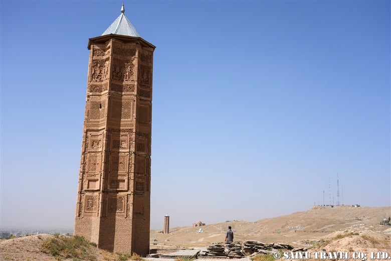
The Minaret of Jam is 65 meters high and has three levels.

The site is located at the confluence of two rivers, Harirud and Jam, which has eroded the foundation and tilted the slim tower slightly. The Minaret of Jam is the only remaining structure from the Ghurid dynasty and is very important for understanding Islamic architecture in the medieval period. It was registered as a World Heritage Site (Heritage in Crisis) in 2002.

The Minaret of Jam has three levels, each level separated by a balcony corbel and topped by a circular arcade of six arches.

Six arches arcade at the top

The first tier up to around 37m is elaborately decorated with molded buff-colored brick reliefs.

The octagonal base of the minaret is 14.5 meters in diameter and 65 meters high, with a tapered tower made of baked bricks. The eight vertical panels corresponding to the octagonal base are superbly done with molded bricks. The rich variety of geometric and plant patterns developed in Bukhara. The most amazing feature is the Arabic Kufi script, in which the entire inscription band of the 19th sura of the Koran (or  Qur’an, the holy scripture of Islam), the chapter of Maryam, is represented from one panel to another.

Kufi Arabic, a manifestation of the 19th chapter of the Koran, surrounds the panel and goes on and on and on.Just below the first balcony is a bright Persian blue kufi inscription, the only colored inscription on the surface, declaring the names of the rulers who spearheaded the construction of this minaret. “Ghiyasuddin Mahammad ibn Sam, Sultan Magnificent! King of Kings!” The architect’s name is also inscribed in small letters: “Ali, son of…”.

The name of the founder appear, “Ghiyasuddin Mahammad ibn Sam, Sultan Magnificent! King of Kings!”

The Qutub Minar in Delhi, India, is the world’s tallest minaret (72.5 m) made of bricks, built around 1200 during the Delhi Sultanate, whose founder, Quṭb al-Dīn Aybak, served the Ghurid dynasty. The minaret of Qutub Minar was built under the influence of the minaret of Jam. Conversely, there is a “Ghazni minaret” in Ghazni of Ghazna Dynasty, and the Minaret of Jam was constructed under the influence of this minaret.

Qurub Minar (Delhi), which was inspired by the Minaret of Jam.
Ghazni’s minaret that inspired and influenced the minaret of Jam.

It used to be possible to climb the spiral staircase inside the minaret, but the entrance is now closed, no longer inaccessible.The view of the “Minaret of Jam” at the end of a long and rough journey is breathtaking and full of archeological awe and majectic beauty.


Image & Text : Mariko SAWADA

Reference :”An historical guide to Afghanistan ” Nancy Hatch Dupree

*Contact us, Indus Caravan for more information or to make arrangements for visiting Minaret of Jam and Afghanistan.

*Please follow us on YoutubeInstagram & Facebook 

Category : - West Afghanistan > ◆Afghanistan
Tag : , , , , , , , , , , , , , ,

Re-discovering Afghanistan: Wakhan Corridor, and the Kyrgyz in the Afghan Pamir

Wakhan Corridor, Afghanistan is the “last frontier” for travelers who love unexplored areas. Unpaved rough road, bumby and dusty, has been completed to Lake Chaqmaqtin. Now it became possible to drive to Little Pamir, the home of the Kyrgyz people. The four-day trek has become to take a four-hour 4WD trip. See the lifestyle of the Kyrgyz people living on the plateau with your own eyes – as it is rapidly changing,  some old traditions and charming rustic lifestyle may get diluted and disappear in modernity.
Wakhan Corridor

The Wakhan corridor is a long and narrow territory, in a way a corridor in the Badakhshan province of Afghanistan bordering Tajikistan, China, and Pakistan. It is a mountainous plateau where the source of the Amu Darya river originates, and in summer, plentiful water and meadows appear and are called “Pamir”. This idyllic pastoral landscape has a lot of historical significance.
This corridor-like borderline was created in 1873, when the border between Afghanistan and the Russian Empire was drawn along the Panj and Pamir rivers. Twenty years later, in 1893 the border (the Durand Line) between Afghanistan and the British Indian Empire (now Pakistan) was drawn. It was the buffer zone for the “Great Game” between Russian and British empires at that time.
The landcape around Lake Chaqmaqtin
Bozai Gumbaz, old Kyrgyz tomb situated at the confluence of the Wakhjir River ( the source of the Amu Darya) and the Wakhan River.

In the Wakhan corridor, Wakhi people live from Ishkashim to Sarhad at altitude 2,500 – 3,300 meters, while Kyrgyz people live in the “Pamir” above 4,000 meters above sea level.

The area around Lake Chaqmaqtin is called “Little Pamir” and the plateau along the Pamir River from the Tajikistan border to Lake Zorkul is called “Big Pamir”. Both are mountainous plateaus. In the Little Pamirs, used to the seasonal nomadic element in their traditional lifestyle, Kyrgyz live to south of the lake in the summer, and move north of the lake in the winter.

Kyrgyz family with Lake in the background


Kyrgyz people in Wakhan Corridor

The Kyrgyz are Turkic people living in Central Asia. There have long been small groups of Kyrgyz who came to the Afghan Pamirs in search of summer grazing lands, but many Kyrgyz moved to the Afghan Pamirs during the Russian Revolution of 1917.They then created a lifestyle of seasonal small migrations in this largely isolated region. Later, when China was founded in 1949 and the communist government of Afghanistan was established in 1978, there were cross-border ethnic migrations, and it is said that about 1,300~1,400 Kyrgyz people are currently living in Afghan Pamir. Recently, people who feared the Taliban temporarily moved to the Tajikistan border after the establishment of the new Taliban regime in 2021, but they have returned after hearing that their lives and livestock would be protected.

According to the shura, a village authority in Andamin settlement, Little Pamir has 28 settlements. There used to be 500 people living in Little Pamir and about 800 people in Big Pamir, but about 3 years ago, people moved from Big Pamir to Little Pamir and now there are 1,150 people living in Little Pamir. This move might have happened partially due to the completion of the new road in 2020.

Kyrgyz people living around Lake Chaqmaqtin

Life on the plateau: harsh environment

On the way from Ishkashim to Sarhad, we met a Kyrgyz man who asked for help. According to the man, his wife, who had given birth in Pamir, was not feeling well and the clinic told him to go to a hospital in Ishkashim. “I have no money”, he said.
Some Kyrgyz people get things in exchange for sheep and other livestock with merchants visiting the Pamirs and have no cash. They need money to “get in the car and go to the hospital.” At this time, we could only give money and pray for the safety of this person’s wife.

In the village, we also met parents who lost their children and a man who lost his wife. And there were very few old people. We realized that they live in a harsh environment.

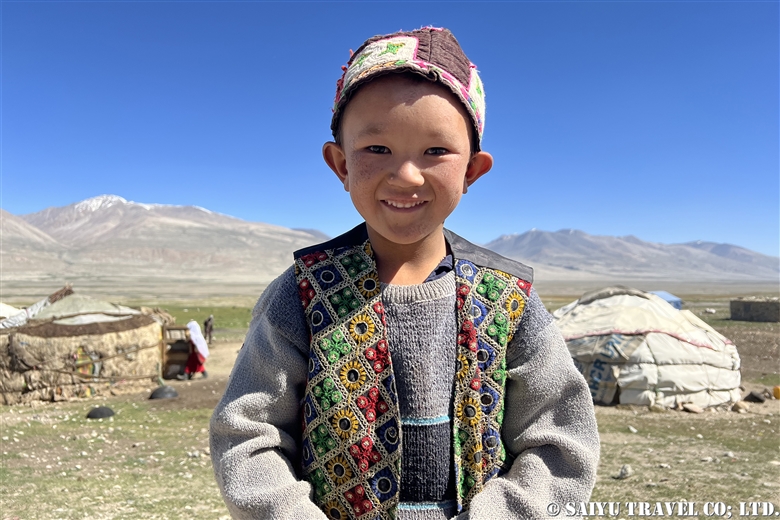
Kyrgyz Boy

The Kyrgyz people of the Afghan Pamirs are not self-sufficient. They raise livestock, produce dairy products, and obtain what they need from merchants who come to the Pamirs (Wakhi people from the Wakhan corridor, and Pashtoon people from the south). They exchange or sell their livestock and dairy products to obtain goods and cash for their daily needs. In many cases, the exchange of sheep is concluded with a promise to receive this year’s lambs next year.

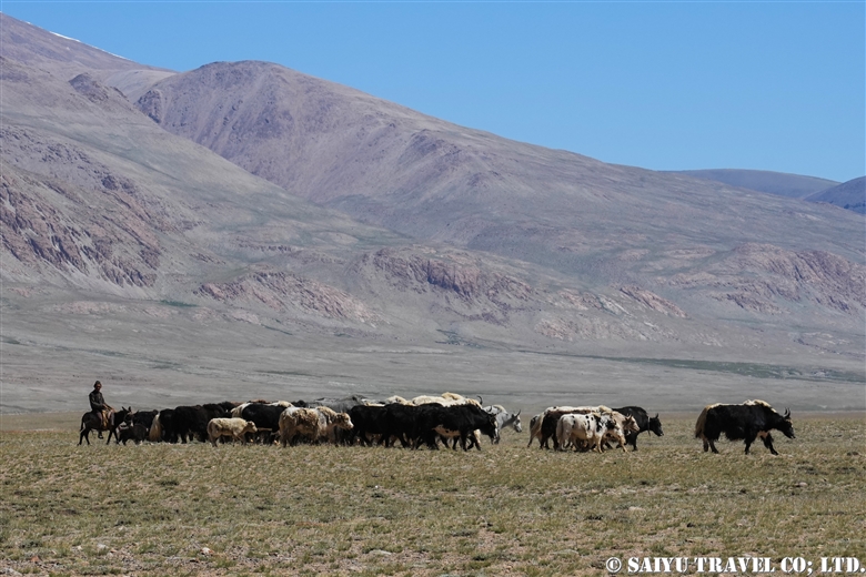
Goats and sheep raised by the Kyrgyz people
Kyrgyz yak. Compared to the yaks of Pakistan, the Kyrgyz yaks are noticeably bigger
Making a dairy product called Qurut

Before the new Taliban regime (2021), there was trade with Chapruson, Pakistan. Every year 500 yaks and Qurut (a type of dried cottage cheese) made during the summer were sold. Now they sell sheep and goats to traders coming from Kabul and other part of Afghanistan and say they are looking forward to resuming trade with Chapruson.

Kyrgyz Women’s Summer Life

Kyrgyz women take care of the offspring of livestock born in the spring and early summer, milking them and making dairy products for a living. In the morning, the milking begins around 8 to 8:30 am. After that, the women wash dishes in the river, bake Naan bread, and make Qurut (cottage cheese which they will dry later for sale). Bargaining with merchants from the Wakhan corridor and southern Afghanistan is also part of the fun. The women like to buy fancy fabrics and wear new clothes for every important occasion. The merchants seem to have a good grasp of what suits their tastes. In comparison, men in Kyrgyzstan wear mainly “second-hand clothes” and look very plain.
milking a yak

Beauty, the life of the Kyrgyz

On our trip to Little Pamir, we spent four days in a settlement where a small group of Kyrgyz people live. Not only did we visit the yurts, but the children and families of the Kyrgyz came to visit our camp, interest in what we have and what we eat. Some of the children were so curious that they stayed at our camp from morning till night, while others could only come with their parents.

They milked yaks in the morning, washed clothes, made Qurut cottage cheese, baked Naan bread, and visited friends in their spare time.

Woman washing her hair while her older relative is making Qurut from fresh milk
Young Kyrgyz lady washing her hair
In the yurt where the Kyrgyz live
Girls washing dishes
Children visiting our campsite

A merchant who has been coming to Pamir for more than 20 years said: “There are people who became poor after the road was built.” and “I saw the guy who became poor because they sold a lot of yak and bought cars, which later broke down”.The construction of the road has probably attracted more traders than before, and the number of cash transactions has increased. While some people have become poor, some Kyrgyz families with cars and livestock seem to have become rich. The disparity is clearly on the rise.

Kyrgyz girl holding a baby goat

The Kyrgyz people’s way of life in the wilderness of Wakhan is absolutely fascinating. These nomads of the Afghan Pamirs have a lot of resilience and the history of coexisting and interacting with other ethnicities.


Photo & Text : Mariko SAWADA

*Contact us, Indus Caravan for more information or to make arrangements for visiting Afghanistan, Wakhan Corridor.

*Please follow us on YoutubeInstagram & Facebook

Category : ◆Afghanistan > - Wakhan Corridor
Tag : , , , , , , , , , , , , , , ,

TOP