English / Japanese

Over the Baltoro Glacier, the Trek to Broad Peak B.C. and K2 B.C., Part 2

The following is the continuation of a photo report of Teppei Kamitani’s 2024 season excursion to the Baltoro Glacier—titled “Over the Baltoro Glacier to Broad Peak B.C. and K2 B.C.” Many spectacular drone aerial photographs are included within.

The second part of the blog traces and documents (with photos) the trek to Concordia in the following order: [Urdukas → Goro Ⅱ → Concordia → Broad Peak B.C. → K2 B.C.→ Concordia].

Over the Baltoro Glacier, the Trek to Broad Peak B.C. and K2 B.C., Part 1

Day 7: Urdukas to Goro Ⅱ

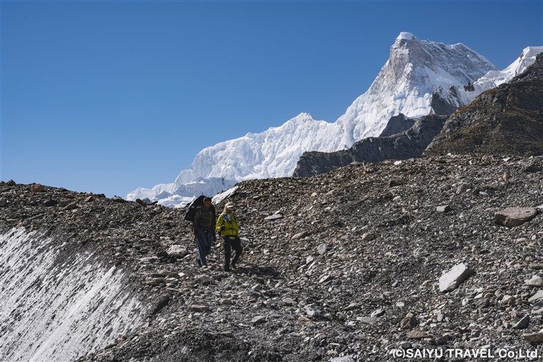
We left Urdukas at 7:00 a.m. and were up on the Baltoro Glacier within 30 minutes. Today’s route was a continuous up-and-down walk along the moraine of the Baltoro Glacier.
It was a clear day, so even though we were on a glacier, the sunlight made us feel warmer than the real temperature let on. We proceeded deeper into the moraine, wearing light clothing.
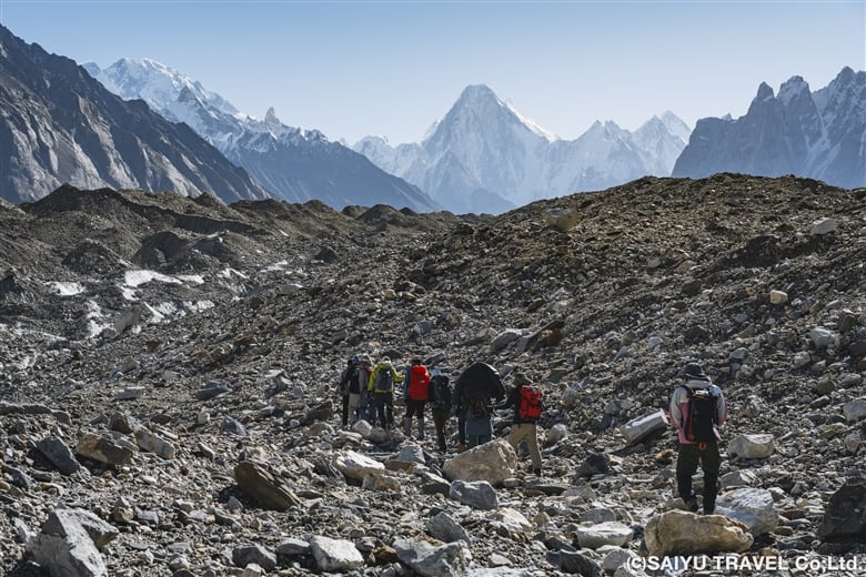
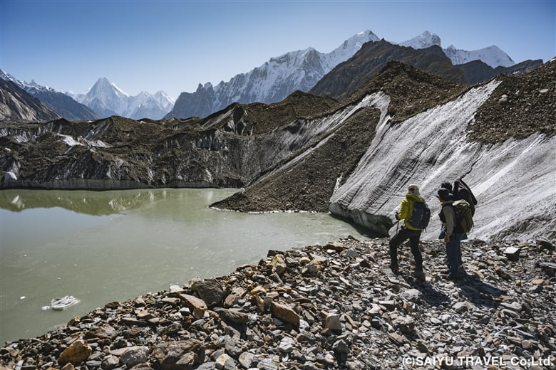
The mountain rising high in the front is Gasherbrum IV Peak (7925m)
Gasherbrum Mountains seen behind the glacial lake
Masherbrum (7821m), the 22nd highest peak in the world, designated as K1 according to surveying notation

At 11:45 we arrived at our lunch stop, Goro I (4,100m), where we had ourselves a lavish lunch at a table in the middle of the glacier. On the outward trek, we did not stay here but continued instead on to Goro II.
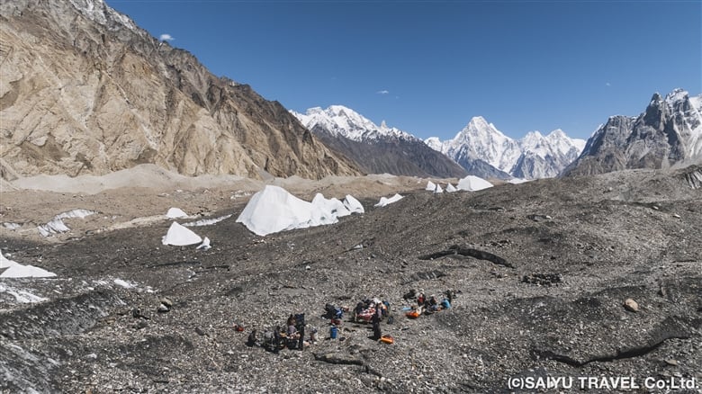
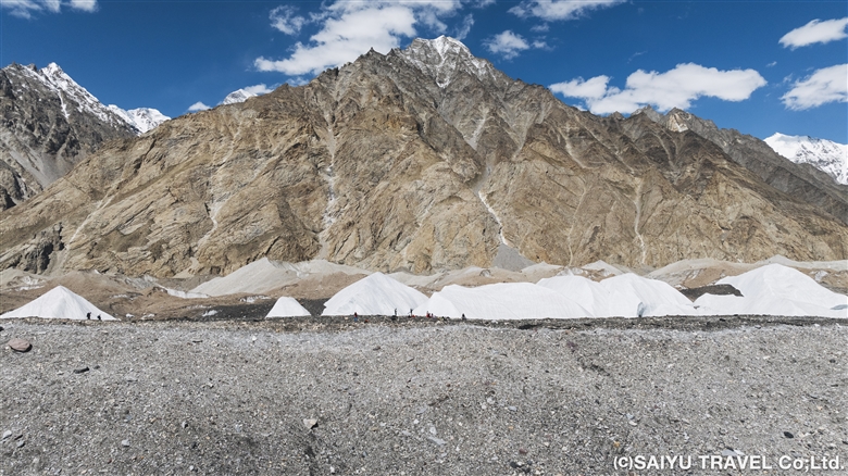
Arrival at Goro I (4100m). We enjoyed lunch at a table in the middle of a glacier with a luxurious view.
Baltoro Glacier is approximately 100 meters thick, equivalent to 25 floors of a building!

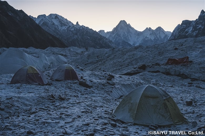
After another 2.5 hours, we arrived at Goro II (4,380m), also a camp on the glacier, at 15:00. After Goro II, we slept on the ice, as the temperature continued to drop in both the morning and evening. It was cloudy on the outward trek, but on the way back to Goro I, we had an excellent view of the Gasherbrum mountains. The -6℃ temperature in the morning, however, was less than excellent. My hands were freezing cold.
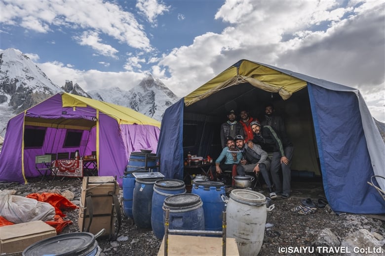
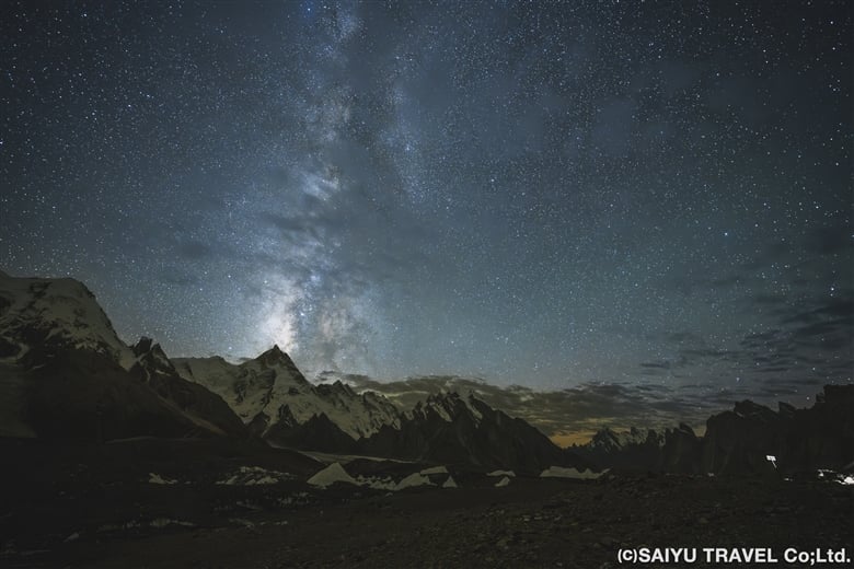
At Goro II Camp, treated to a good view of Masherbrum. A glimpse into the tour kitchen and dining room
The Milky Way over Masherbrum
Thisphoto was taken on the way back

Day 8 & 9: GoroⅡ to Concordia

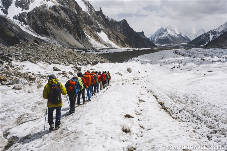
Waking up in the morning at the camp on the glacier, the cold air—which now felt stronger than before—imbued us with a sense of determination. Under slightly overcast skies, we departed for our destination, Concordia. Continuing from the previous day, it was just up and down on the glacier moraine. Thankfully, however, the path was quite gentle and flat in many parts, making for an easy walk.
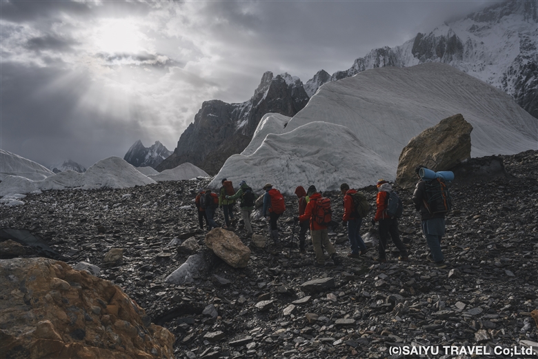
With the morning sun shining through the clouds, we walked through the icy world to reach Concordia

In the afternoon, cold rain began to fall, which was hard on our tired bodies at the end of the day. We continued further into the depths of the mountain to a campsite where we could see K2 in front of us. Finally, we arrived at the Concordia camp, the turnaround point.
Unfortunately, K2 was still obscured by clouds when we arrived and did not grace us with its presence, but we still held on to hope. We stayed at the Concordia Camp for two days, which served also as time to rest.
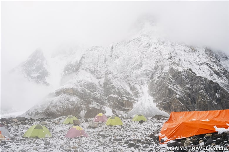
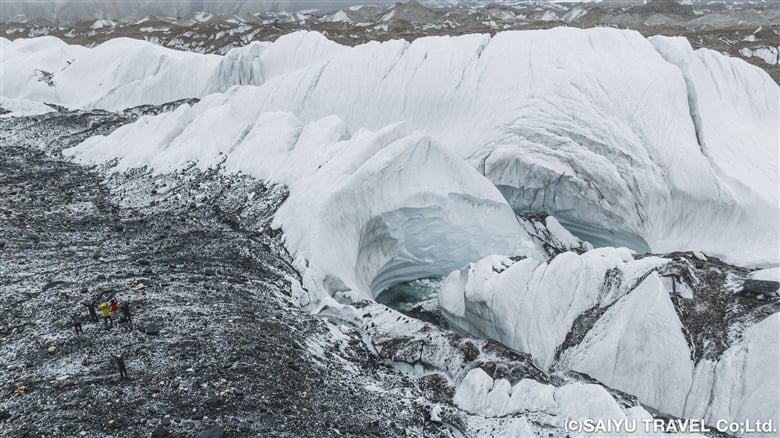
When we arrived at Concordia, the snow cover had turned the surroundings into a world of silvery white!
A spectacular serac zone

Day 10 Concordia to Broad Peak B.C.

In the morning, we woke up to steady snowfall. Visibility was almost zero, making it difficult for the porters and horses to move forward, so we had to temporarily postpone our departure and wait until 9:00 a.m. The sun came out before 9:00 a.m., and a blue sky quickly revealed itself before us. It was time to set out!
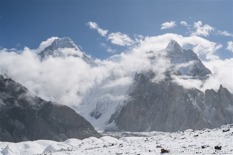
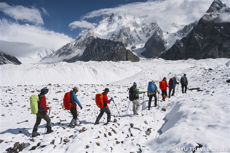
Early in the morning it was snowing, with zero visibility, but it cleared up around 9:00 a.m.
Now it was time to depart for Broad Peak B.C.!
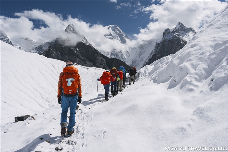
The ordinary moraine was covered with snow, making it look almost fantastical

We changed to chain spikes/light crampons after 10 minutes of walking and passed through a serac zone. The route seemed to have changed a bit, and the serac was very gentle—traversable even without spikes. After the ups and downs of the large moraine, we simply walked along the side moraine of the Godwin-Austen Glacier, arriving at Broad Peak B.C. at about 14:00.
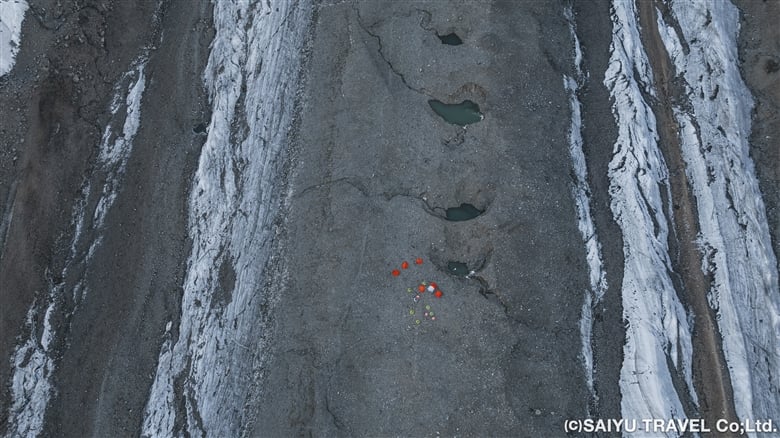
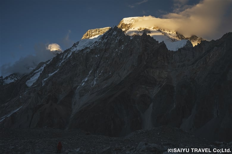
Broad Peak B.C. in the middle of Godwin-Austen Glacier
Broad Peak seen from the BC is divided into three peaks. From the back left: Broad Peak North Peak, Broad Peak Central Peak, and Broad Peak Main Peak (8,051m)
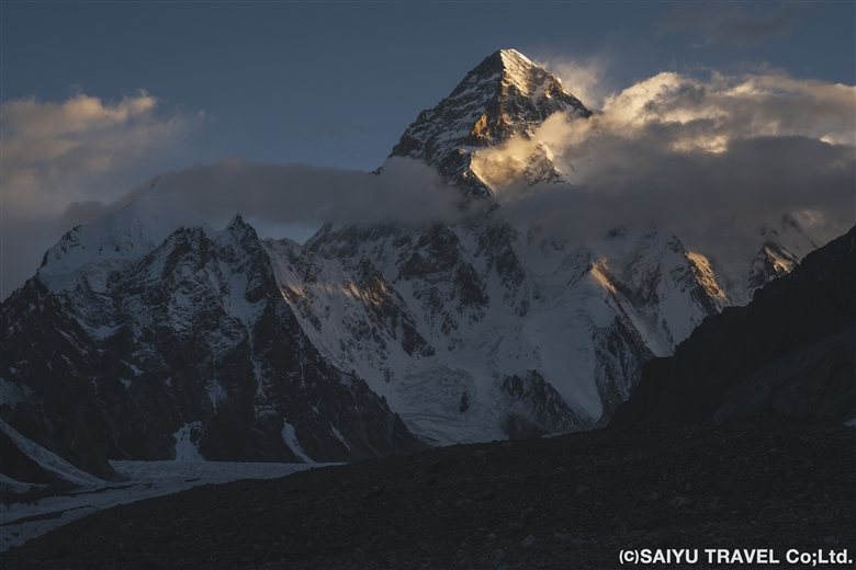
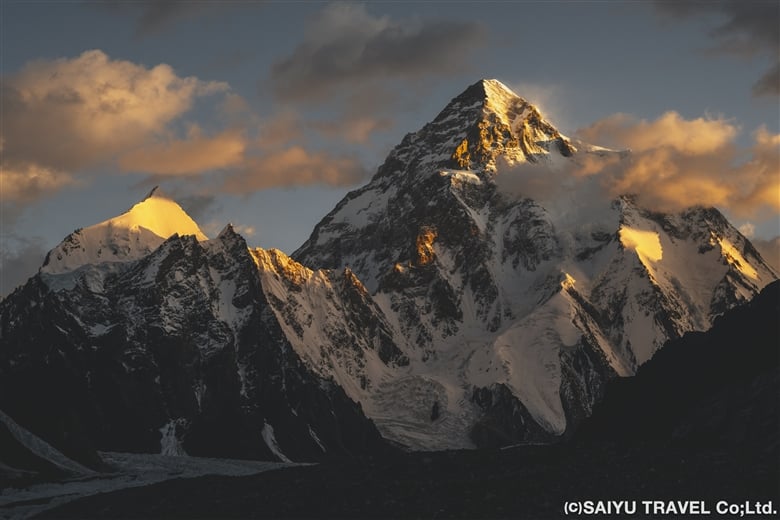
K2 (8,611m) at sunrise is a breathtaking sight

Day 11 Broad Peak B.C. to K2B.C and Back

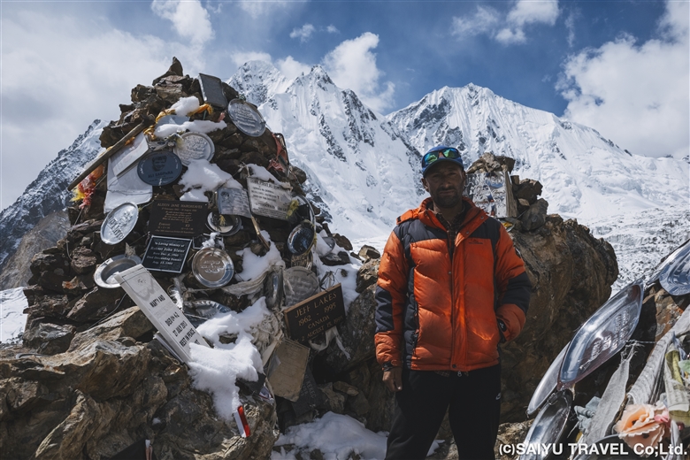
Finally, we set out for K2 B.C. This was a day round trip from Broad Peak B.C. We started at 7:00 a.m. and had a very pleasant 2 ½ hour flat walk up an icy area next to a moraine. Then we trekked up and down the messy moraine to our first destination, K2 Memorial. The K2 Memorial is built on a very steep rock slope, so it was tough to climb up, but we visited and said a prayer for the climbers who lost their lives in the mountains of the Baltoro Glacier, including K2. After descending to the bottom of the rock tower, we had a quick lunch of onigiri (rice balls) and then continued further along the gentle moraine, eventually arriving at K2 Base Camp at 11:30!
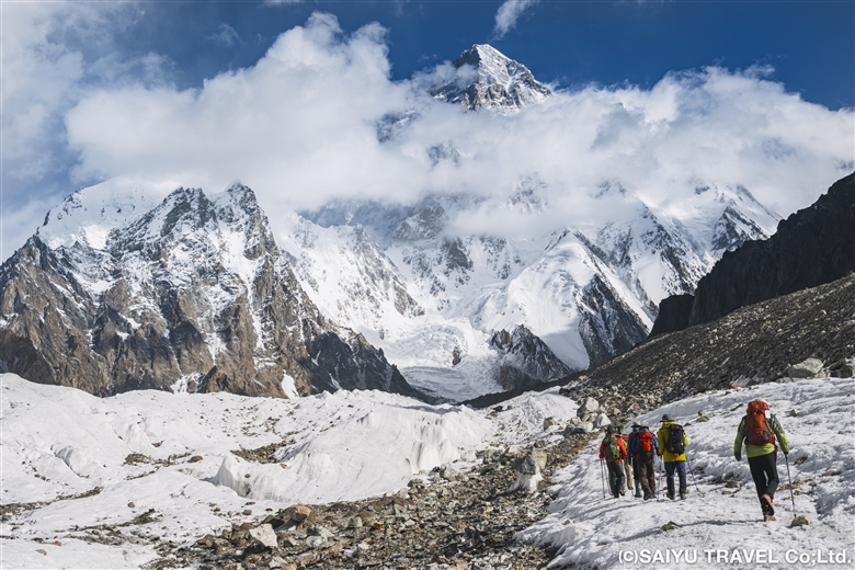
To K2 B.C.
Memorial to the many climbers who lost their lives in the mountains of the Baltoro Glacier
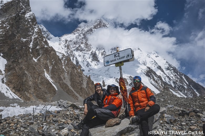
We reached K2 B.C. (5,150m). Our guide found the fallen K2 BASE CAMP sign in the moraine and took a commemorative photo

Day 12: Broad Peak B.C to Concordia

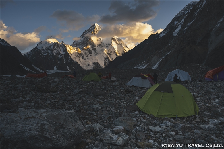
At Broad Peak B.C., where we stayed for two nights, K2 came into view around 5:35 a.m., glowing in the morning sun, giving the members a chance to gaze at the world’s second highest peak. After breakfast, we headed back to Concordia.
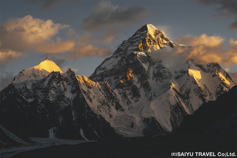
K2 shining in the morning glow seen from Broad Peak B.C.
A view of the base camp. Members gazed at the world’s second highest peak

As on the outward trek, we walked for 3 hours on gentle moraines, passing army camps. After 1 hour of walking along the moraine & serac belt, we arrived at Concordia. At Concordia, the staff had set up camp in the exact same spot as our previous stay and had prepared a welcome drink and lunch for us. I have nothing but gratitude for them and their consistently prompt work.
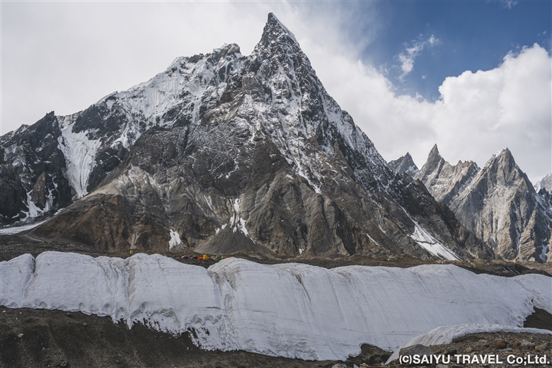
Passing through the serac belt again, we return to Concordia
Our camp visible at the foot of Mitre Peak, behind the serac belt
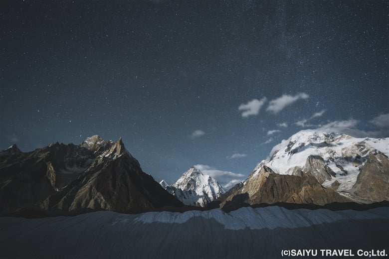
At night, the moonlight illuminated the mountains, creating a beautiful scene

We then said goodbye to K2 from Concordia and retraced our outward route for another 5 days, ending our long trek in Askole. The entire trip took 17 days. At the finish line, the staff congratulated us and toasted us with drinks, in the form of Coke. Some of our members commented that they had never enjoyed a Coke so much in their lives. It must have been because of the overwhelming accomplishment they felt after walking all the way back. Thank you very much, everyone!
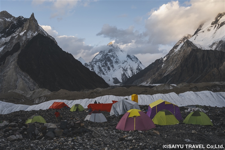
Today was the day we said goodbye to K2. We were about to go back the way we came


Photo & text : Teppei Kamitani

Visit : Aug-Sep 2024 Baltoro Galcier- K2BC


▼Related Articles

Youtube : CONCORDIA 360 DEGREE

Youtube : Our baltoro Trek in 1 Min !

K2 & Baltoro Glacier Trekking 2022 (Part 1) Skardu to Paiju

K2 & Baltoro Glacier Trekking 2022 (Part 2) Paiju to Khoburtse

K2 & Baltoro Glacier Trekking 2022 (Part 3) Khoburtse to Urdukas

K2 & Baltoro Trekking 2022 (Part 4) Urdukas to GoreⅡ

K2 & Baltoro Trekking 2022 (Part 5) GoreⅡ to Concordia

Staying in Concordia, surrounded by the high Peaks of the Karakorum: K2, Broad Peak, Gasherbrum Mountain Range

*Contact us, Indus Caravan for more information or to make arrangements for your Baltoro Glacier K2BC trek.

*Please follow us on YoutubeInstagram & Facebook

Category : - Baltoro Glacier & Concordia > - Baltoro Glacier & Concordia > ◆ Gilgit-Baltistan > ◇ Mountain of Pakistan
Tag : , , , , , , , , , , , , ,

K2 & Baltoro Trekking 2022 (Part 4) Urdukas to GoreⅡ

Finally, the Baltoro Glacier camping is about to begin. Today, in a relatively short hike, we will walk from Urudukas (4,061 m) to Gore I (4,185 m), lunch, and then continue the hike to Gore II (4,271 m). Immediately after leaving Urdukas, we will enter the Baltoro Glacier and repeat many ups and downs to progress.

K2 & Baltoro Glacier Trekking 2022 (Part 1) Skardu to Paiju

K2 & Baltoro Glacier Trekking 2022 (Part 2) Paiju to Khoburtse

K2 & Baltoro Glacier Trekking 2022 (Part 3) Khoburtse to Urdukas

K2 & Baltoro Trekking 2022 (Part 4) Urdukas to GoreⅡ

K2 & Baltoro Trekking 2022 (Part 5) GoreⅡ to Concordia

Staying in Concordia, surrounded by the high Peaks of the Karakorum: K2, Broad Peak, Gasherbrum Mountain Range

The five kilometer journey between Gore I and Gore II is GIV (7,925 m) in front of Masherbrum (K1, 7,821 m ) to the south and Muztag Tower (7,273 m) to the north. So I got a few photos while trekking.

The view from the Urdukas camp in the morning. From Paiju Peak to Biale, it seems to be a comparison of the high peaks north of the Baltoro Glacier.

From the early morning, the porters and various expeditions started departing one after another. Our group is on the way to Gore II, but the expedition teams will go directly to Concordia or the base camp of the target mountain. For the porters, they just want to quickly carry it up and get back in order to take the next job.

Heading up to the Baltoro Glacier in a caravan of mules and porters.

As we climb, we sit on the boulders that are at the right height, for taking a break along the way.

As the glacier melts, the rocks crumble and from moment to moment the route changes.

We cross over several small rivers that have formed at the various breaks in the glacier.

Just ahead, GIV is getting closer and closer!

We have arrived at our lunch spot on Gore I (4,185m). It was a little too early lunch, so I just took a break.

It is exceptional to be able to sit on a Glacier for lunch on such a sunny day.

After lunch, the peak of Masherbrum (K1) is our guiding star.

The view of Masherbrum as seen from the Baltoro Glacier. With an altitude of 7,821 m, this is the 22nd highest mountain in the world, and in Pakistan, it is the 11th highest mountain. Masherbrum can be seen from the Baltoro Glacier, and can easily be climbed from the Hushe Valley on the south side.

Peak of Masherbrum (7,821 m). In 1856, the British army named this as the first peak of their Karakorum mountain survey, so it got the name K1.

With Masherbrum to our south, we kept making our way across the glacier to Gore II (4,271m).

From our campsite at Gore II, we could continue to enjoy our day of “Masherbrum watching” until dark.


Photos & Text: Mariko SAWADA
Trek Date: Early Jun, 2022

*The altitudes and distances traveled from site to site that are listed, are based on our own measurements and GPS equipment. Please note that these may differ from other official books or reference materials.

*Contact us, Indus Caravan for more information or to make arrangements for your Baltoro Glacier trek.

*Please follow us on YoutubeInstagram & Facebook

Category : - Baltoro Glacier & Concordia > - Baltoro Glacier & Concordia > ◆ Gilgit-Baltistan > ◇ Mountain of Pakistan
Tag : , , , , , , , , , , , , , , , , , , ,

K2 & Baltoro Glacier Trekking 2022 (Part 3) Khoburtse to Urdukas

Today we only travel about 7 km, from Khoburtse (3,834m) to the campsite in Urdukas (4,061m), which makes it a short day for trekking. Along the way, we cross two glaciers from the Urdukas Peaks, and from tonight we will finally begin camping at over 4,000 m.

K2 & Baltoro Glacier Trekking 2022 (Part 1) Skardu to Paiju

K2 & Baltoro Glacier Trekking 2022 (Part 2) Paiju to Khoburtse

K2 & Baltoro Glacier Trekking 2022 (Part 3) Khoburtse to Urdukas

K2 & Baltoro Trekking 2022 (Part 4) Urdukas to GoreⅡ

K2 & Baltoro Trekking 2022 (Part 5) GoreⅡ to Concordia

Staying in Concordia, surrounded by the high Peaks of the Karakorum: K2, Broad Peak, Gasherbrum Mountain Range

Shortly after leaving Khoburtse, we crossed the glacier from the Urdukas Peaks. The big boulders and rocks are scattered around us everywhere.

The mules are loaded down with climbing equipment, as one party passes by us one after another. When I asked the porter what is going on, he said that there are two expedition groups heading for Urdukas from Paiju. It seems the campsite will be crowded tonight.

A Balti porter who is drinking the glacier water. Throughout the trip, you will be amazed at their strength.

As we near Urdukas, the there is more vegetation, and the alpine plants were in bloom. For the rest of the trip, the campsites will all be on the glacier, so this is the last chance for the pack animals to eat fresh grass.

Even so, the flowers were in bloom near the campsite and those tough little mules were grazing on them. The mules kept arriving in droves, to eat the flowers and grass. The number of mules that arrived on this one day exceeded 200 head.

These flowers can typically be seen until early July. Not only flowers, but here, wild birds can also be seen as well. I will introduce just a few of the shots I got.

A Yellow-billed chough, Pyrrhocorax graculus. They are waiting patiently for the humans to leave the campsite with leftovers.

This is the Red-billed chough, Pyrrhocorax pyrrhocorax. They forage for nuts and insects, but here they were aiming for leftover food with the Yellow-billed choughs. Living in this harsh environment, anything we leave behind is such a treat! During the Baltoro Glacier trek, we tend to see more Yellow-billed choughs than the red-billed choughs.

In addition to the two wild crow family, which I just introduced, there is also the raven. This area’s ravens is a subspecies Corvus corax tibetanus (also Tibetan raven), which are the largest and most gorgeous raven species. From this campsite all the way to Concordia, you’ll see these three crows at every campsite along the way.

When I got this shot of the Red-fronted Rose finch, Carpodacus puniceus I was so excited. According to the distribution maps, it is a bird that lives in the high mountains around the Tibetan Plateau.

When we arrived at the campsite, we had it all to ourselves, but then soon after that, two other groups arrived one after another.

By the evening the campsite was bustling. One problem with the Urdukas campsite is that the permanent toilets are very far away. We only stayed for one night, but for groups that come from Paiju to Urdukas in one day, they tend to stay for two nights and take a full day of rest before continuing.

Today, the goat we had brought up with us was butchered, we were offered a fresh “charcoal-grilled liver” and the staff enjoyed a stewed dish of the organs. This goat meat was our source of food until the final day of our trek. By the way, the other group of climbers had brought yaks and dzo (or zho, which are yak-cow hybrids).

The view from the campsite in the evening. Baltoro Glacier with the Trango Castle and beyond that, Uri Biaho.

The west side of the Urdukas campsite just as the sun was setting. A part of the Urdukas Peaks appeared in the background, and moments later, the moon rose from here.

Photos & Text: Mariko SAWADA
Trek date: Early June 2022

*The altitudes and distances traveled from site to site that are listed, are based on our own measurements and GPS equipment. Please note that these may differ from other reference materials.

*Contact us, Indus Caravan for more information or to make arrangements for your Baltoro Glacier trek!

Category : - Baltoro Glacier & Concordia > - Baltoro Glacier & Concordia > ◆ Gilgit-Baltistan > ◇ Mountain of Pakistan > ◇ Birds of Pakistan
Tag : , , , , , , , , , , , , , , , , , , , , ,

K2 & Baltoro Glacier Trekking 2022 (Part 2) From Paiju to Khoburtse

Today is the journey from Paiju to Khoburtse. The route of the Baltoro Glacier changes every year, actually it changes constantly, because the glacier constantly moves and collapses, and the distance to travel changes, depending on that. This year we went near the middle of the glacier and climbed up to Moraine just before the Liligo camp.

K2 & Baltoro Glacier Trekking 2022 (Part 1) Skardu to Paiju

K2 & Baltoro Glacier Trekking 2022 (Part 2) Paiju to Khoburtse

K2 & Baltoro Glacier Trekking 2022 (Part 3) Khoburtse to Urdukas

K2 & Baltoro Trekking 2022 (Part 4) Urdukas to GoreⅡ

K2 & Baltoro Trekking 2022 (Part 5) GoreⅡ to Concordia

Staying in Concordia, surrounded by the high Peaks of the Karakorum: K2, Broad Peak, Gasherbrum Mountain Range

The journey is slow-going from Paiju, at an altitude of 3,420 m to Khoburtse, at an altitude of 3,834m. It is only a 15km in distance, but it takes a lot of adapting to the conditions and going carefully along. Most trekkers just head directly for Urdukas.

From the Paiju campsite, we walked north along the banks of Braldu River for 4 km and then hiked up the Baltoro Glacier.

The Braldu valley is formed by the water that flows out from the Glacier.

The Trango Towers in the background.

Great Trango Tower, 6,286m as seen from the Baltoro Glacier. The Trango Towers are famous for having one of the largest rocky cliffs in the world.

Breaktime!

The view after crossing Liligo. The Glacier and the Baltoro Cathedral and the Lobsang Spire just beyond it.

Arrived at the Khoburtse campsite. It is much smaller compared to the Paiju and Urdukas. There were no other guests so our group had the whole campsite to ourselves.

The Kitchen tent. Dinner usually starts at 6:30pm every day during trekking.

After dinner, the sunset from Khoburtse. The porters’ tents stayed lit. The clear skies over the mountains were beautiful.

On the left is Paiju Peak, and on the right is Uli Biaho.

The Khoburtse campsite is set right in the front of the Trango castle (on the right).
Tonight was another quiet night for us.


Photos & Text: Mariko SAWADA
Trek Date: Early June 2022

*The altitudes and distances traveled from site to site that are listed, are based on our own measurements and GPS equipment. Please note that these may differ from other official reference materials.

*Contact Indus Caravan for more information or to make arrangements for your Baltoro Glacier trek!

Category : - Baltoro Glacier & Concordia > - Baltoro Glacier & Concordia > ◆ Gilgit-Baltistan
Tag : , , , , , , , , , , , , , , ,

TOP