English / Japanese

Re-discovering Afghanistan:Bamiyan Valley

“Bamiyan? There are no more big Buddha statues there, right?”

In March 2001, two huge Buddha statues, one 55 meters and the other 38 meters high, were cruelly destroyed by the Taliban of the time. It was an eye-opening event that made the world aware of the Taliban and the situation in Afghanistan at that time.

Though the Great Buddha has been lost and many of the caves destroyed, the valley of Bamiyan has much more to offer than that. Nowadays, the bazaar has expanded, more hotels have been built, and Bamiyan now attracts domestic tourists from Kabul and other urban areas on weekends as well as foreign tourists. Those who knew the old Bamiyan will be surprised at its changes.

There are two routes from the capital Kabul to Bamiyan. One is the so-called ”northbound route over the Shibar Pass“ and the other is the ”southbound route over the Hajigak Pass“. Both routes lead to the Shahr-i-Zohak, which stands in front of the checkpoint at the entrance to the Bamiyan Valley.

Shahr-i-Zohak, located at the entrance of the Bamiyan Valley

Shahr-i-Zohak

Shahr-i-Zohak is the remains of a fortress located at the confluence of the Bamiyan and Kalu Rivers, 17 kilometers east of the town of Bamiyan. The present ruins of the fort are said to date back to the reign of the Shansabani kings in the 12th century (during the Genghis Khan invasion), but in fact it was used as a natural fortress from around the 6th century. It is said that remains from the Buddhist period were also found. It was also used in modern warfare during the civil war. In the evening sun, Shahr-i-Zohak glows red, giving it the nickname ”Red City.“ From the top of the fort, you can see the beautiful valley along the Kar River.

Bamiyan valley seen from Shahr-i-Zohak

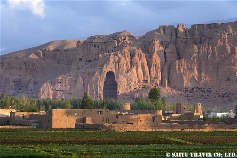
Passing Shahr-i-Zohak, you can continue to Bamiyan. On your left, you will see the ruins of an old caravanserai, followed by the village of the Hazara people. Soon you will see a group of caves ahead. These are the Bamiyan Caves.

Bamiyan Caves

The Bamiyan Caves are comprised of approximately 750 caves built over a length of 1,300 m on the northern cliffs of the Bamiyan Valley. Located on the east and west sides of the caves are the Western Buddha (55 m high) and Eastern Buddha (38 m high), both of which were destroyed by the Taliban in 2001. In 2003, the site was registered as a UNESCO World Heritage Site as the ”Cultural Landscape and Archaeological Remains of the Bamiyan Valley“. In the past, UNESCO and archaeologists from various countries were working to restore and preserve the site, but conservation work has been suspended since the new Taliban regime came to power.
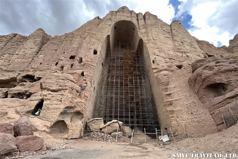
Bamiyan West Buddha

As of 2024, visitors can walk from the West Buddha to the East Buddha and climb the stairs to the interior of the East Buddha. The caves with remaining murals are often locked to protect them from destruction by local tourists.
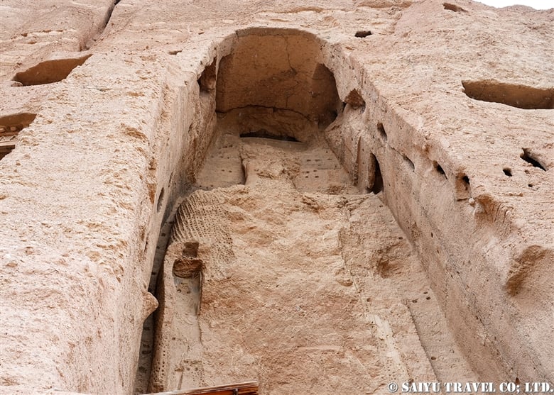
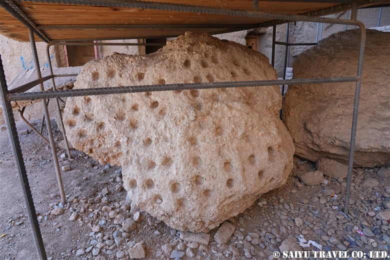
Bamiyan East Buddha
Part of the Buddha statue that was blown up and collapsed in March 2001
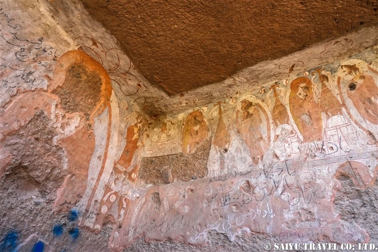
Mural paintings remaining on the terrace of the East Buddha

As you go up inside the East Buddha, you can see a view of the Bamiyan Valley from the terraced caves and the terrace near where the head of the Buddha used to be. The area between the Bamiyan Caves and the bazaar has been preserved without development as a UNESCO Scenic Area, but after the new Taliban regime, this has not been followed and new gas stations and stores have begun to be built.
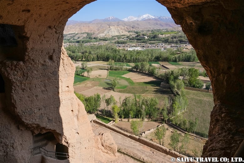
Bamiyan Valley seen from the terrace of the East Buddha niche

The large hill at the edge of town is Shahr-i-Gholghola.
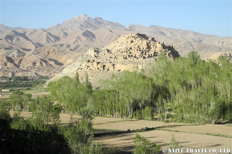
Shahr-i-Gholghola

Shahr-i-Gholghola

Shahr-i-Gholghola is the ruins of a fort, which was also known as the ”City of Screams“. 12th century Bamiyan was a prosperous city of the Shansabani dynasty, the successor to the Ghurid dynasty, but it was turned into a ghost town after Genghis Khan’s army attacked the city in 1221. The screams of those slaughtered at that time were the reason for the fort’s name. Although part of the ruins have been renovated and renewed with international aid, some people say that it has been cleaned up too much and was more impressive in the past. From the top of the fort, you can enjoy a panoramic view of the Bamiyan Valley.
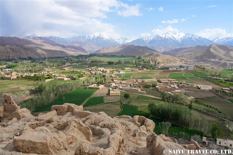
Bamiyan valley seen from Shahr-i-Gholghola

In addition to the famous Bamiyan Caves, there are two other cave complexes in Bamiyan: the Foladi Caves and the Kakrak Caves. Both caves are located by the river and are accessible by a short walk. Tourists who visited here before the Soviet invasion used to visit the Kakrak Caves in the evening and call the standing Buddha statue “Sunset Buddha,” because of the view when the setting sun shone on it.

Foladi Caves

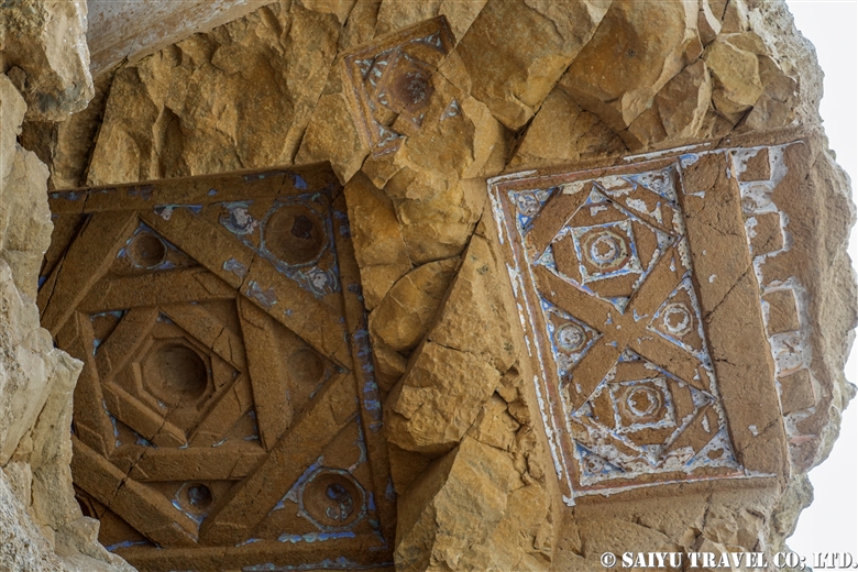
This is a group of about 50 caves built along the Foladi River, which runs along the west side of the Bamiyan Valley. Although the caves are damaged because villagers continue to use them as livestock pens and dwellings, ceiling decorations such as those of the Laternendecke can still be seen. It is a peaceful place where visitors can see glimpses of village life.
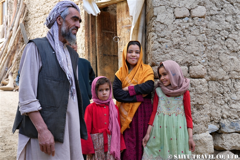
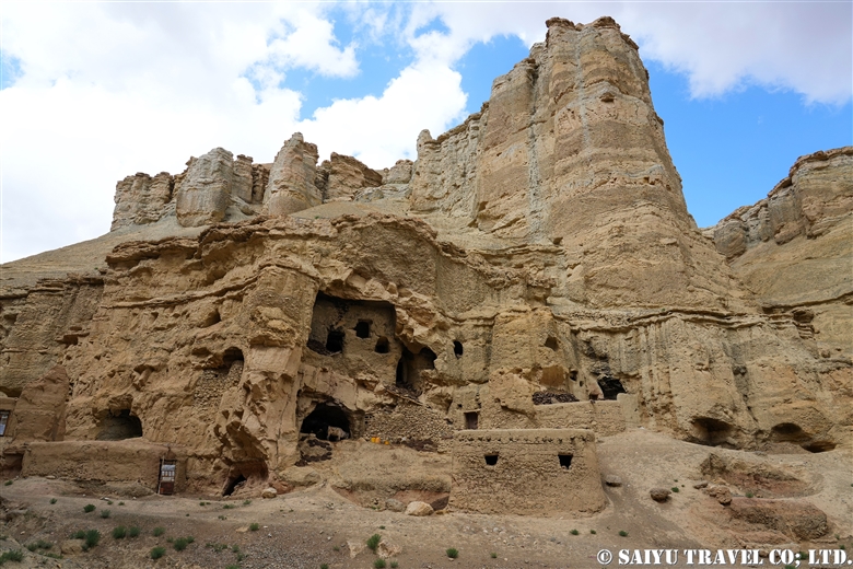
People living near Foladi Caves
People have used the grottoes as livestock pens and dwellings.
Laternendecke ceiling decoration

Kakrak Caves

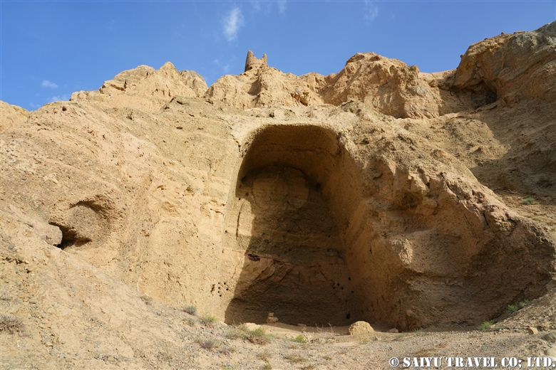
A group of caves built along the Kakrak River, which runs along the eastern side of the Valley. These caves are the site of the famous red-toned mural paintings that are kept in the Guimet Museum in France and the Kabul Museum. There was a 6.4-meter-high standing Buddha statue, but it was destroyed by the former Taliban regime in 2001, along with two Great Buddha statues. The ruins of an Islamic watchtower can be seen on top of the caves. Although nothing remains, visitors can enjoy a typical view of Bamiyan Valley while walking through the farmland.
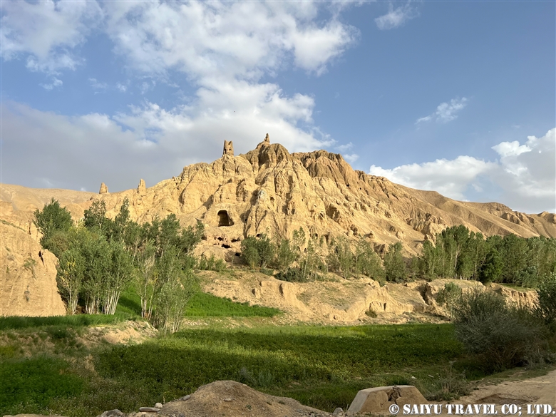
Distant view of Kakrak Caves
A wall niche that once housed a standing Buddha, destroyed by the Taliban in 2001 along with two Great Buddha

Dragon Valley

The valley is located 9 km southwest of Bamiyan. According to legend, when a village girl was about to be sacrificed to a dragon, a brave man (Hazrat Ali) confronted the dragon and cut it in two. The dragon cried tears of regret. The dragon’s split back is the cleft in the rock, and the ”tears” still flow as a mineral spring. After the civil war, this valley, which had been empty, has grown into a new residential area.
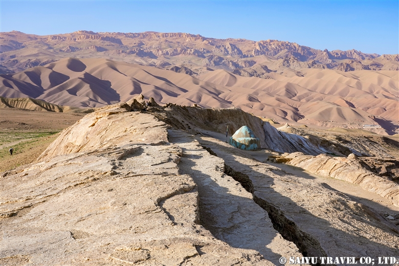
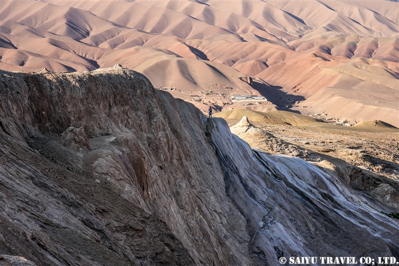
The place that corresponds to the “dragon’s back
At the bottom is “Tears of the Dragon”, a mineral spring gushing out

This has been a brief introduction to the highlights of the Bamiyan Valley, but since the topic of our discussion is Afghanistan, some of you may be wondering whether there are still any remnants from the civil war. In Bamiyan and the surrounding area, mine clearing began at an early stage. For a while after the civil war, tanks were seen here and there on the road from Kabul to Bamiyan and in the valley, but they are long gone now.
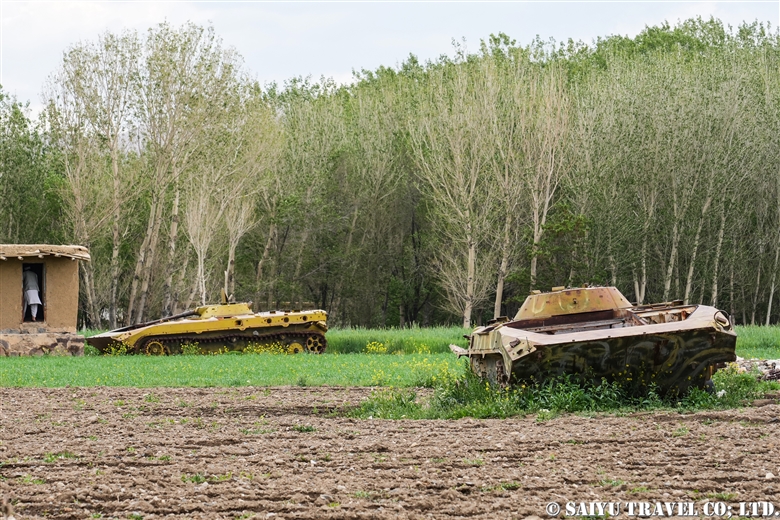
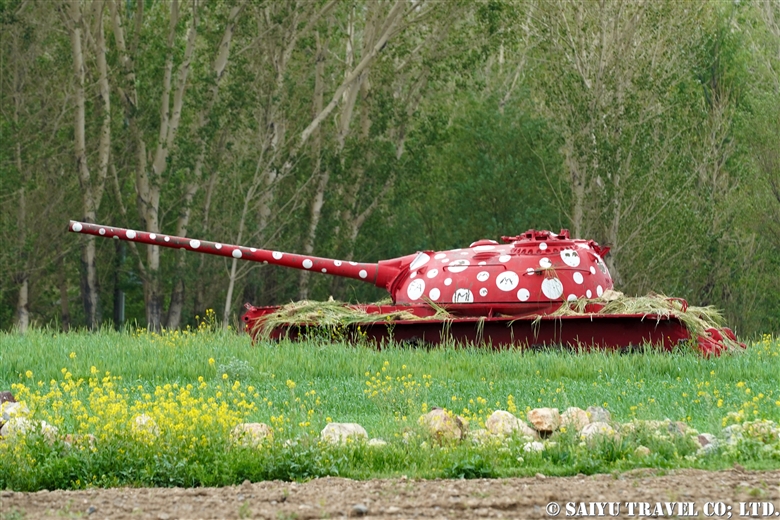
Remaining tanks on the hill of Bamiyan

This is surprising, isn’t it? It was painted by an Iranian artist.
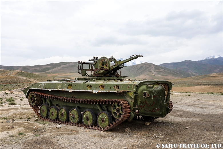
Remaining self-propelled anti-aircraft gun on the Shibar Pass

Perhaps the best-preserved tank in the vicinity of Bamiyan is the one on top of Shibar Pass.
Here we have an everyday scene from the bazaar in Bamiyan.
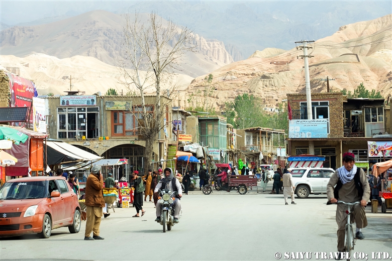
Main Bazaar of Bamiyan

Bamiyan is famous for growing potatoes. Walking around the village, you will encounter many people.

A father and kids met in a potato field in Kakrak
at Kakrak potato field
Girls I met in Foradi

The valley of Bamiyan is photogenic and inspiring enough just for its scenery surrounded by the Hindu Kush mountains and the seasonal life of the Hazara people.


Photo & text : Mariko SAWADA

*Contact us, Indus Caravan for more information or to make arrangements for visiting Afghanistan. >> Our Afghanistan tour .

*Please follow us on YoutubeInstagram & Facebook

Category : ◆Afghanistan > - Bamiyan & around
Tag : , , , , , , , , , , , , , , , ,

Re-discovering Afghanistan: Band-e Amir

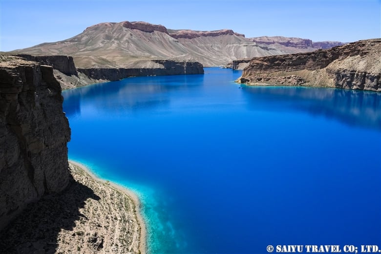
Band-e Amir is a group of lakes located 75 km west of Bamiyan at an altitude of approximately 3,000 meters. Band-e Amir is so beautiful that it is often referred to as the ”Pearl of the Desert,” and is the most picturesque site in Afghanistan, which has many spectacular views.

The road from Bamiyan to Band-e Amir crosses the beautiful valleys and passes of Shahidan. In summer, the road offers spectacular views of the green meadows, which feature beautiful alpine vegetation and pastures. The road before the lake is now paved, making it much easier to access.

Watchtower of the Ghurid dynasty

Departing from Bamiyan, shortly after passing the checkpoint for the Kotal Aqrabat Pass, a watchtower dating back to the Islamic period can be seen in front of you. The watchtowers, dating back to the Ghurid dynasty in the 12th century, remain along the roads around Bamiyan.

Near Shahidan Pass

As you ascend the Shahidan pass, you will see the snow-capped mountains of the Hindu Kush, smooth green meadows, and grazing livestock.

Near Shahidan Pass

Healthy goats and sheep blessed with abundant water and grass!

Ruins of medieval buildings Qala-i-Shahidahn

Ruins of a medieval castle (fortress) in the village of Shahidan. It is a proof that people have been passing through the area as part of the “Silk Road” for a long time. There is also a small bazaar.

Girls running to school

There was also a school, the Hazara girls were just heading to class.

A boy carrying grass for fuel

From Shahidan, drive along a scenic road through Shebartu and Qarghanatu, and finally enter the road to Band-e Amir. A large gate has recently been built. From here, the road is unpaved.

Band-e Zulfiqar

Driving slowly along the dirt road, you will see a beautiful lake in front of you. This is the first view of Band-e Amir. This is part of Band-e Zulfiqar. You will be surprised at how beautiful the color blue can be as it appears in the midst of the desolate landscape.

The ticket office is just ahead, and further along the road, the viewpoint of the main lake, Band-e Haibat, appears.

Band-e Haibat

Band-e Haibat has a first and second parking lot (and a third on weekends…), accommodations, chaikhana, and even an amusement park of sorts. Since the new Taliban regime, the number of tourists from urban areas (especially Pashtuns) who never used to come to this area has increased, and the area has become so crowded that if you can choose the day of your visit, you should avoid the weekend.

Band-e Haibat

For domestic tourists, boat rides are one of the must-do activities when visiting Bande Amir.

Band-e Haibat

This is the 12-meter-high natural dam at Band-e Haibat. The wall (a natural dam) separating the lakes of Band-e Amir is composed of a calcium carbonate called travertine. Mineral-rich water seeping through faults and fissures in the rocky terrain has deposited layers of travertine that have been solidified over time, creating this natural dam.

Band-e Haibat fish

This is a fish from Band-e Haibat, though we’re not sure of the species. Band-e Haibat is the deepest of the six lakes, about 150 meters deep, according to a survey by a New Zealand diving team.

Water overflowing from Band-e Haibat

There are a total of six lakes in Band-e Amir. Of these, Band-e Qambar is almost dry.

Band-e Zulfiqar   (Lake of the sword of Ali)

Band-e Haibat  (Lake of grandiose)

Band-e Gholaman (Lake of the slaves)

Band-e Qambar (Lake of Caliph Ali’s slave)

Band-e Panir  (Lake of cheese)

Band-e Pudina  (Lake of wild mint)

here is a shrine on the banks of Band-e Haibat that is considered sacred as the place where Hazrat Ali spent the night, and people have been making pilgrimages to the lake for a long time. In the past few years, the area has been transformed from a pilgrimage site to a major tourist destination.

Natural dam between Band-e Haibat and Band-e Panir

Natural dam (travertine deposits) between Band-e Haibat (left), Band-e Paneer (right), and Band-e Pudina (top center right).

Band-e Paneer, Band-e Pudina

This photo shows Band-e Paneer and Band-e Pudina about 10 years ago. Now the topography seems to have changed a bit. Also, facilities for tourists have been built.

Walkway between lakes

A boardwalk built between Band-e Paneer and Band-e Pudina. It continues to Band-e Zulfiqar

Band-e Pair

Picnic huts built around Bande Paneer. For domestic tourists, having a picnic in Band-e Amir is like a dream come true.

The truly beautiful Band-e Amir has become a major tourist attraction—one that is very crowded on weekends. However, we are very concerned about the water pollution caused by the garbage left by domestic tourists and the washing the leftover food.

By the way, on the way to Band-e Amir, you may encounter some very beautiful sights, such as the local Hazara people on the move.

A Hazara family traveling on donkeys. The red color stands out in the desolate landscape.
Transporting grass for fuel

We hope you enjoyed this showcase of the spectacular Band-e Amir and the Hazara people who live there. Afghanistan is always undergoing great changes, but we hope that all the ethnic groups living in Afghanistan can live in peace.


Photo & text : Mariko SAWADA

*Contact us, Indus Caravan for more information or to make arrangements for visiting Afghanistan, Bamiyan and Band-e Amir.

*Please follow us on YoutubeInstagram & Facebook

Category : ◆Afghanistan > - Bamiyan & around
Tag : , , , , , , , , , , , , , , , , ,

Re-discovering Afghanistan: the majestic Minaret of Jam

One of the two World Heritage Sites in Afghanistan, Jam minaret and archaeological remains of Jam in the mountains of Ghor Province, the site is not easily accessible neither from Bamiyan nor Herat, and can only be reached by a long drive on rough roads.

It is called a “minaret and archaeological site,” but it is unclear if it is actually a minaret. There is no mosque (perhaps there was an open-type mosque), and there are many opinions, including that it may be a victory tower built over a pre-Islamic pagan holy site.
It could well be Firozkoh of the legendary city, according to one of hypothesis.

There were three main capitals in Ghurid dynasty, Ghazni, Bamiyan, and Firozkoh. The location of one of those three, Firozkoh, is not known, and it is speculated that the ruins near the minaret may be the site of that capital. Incidentally, Chaghcharan in Ghor Province has recently changed its name to Firozkoh and has become a gateway town for tourists visiting the Minaret of Jam from the Bamiyan side.

Remains of buildings on the rocky hill by the minaret. The watchtower is clearly visible.

The Minaret of Jam was built during the reign of the Ghurid dynasty that ruled from Afghanistan to northwestern India, reaching the peak of its power from 1150 to 1215 and reached its peak during the reign of the 12th century king, Ghiyath al-Din Muhammad (1162-1203) and his brother Mu’ izz ad-Din Muhammad (1203-1206). The dynasty was divided after the death of these brothers, and the capital was destroyed by Genghis Khan’s army in 1221. In 1943, the governor of Herat publicized the site, and finally in 1957, the Afghan Historical Society and the French Archaeological Delegation in Afghanistan visited and “discovered” this valuable site.

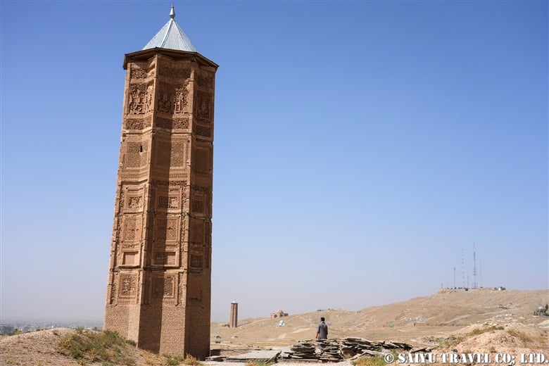
The Minaret of Jam is 65 meters high and has three levels.

The site is located at the confluence of two rivers, Harirud and Jam, which has eroded the foundation and tilted the slim tower slightly. The Minaret of Jam is the only remaining structure from the Ghurid dynasty and is very important for understanding Islamic architecture in the medieval period. It was registered as a World Heritage Site (Heritage in Crisis) in 2002.

The Minaret of Jam has three levels, each level separated by a balcony corbel and topped by a circular arcade of six arches.

Six arches arcade at the top

The first tier up to around 37m is elaborately decorated with molded buff-colored brick reliefs.

The octagonal base of the minaret is 14.5 meters in diameter and 65 meters high, with a tapered tower made of baked bricks. The eight vertical panels corresponding to the octagonal base are superbly done with molded bricks. The rich variety of geometric and plant patterns developed in Bukhara. The most amazing feature is the Arabic Kufi script, in which the entire inscription band of the 19th sura of the Koran (or  Qur’an, the holy scripture of Islam), the chapter of Maryam, is represented from one panel to another.

Kufi Arabic, a manifestation of the 19th chapter of the Koran, surrounds the panel and goes on and on and on.Just below the first balcony is a bright Persian blue kufi inscription, the only colored inscription on the surface, declaring the names of the rulers who spearheaded the construction of this minaret. “Ghiyasuddin Mahammad ibn Sam, Sultan Magnificent! King of Kings!” The architect’s name is also inscribed in small letters: “Ali, son of…”.

The name of the founder appear, “Ghiyasuddin Mahammad ibn Sam, Sultan Magnificent! King of Kings!”

The Qutub Minar in Delhi, India, is the world’s tallest minaret (72.5 m) made of bricks, built around 1200 during the Delhi Sultanate, whose founder, Quṭb al-Dīn Aybak, served the Ghurid dynasty. The minaret of Qutub Minar was built under the influence of the minaret of Jam. Conversely, there is a “Ghazni minaret” in Ghazni of Ghazna Dynasty, and the Minaret of Jam was constructed under the influence of this minaret.

Qurub Minar (Delhi), which was inspired by the Minaret of Jam.
Ghazni’s minaret that inspired and influenced the minaret of Jam.

It used to be possible to climb the spiral staircase inside the minaret, but the entrance is now closed, no longer inaccessible.The view of the “Minaret of Jam” at the end of a long and rough journey is breathtaking and full of archeological awe and majectic beauty.


Image & Text : Mariko SAWADA

Reference :”An historical guide to Afghanistan ” Nancy Hatch Dupree

*Contact us, Indus Caravan for more information or to make arrangements for visiting Minaret of Jam and Afghanistan.

*Please follow us on YoutubeInstagram & Facebook 

Category : ◆Afghanistan > - West Afghanistan
Tag : , , , , , , , , , , , , , ,

Cave City of Bela, Gondrani

A Buddhist ruin, located in Balochistan … though its existence is still a mystery …
This bygone site is known as, “The Cave City of Bela” or “Cave city of Gondrani”. It is located on the outskirts of the secluded town of Bela, where you have to go by a 4WD vehicle or walk across the river.


Till this date, we still don’t know the details and the exact history of what these ruins were or for what purpose they were built and from which era.
However, it is said that it is one of the remains of a Buddhist monastery from around the 8th century when it was a territory of a Buddhist kingdom.


The front side is a terrace and there is a room behind it.


A closer view. I had a strong sense of déjà vu when I first came here. It reminded me of a cave of Bamiyan Valley in Afghanistan. The difference from the Bamiyan was that in Bamiyan the caves were with Buddha and some wall paintings and ceiling decorations, but here there were no decorations at all.


As you walk along the path created by the flow of water, the caverns would eventually become smaller and distorted. Some of the caves have hardly remained in shape due to weathering over many years.


I touched about the Buddhist cave in Afghanistan. This is a panoramic view of the majestic Bamiyan Caves. There are over 750 caves spread over 1300m long cliff. These caves started to build from the 5th century and are considered to have reached their peak in the 6th and 7th centuries and ended in the 8th and 10th centuries. Wall painting and decoration remains on the terrace of East Buddha, on the right side of the photo.


More like the Gondrani Caves than the Bamiyan Cave are the Foladi Caves in the Bamiyan valley.


Some people lived in the cave to take refuge during the recent war. There was also a cave with a black ceiling due to fire.


Unlike the Gondrani Caves, the Foladi Caves have beautiful ceiling decorations such as “Laternendecke”.
Above all, we hope that Gondrani (Bela) Cave city’s historical survey will be conducted soon. So that this uncharted place gets historically recognized throughout the world.


Photo & Text : Mariko Sawada
Visit: Nov 2018, Feb 2019 Cave city of Bela/Gondrani, Baluchistan :
Photographs of Bamiyan & Foladi Cave were taken from 2003-2012

Category : ◆ Balochistan > ◇ Heritage of Pakistan
Tag : , , , , , , , , , , , , , , , ,

TOP