English / Japanese

Over the Baltoro Glacier, the Trek to Broad Peak B.C. and K2 B.C., Part 2

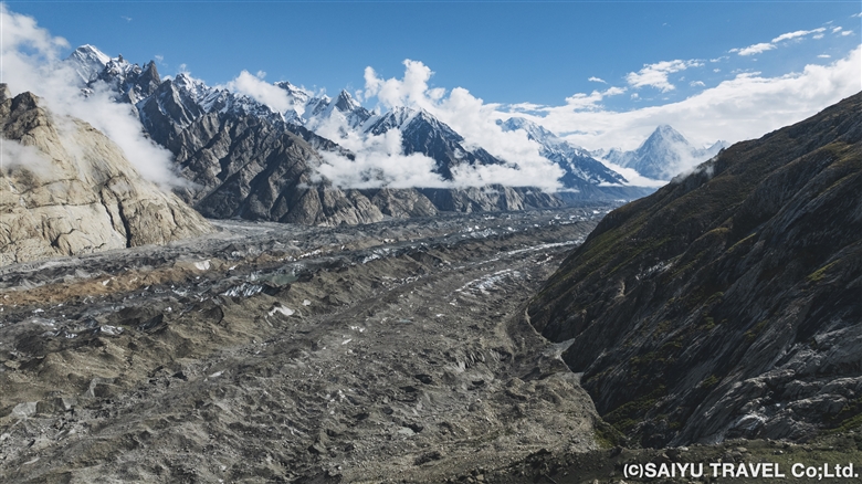
The following is the continuation of a photo report of Teppei Kamitani’s 2024 season excursion to the Baltoro Glacier—titled “Over the Baltoro Glacier to Broad Peak B.C. and K2 B.C.” Many spectacular drone aerial photographs are included within.

The second part of the blog traces and documents (with photos) the trek to Concordia in the following order: [Urdukas → Goro Ⅱ → Concordia → Broad Peak B.C. → K2 B.C.→ Concordia].

Over the Baltoro Glacier, the Trek to Broad Peak B.C. and K2 B.C., Part 1

Day 7: Urdukas to Goro Ⅱ

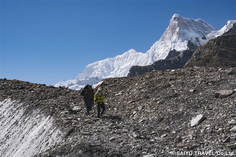
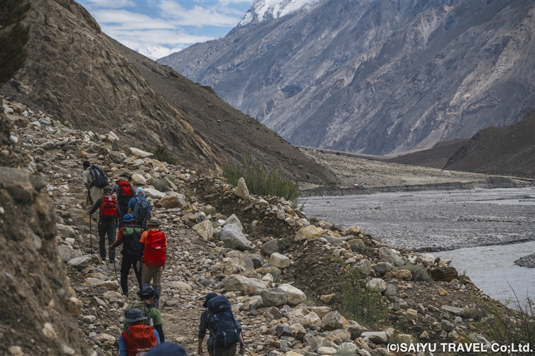
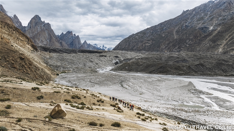
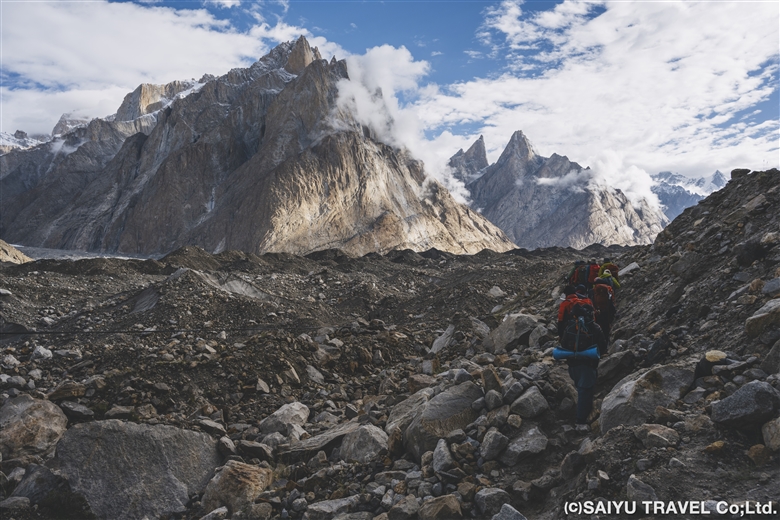
We left Urdukas at 7:00 a.m. and were up on the Baltoro Glacier within 30 minutes. Today’s route was a continuous up-and-down walk along the moraine of the Baltoro Glacier.
It was a clear day, so even though we were on a glacier, the sunlight made us feel warmer than the real temperature let on. We proceeded deeper into the moraine, wearing light clothing.
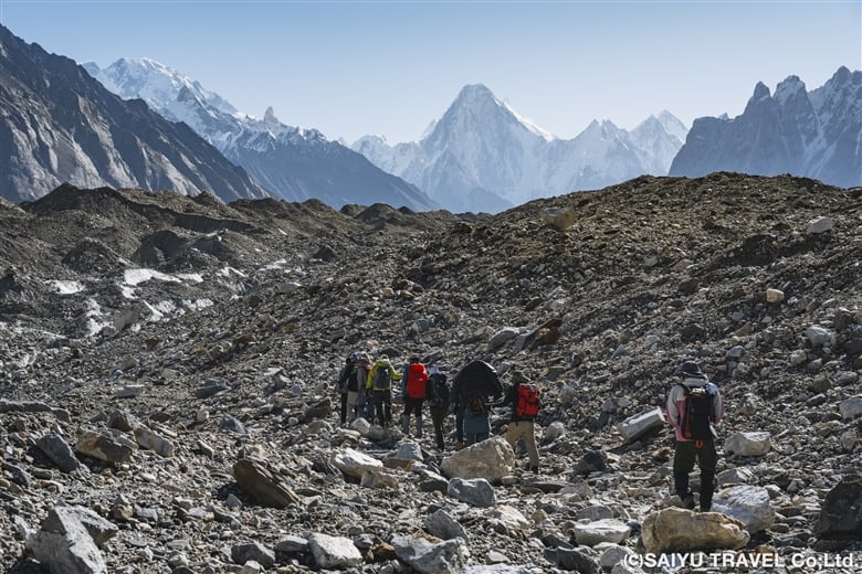
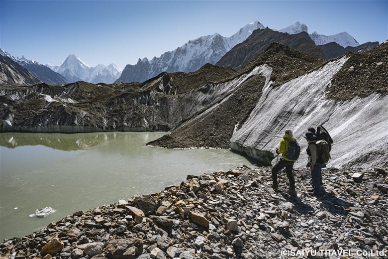
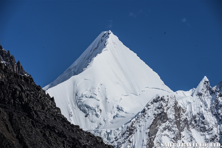
The mountain rising high in the front is Gasherbrum IV Peak (7925m)
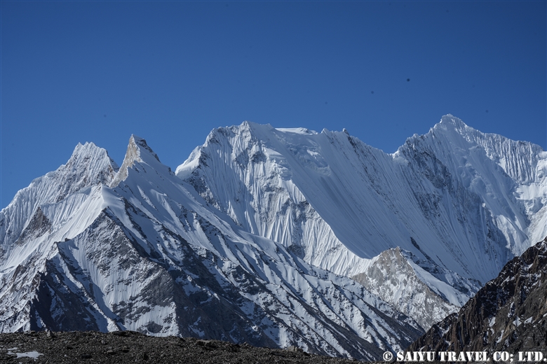
Gasherbrum Mountains seen behind the glacial lake
Masherbrum (7821m), the 22nd highest peak in the world, designated as K1 according to surveying notation

At 11:45 we arrived at our lunch stop, Goro I (4,100m), where we had ourselves a lavish lunch at a table in the middle of the glacier. On the outward trek, we did not stay here but continued instead on to Goro II.
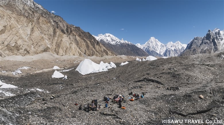
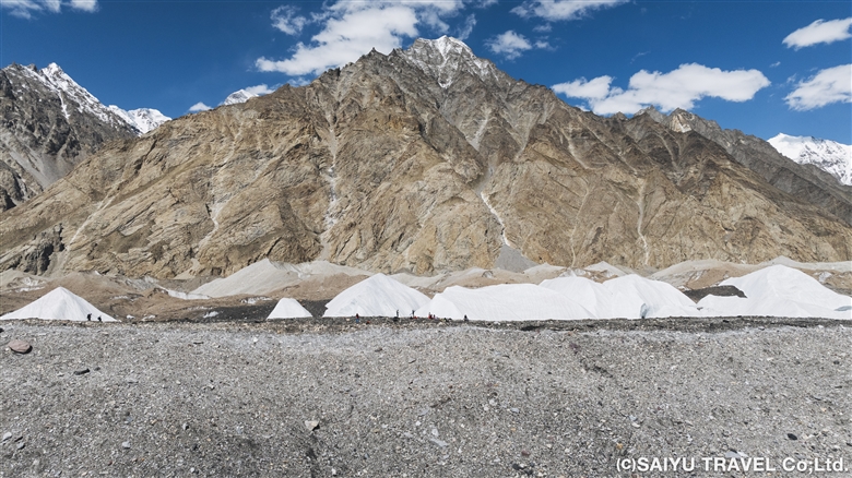
Arrival at Goro I (4100m). We enjoyed lunch at a table in the middle of a glacier with a luxurious view.
Baltoro Glacier is approximately 100 meters thick, equivalent to 25 floors of a building!

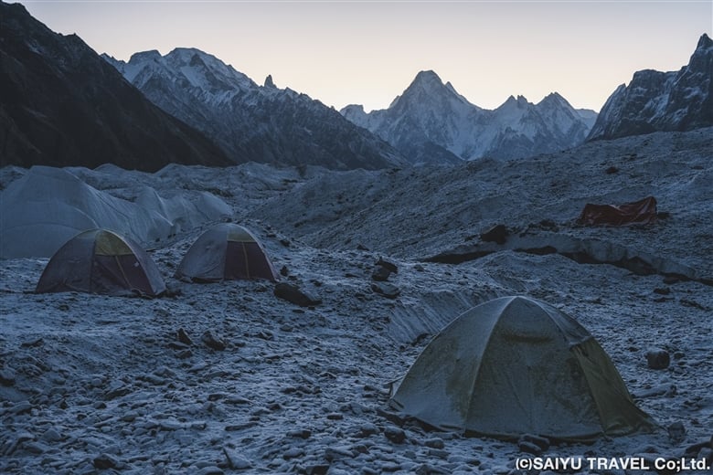
After another 2.5 hours, we arrived at Goro II (4,380m), also a camp on the glacier, at 15:00. After Goro II, we slept on the ice, as the temperature continued to drop in both the morning and evening. It was cloudy on the outward trek, but on the way back to Goro I, we had an excellent view of the Gasherbrum mountains. The -6℃ temperature in the morning, however, was less than excellent. My hands were freezing cold.
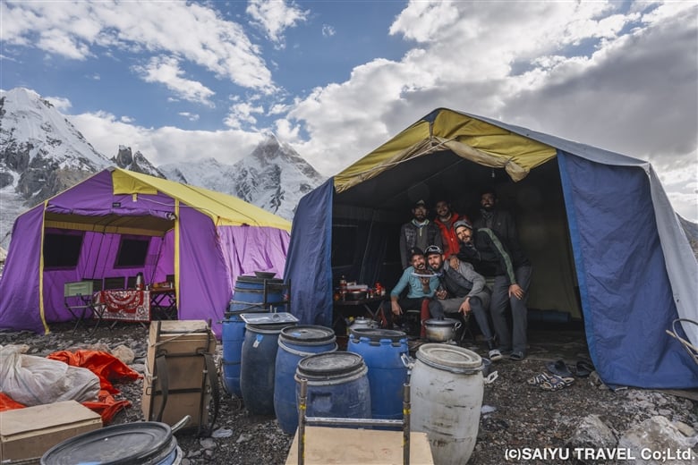
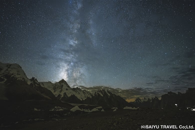
At Goro II Camp, treated to a good view of Masherbrum. A glimpse into the tour kitchen and dining room
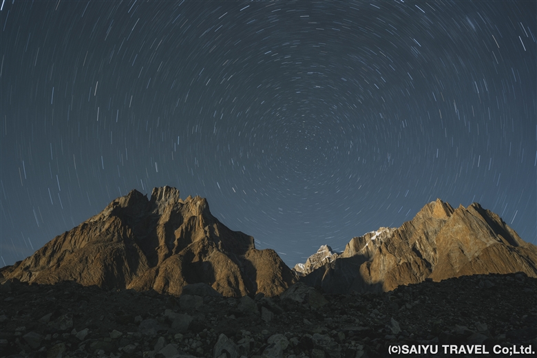
The Milky Way over Masherbrum
Thisphoto was taken on the way back

Day 8 & 9: GoroⅡ to Concordia

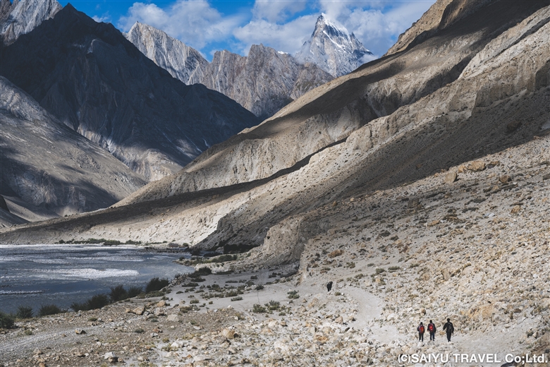
Waking up in the morning at the camp on the glacier, the cold air—which now felt stronger than before—imbued us with a sense of determination. Under slightly overcast skies, we departed for our destination, Concordia. Continuing from the previous day, it was just up and down on the glacier moraine. Thankfully, however, the path was quite gentle and flat in many parts, making for an easy walk.
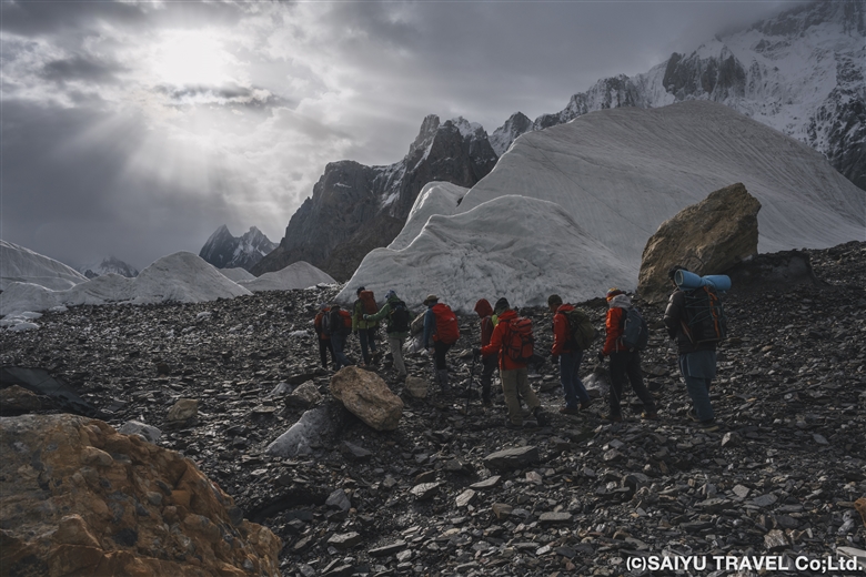
With the morning sun shining through the clouds, we walked through the icy world to reach Concordia

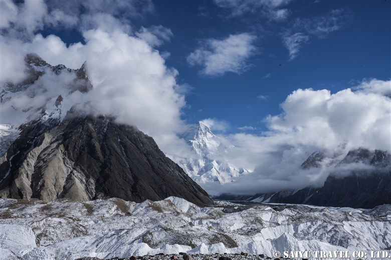
In the afternoon, cold rain began to fall, which was hard on our tired bodies at the end of the day. We continued further into the depths of the mountain to a campsite where we could see K2 in front of us. Finally, we arrived at the Concordia camp, the turnaround point.
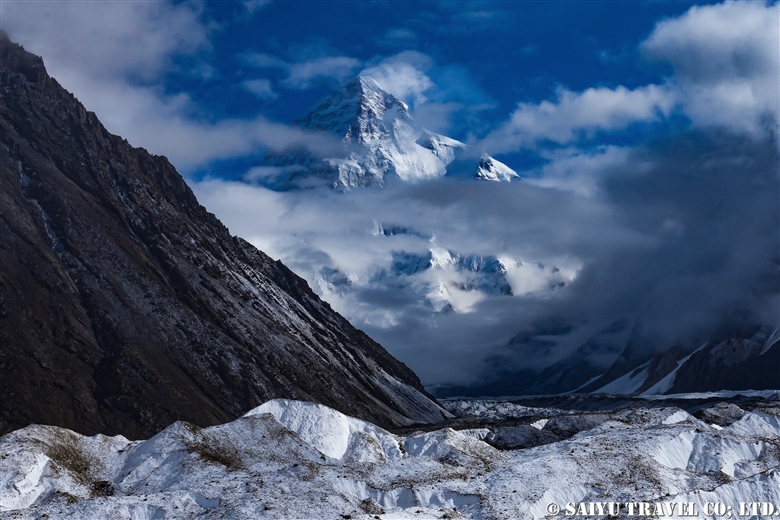
Unfortunately, K2 was still obscured by clouds when we arrived and did not grace us with its presence, but we still held on to hope. We stayed at the Concordia Camp for two days, which served also as time to rest.
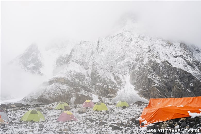
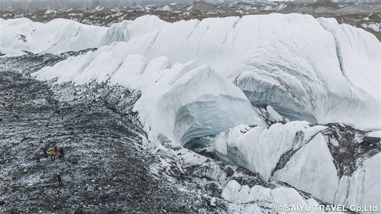
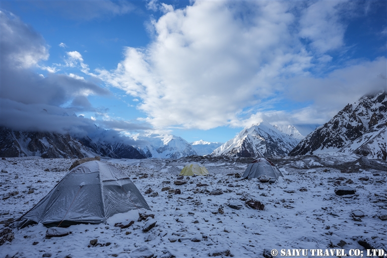
When we arrived at Concordia, the snow cover had turned the surroundings into a world of silvery white!
A spectacular serac zone

Day 10 Concordia to Broad Peak B.C.

In the morning, we woke up to steady snowfall. Visibility was almost zero, making it difficult for the porters and horses to move forward, so we had to temporarily postpone our departure and wait until 9:00 a.m. The sun came out before 9:00 a.m., and a blue sky quickly revealed itself before us. It was time to set out!
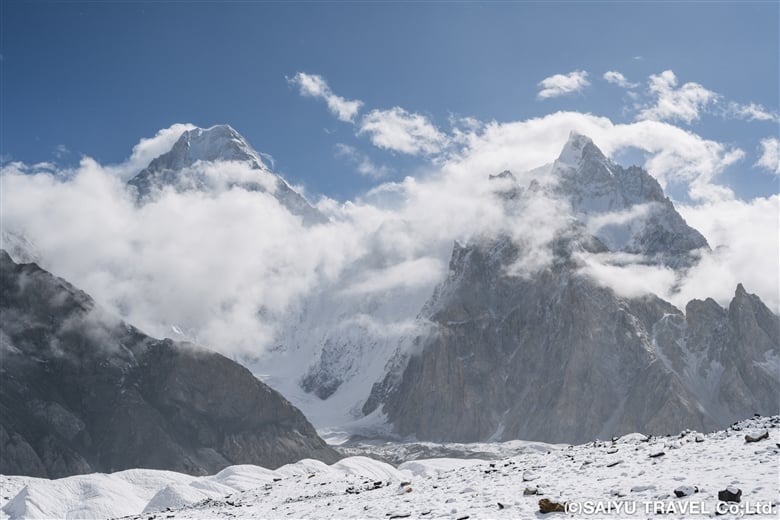
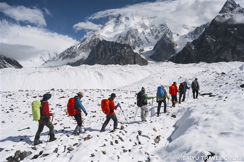
Early in the morning it was snowing, with zero visibility, but it cleared up around 9:00 a.m.
Now it was time to depart for Broad Peak B.C.!
The ordinary moraine was covered with snow, making it look almost fantastical

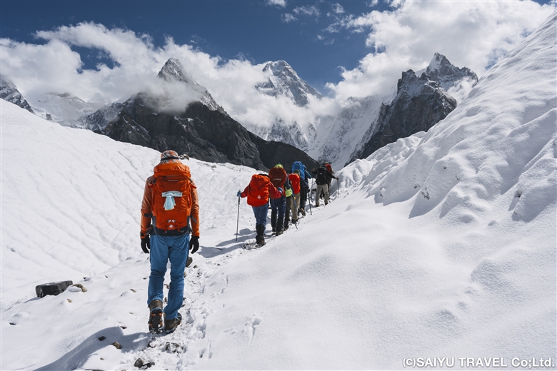
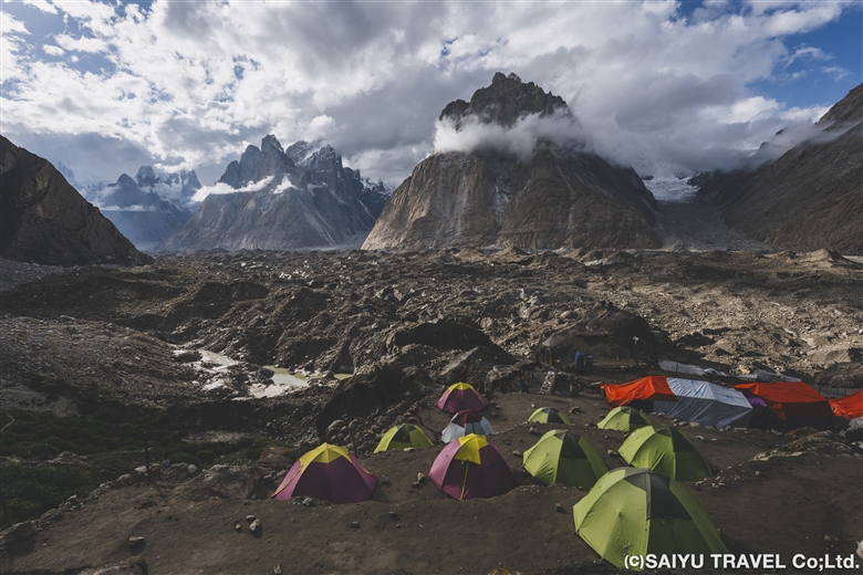
We changed to chain spikes/light crampons after 10 minutes of walking and passed through a serac zone. The route seemed to have changed a bit, and the serac was very gentle—traversable even without spikes. After the ups and downs of the large moraine, we simply walked along the side moraine of the Godwin-Austen Glacier, arriving at Broad Peak B.C. at about 14:00.
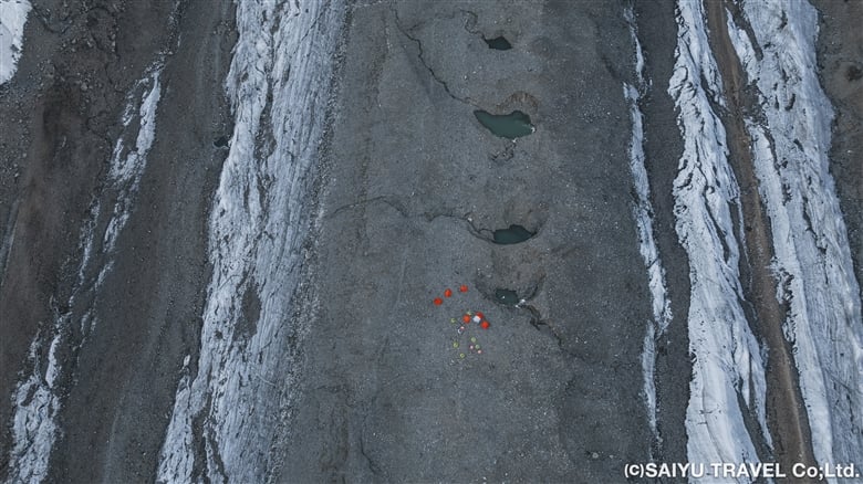
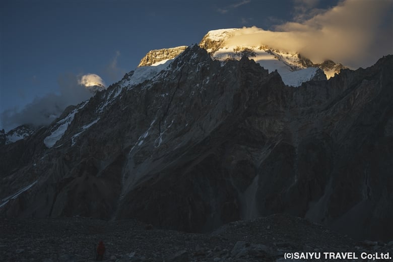
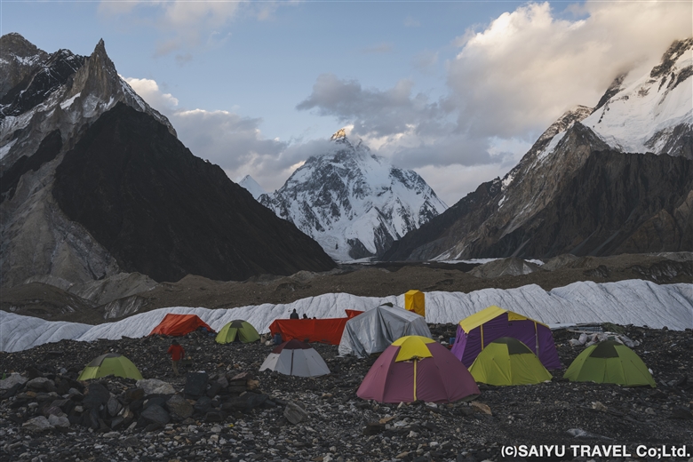
Broad Peak B.C. in the middle of Godwin-Austen Glacier
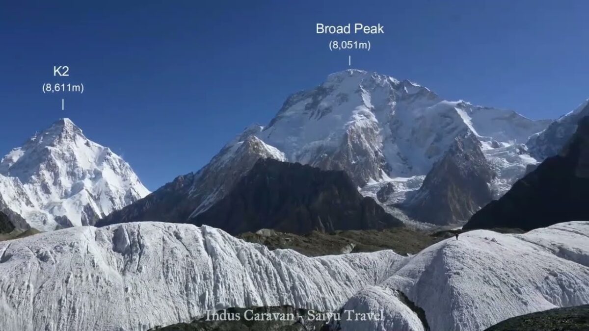
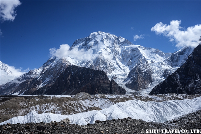
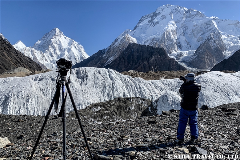
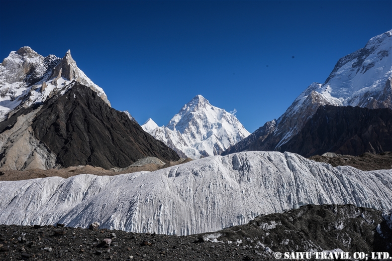
Broad Peak seen from the BC is divided into three peaks. From the back left: Broad Peak North Peak, Broad Peak Central Peak, and Broad Peak Main Peak (8,051m)
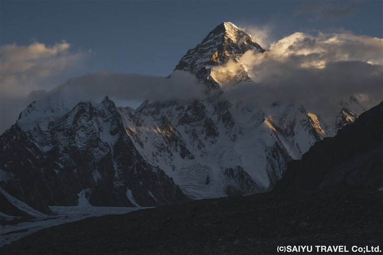
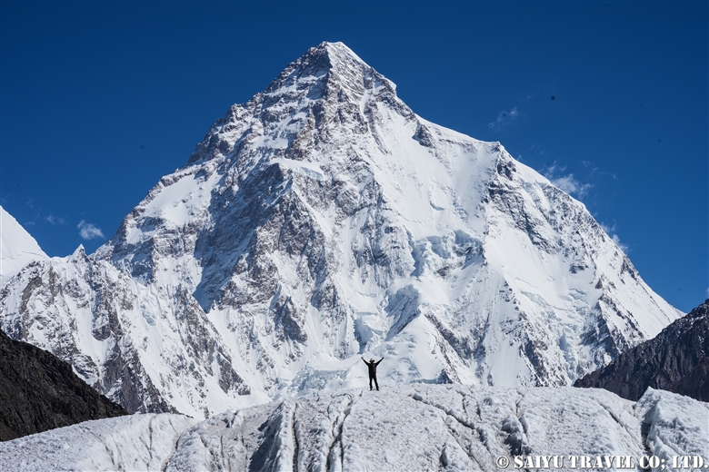
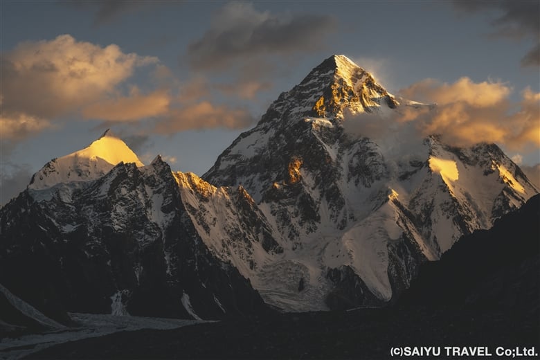
K2 (8,611m) at sunrise is a breathtaking sight

Day 11 Broad Peak B.C. to K2B.C and Back

Finally, we set out for K2 B.C. This was a day round trip from Broad Peak B.C. We started at 7:00 a.m. and had a very pleasant 2 ½ hour flat walk up an icy area next to a moraine. Then we trekked up and down the messy moraine to our first destination, K2 Memorial. The K2 Memorial is built on a very steep rock slope, so it was tough to climb up, but we visited and said a prayer for the climbers who lost their lives in the mountains of the Baltoro Glacier, including K2. After descending to the bottom of the rock tower, we had a quick lunch of onigiri (rice balls) and then continued further along the gentle moraine, eventually arriving at K2 Base Camp at 11:30!
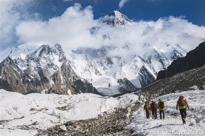
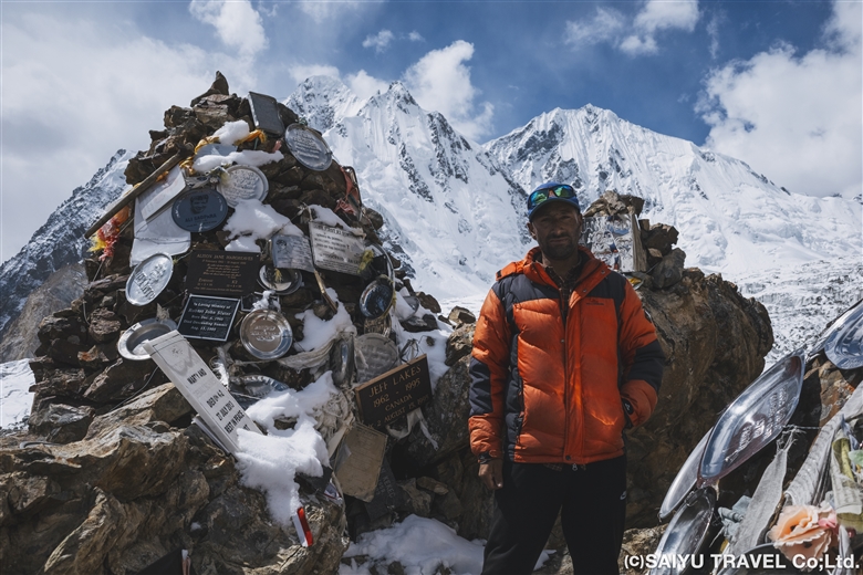
To K2 B.C.
Memorial to the many climbers who lost their lives in the mountains of the Baltoro Glacier
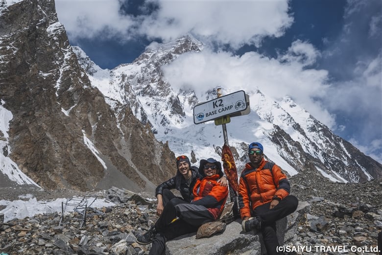
We reached K2 B.C. (5,150m). Our guide found the fallen K2 BASE CAMP sign in the moraine and took a commemorative photo

Day 12: Broad Peak B.C to Concordia

At Broad Peak B.C., where we stayed for two nights, K2 came into view around 5:35 a.m., glowing in the morning sun, giving the members a chance to gaze at the world’s second highest peak. After breakfast, we headed back to Concordia.
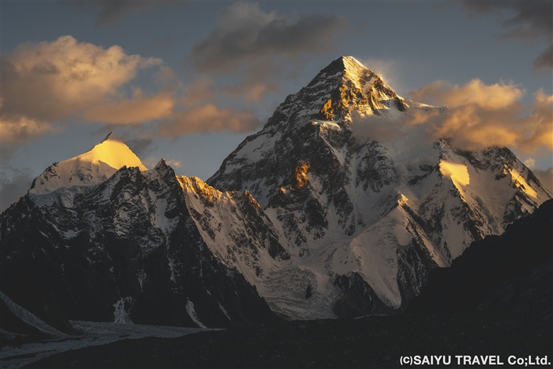
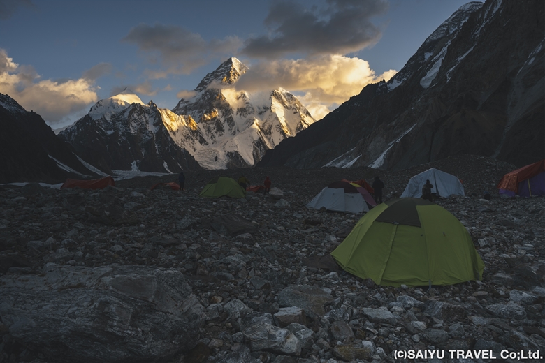
K2 shining in the morning glow seen from Broad Peak B.C.
A view of the base camp. Members gazed at the world’s second highest peak

As on the outward trek, we walked for 3 hours on gentle moraines, passing army camps. After 1 hour of walking along the moraine & serac belt, we arrived at Concordia. At Concordia, the staff had set up camp in the exact same spot as our previous stay and had prepared a welcome drink and lunch for us. I have nothing but gratitude for them and their consistently prompt work.
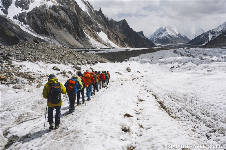
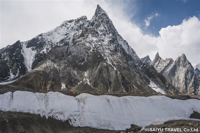
Passing through the serac belt again, we return to Concordia
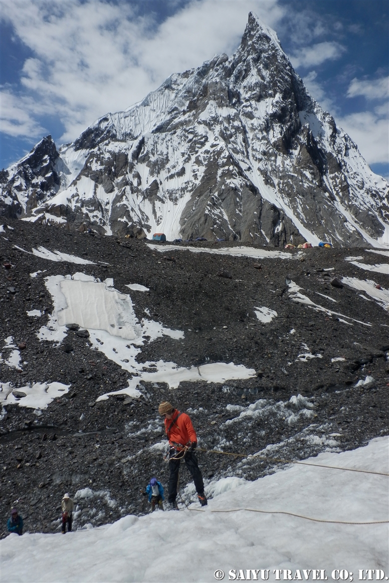
Our camp visible at the foot of Mitre Peak, behind the serac belt
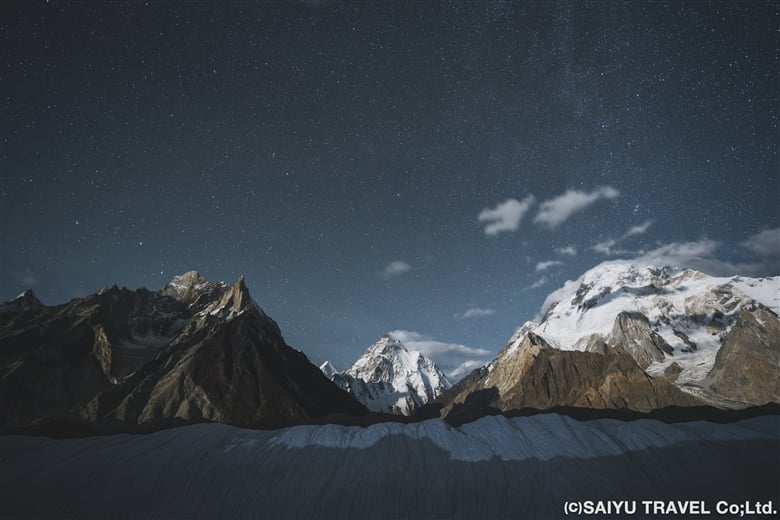
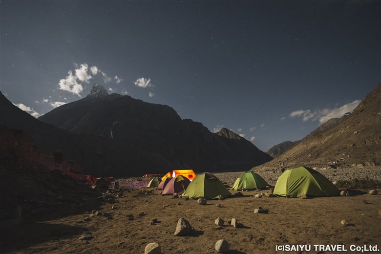
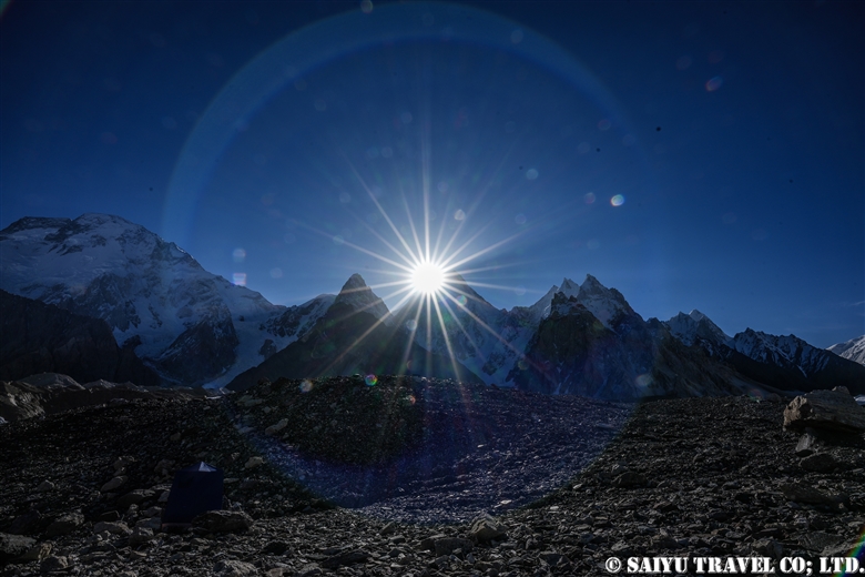
At night, the moonlight illuminated the mountains, creating a beautiful scene

We then said goodbye to K2 from Concordia and retraced our outward route for another 5 days, ending our long trek in Askole. The entire trip took 17 days. At the finish line, the staff congratulated us and toasted us with drinks, in the form of Coke. Some of our members commented that they had never enjoyed a Coke so much in their lives. It must have been because of the overwhelming accomplishment they felt after walking all the way back. Thank you very much, everyone!
Today was the day we said goodbye to K2. We were about to go back the way we came


Photo & text : Teppei Kamitani

Visit : Aug-Sep 2024 Baltoro Galcier- K2BC


▼Related Articles

Youtube : CONCORDIA 360 DEGREE

Youtube : Our baltoro Trek in 1 Min !

K2 & Baltoro Glacier Trekking 2022 (Part 1) Skardu to Paiju

K2 & Baltoro Glacier Trekking 2022 (Part 2) Paiju to Khoburtse

K2 & Baltoro Glacier Trekking 2022 (Part 3) Khoburtse to Urdukas

K2 & Baltoro Trekking 2022 (Part 4) Urdukas to GoreⅡ

K2 & Baltoro Trekking 2022 (Part 5) GoreⅡ to Concordia

Staying in Concordia, surrounded by the high Peaks of the Karakorum: K2, Broad Peak, Gasherbrum Mountain Range

*Contact us, Indus Caravan for more information or to make arrangements for your Baltoro Glacier K2BC trek.

*Please follow us on YoutubeInstagram & Facebook

Category : - Baltoro Glacier & Concordia > - Baltoro Glacier & Concordia > ◆ Gilgit-Baltistan > ◇ Mountain of Pakistan
Tag : , , , , , , , , , , , , ,

Over the Baltoro Glacier, the Trek to Broad Peak B.C. and K2 B.C., Part 1

The following is a photo report on a 2024 season excursion to the Baltoro Glacier—titled “Over the Baltoro Glacier to Broad Peak B.C. and K2 B.C.“—carried out by Teppei Kamitani, a guide from Japan who has visited and photographed the glacier many times.

The first part of the blog traces and documents (with photos) the first half of the trek in the following order: [Askole → Jhora → Skam Tsok → Paiju → Khoburtse → Urdukas].

My first step was to take a domestic flight from Islamabad to the town of Skardu, the gateway for trekkers in the area. Weather permitting, it’s possible to get a spectacular view of many mountains—including Nanga Parbat—during the flight, but this time it was cloudy and we could not see it. However, had the flight been cancelled, it would have taken two days to travel there on land, so we considered ourselves lucky that we were able to arrive safely.
Town of Skardu, the gateway to trekkers

The day after arrival at Skardu was also a backup day in case of flight cancellations, as well as for obtaining permits and other bureaucratic formalities. During this time, it was possible to head out to the Deosai Plateau to acclimatize oneself to the altitude of 4,200 m.

The following day, we headed to Askole, the starting point of the trek. The route took us through the Shigar Valley, passing the Sarfaranga Cold Desert and viewpoints overlooking the valley. The road became steeper and steeper as we approached Ascole, with more ups and downs along the riverside slopes.

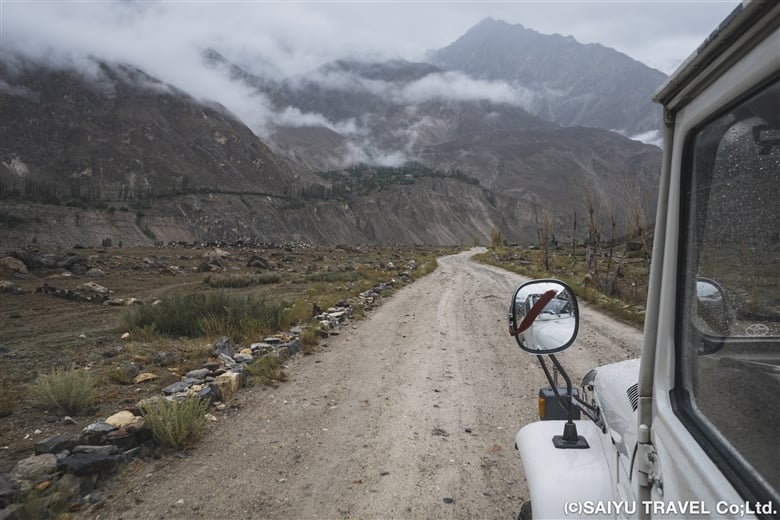
Heading towards Askole by 4WD

Day 1: Askole-Korophong-Jhola

At long last, the trek began from the lush green village of Askole. On the way, we completed the various formalities at the office in Testay Village, the last inhabited settlement in this vicinity. Beyond this point, a vast, uninhabited path stretched out before us.

Starts in the lush green village of Askole
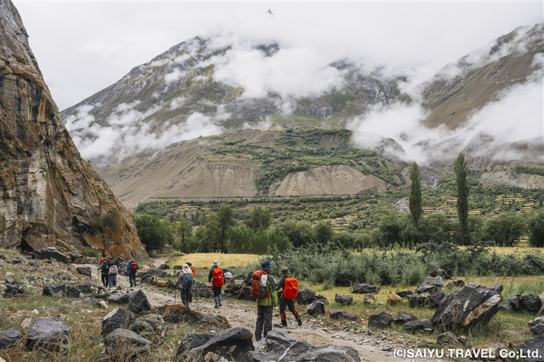
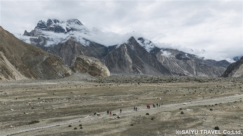
Walking through desolate land

About four and a half hours after leaving Askole, we had lunch at Korophong, a camp in the end moraine of the Biafo Glacier, which flows from the Latok Mountains. We continued walking along the Braldu River and Jhola Camp came into view on the other side of the Domordo River. Here we crossed the recently opened Snow Leopard Bridge to reach the new Jola Camp.

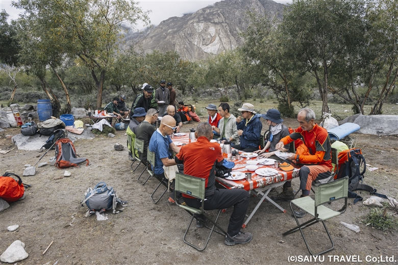
Lunch at Korophong inside the Biafo Glacier
New Jhora Camp, located along the riverbank

Day 2: Jhola to Skam Tsok

The trail follows the Braldu River with gentle ups and downs, the second half of the day walking along the cliffs. When Skam Tsok comes into view in the distance, we saw Broad Peak (8,051m), the 12th highest peak in the world.

Broad Peak(8,051m) can be seen in the distance

We arrived in Skam Tsok at 11:20, taking about four and a half hours. After lunch, we relaxed with a tea break to keep our spirits up.

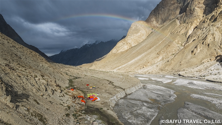
Skam Tsok camp and the big rainbow in the sky

Day 3: Skam Tsok to Paiju

This was the day of the half-day walk to Paiju, the camp in front of the glacier. Two and a half hours after we’d passed the gentle ups and downs from Skam Tsok, the Baltoro Glacier began to come into view. The iconic mountains of the Baltoro Glacier, such as Trango Castle and Cathedral, were also visible.

We continued up and down the river bank path
We crossed the log bridge carefully
The Baltoro Glacier finally came into view

The second half of the route followed a traverse path to reach Paiju Camp (3,450m), which was covered with poplar trees. The clean mountain water jabbered around us, and even gave us the opportunity to wash our clothes. We put chairs in front of our tent and had ourselves a relaxing afternoon. We were refreshed for the trek up the Baltoro Glacier…

Before Paiju, the trail enters the cliff path again, with more ups and downs
The campsite at Paiju was delightfully well-shaded. Once up on the glacier, there would be no shade at all

Day 4: Paiju to Khoburtse

At long last, this was the day we’d walk to the Baltoro Glacier—though it would end up being a long one. We walked to the Baltoro Glacier and reached the glacier tongue in ninety minutes.

Finally, the edge of the Baltoro Glacier tongue

There was a bit of sunshine at first, but clouds started to gather from the lower part of the Pailu and it began to rain. We followed the glacier’s outlet, gradually making our way up the mountainside, and had lunch at Liligo. From here, wearing helmets, we crossed a slope where there was a risk of landslides. What awaited us at the end, on the opposite bank of the glacier river, was the camp of Khoburtse (3,940m)!

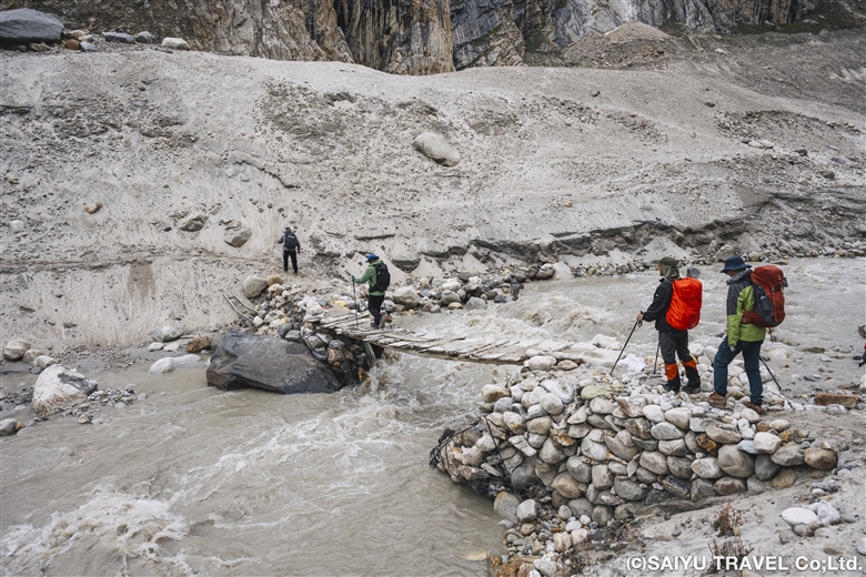
Thanks to this small wooden bridge, we didn’t have to wade across the river. We crossed the bridge on our way to the Khoburtse campsite
The North Star, Trango Castle, Biale, and the Cathedral …. night photography at Khoburtse Camp site

Days 5 & 6: Khoburtse to Urdukas

We spent four hours trekking to Urdukas (4,050m). The plan for today was not to enter the Baltoro Glacier, but to cross two unnamed glaciers on its tributaries. As we made our way up the gently sloping upper reaches of the glacier, there was a point where we could see Broad Peak, Gasherbrum II, III and IV, but this time they were obscured by clouds.

Morning in Khoburtse. The rocky peak in the foreground is Trango Castle (5753m)
We didn’t enter the Bartolo Glacier, but traversed the side slopes. There was a lot of up and down

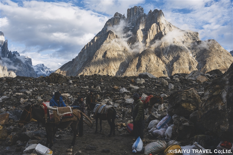
Urdukas means “broken boulder,” so it was fitting that there were actually boulders scattered around the campsite. The Baltoro Glacier lay directly in front, and beyond that, the Trango mountain range, the Cathedral, the Biale Glacier flowing down from Biale, and other famous peaks and glaciers could be seen in a panoramic view.

Urdukas camp site where we stay for two nights, is a high vantage point overlooking the Baltoro Glacier.
The Baltoro Glacier and rock peaks as seen from the rock terrace of Urdus camp
The Baltoro Glacier and the famous mountain range in the direction we are heading to

This trip would not have been possible without the support of the local staff.
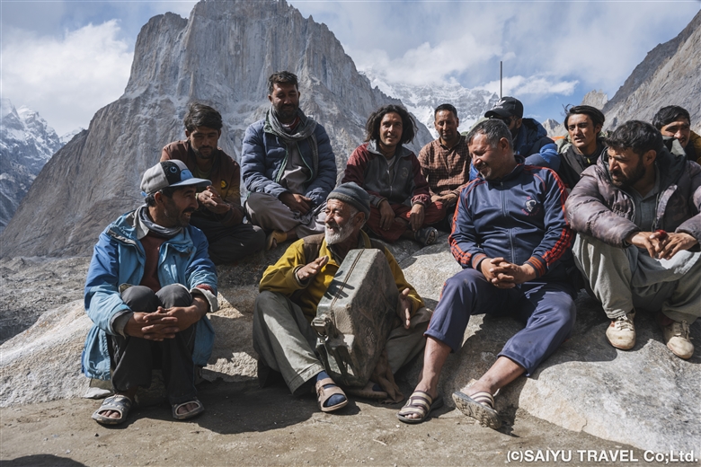
We stayed at the Urdukas camp, which had running water, for two nights, including a rest day. I think this break probably really helped our guides refresh mentally as well. The local staff who supported the trip also took a break and sang along, following Ali’s lead.

Ali led the porters in singing


To be continued in the second half…


Photo & text : Teppei Kamitani

Visit : Aug-Sep 2024 Baltoro Galcier- K2B.C.


▼Related Articles

Youtube : CONCORDIA 360 DEGREE

Youtube : Our baltoro Trek in 1 Min !

K2 & Baltoro Glacier Trekking 2022 (Part 1) Skardu to Paiju

K2 & Baltoro Glacier Trekking 2022 (Part 2) Paiju to Khoburtse

K2 & Baltoro Glacier Trekking 2022 (Part 3) Khoburtse to Urdukas

K2 & Baltoro Trekking 2022 (Part 4) Urdukas to GoreⅡ

K2 & Baltoro Trekking 2022 (Part 5) GoreⅡ to Concordia

Staying in Concordia, surrounded by the high Peaks of the Karakorum: K2, Broad Peak, Gasherbrum Mountain Range

*Contact us, Indus Caravan for more information or to make arrangements for your Baltoro Glacier K2BC trek.

*Please follow us on YoutubeInstagram & Facebook

Category : - Baltoro Glacier & Concordia > - Baltoro Glacier & Concordia > ◆ Gilgit-Baltistan > ◇ Mountain of Pakistan
Tag : , , , , , , , , , , , , , , , , ,

CONCORDIA 360 DEGREE

We stayed at Concordia on a truly cloudless, crystal clear morning in mid-June. The video was rattled by manual paaning, but I made a 360-degree mountain view video from Concordia.

CONCORDIA 360 DEGREE


Image by Mariko SAWADA

A big thank you to the the whole Baltoro Glacier trekking team for working with us!


Related article

Youtube : Our baltoro Trek in 1 Min !

K2 & Baltoro Glacier Trekking 2022 (Part 1) Skardu to Paiju

K2 & Baltoro Glacier Trekking 2022 (Part 2) Paiju to Khoburtse

K2 & Baltoro Glacier Trekking 2022 (Part 3) Khoburtse to Urdukas

K2 & Baltoro Trekking 2022 (Part 4) Urdukas to GoreⅡ

K2 & Baltoro Trekking 2022 (Part 5) GoreⅡ to Concordia

Staying in Concordia, surrounded by the high Peaks of the Karakorum: K2, Broad Peak, Gasherbrum Mountain Range

★★★★★

*Contact us, Indus Caravan for more information or to make arrangements for your Baltoro Glacier trek.

Category : - Baltoro Glacier & Concordia > = Video Clip Gilgit-Baltistan > - Baltoro Glacier & Concordia > ◆ Video Breathtaking Views of Pakistan > ◆ Gilgit-Baltistan > ◇ Mountain of Pakistan > - Karakorum Range
Tag : , , , , , , , , , , , , , , , , ,

Our Baltoro Trek in 1 min

Here’s a staff-centric video clip of our first post-pandemic Bartolo Glacier trek in June 2022! Well done to all the guides, kitchen staff, sardars, and porters who made the round trip to Concordia multiple times this season!

Our Baltoro Trek in 1 min

Image by  Mariko SAWADA

A big thank you to the the whole Baltoro Glacier trekking team for working with us!


Related article

Youtube : CONCORDIA 360 DEGREE

K2 & Baltoro Glacier Trekking 2022 (Part 1) Skardu to Paiju

K2 & Baltoro Glacier Trekking 2022 (Part 2) Paiju to Khoburtse

K2 & Baltoro Glacier Trekking 2022 (Part 3) Khoburtse to Urdukas

K2 & Baltoro Trekking 2022 (Part 4) Urdukas to GoreⅡ

K2 & Baltoro Trekking 2022 (Part 5) GoreⅡ to Concordia

Staying in Concordia, surrounded by the high Peaks of the Karakorum: K2, Broad Peak, Gasherbrum Mountain Range

★★★★★

*Contact us, Indus Caravan for more information or to make arrangements for your Baltoro Glacier trek.

Category : - Baltoro Glacier & Concordia > = Video Clip Gilgit-Baltistan > - Baltoro Glacier & Concordia > ◆ Video Breathtaking Views of Pakistan > ◆ Gilgit-Baltistan > ◇ Mountain of Pakistan
Tag : , , , , , , , , , , , , , , , , , ,

Staying in Concordia, surrounded by the high Peaks of the Karakorum: K2, Broad Peak, Gasherbrum Mountain Range

This is Concordia, The end of the Baltoro Glacier trek. It is a sought-after destination surrounded by 360 degrees of high peaks like K2.

In Latin, the word “Concordia” means “confluence and harmony,” and was given this name due to it being a confluence point between the Baltoro and Godwin-Austen Glacier. From here, climbers will set out for peaks like K2, Broad Peak, Gasherbrum Mountains Basecamp, and the Gondogoro La (Pass).

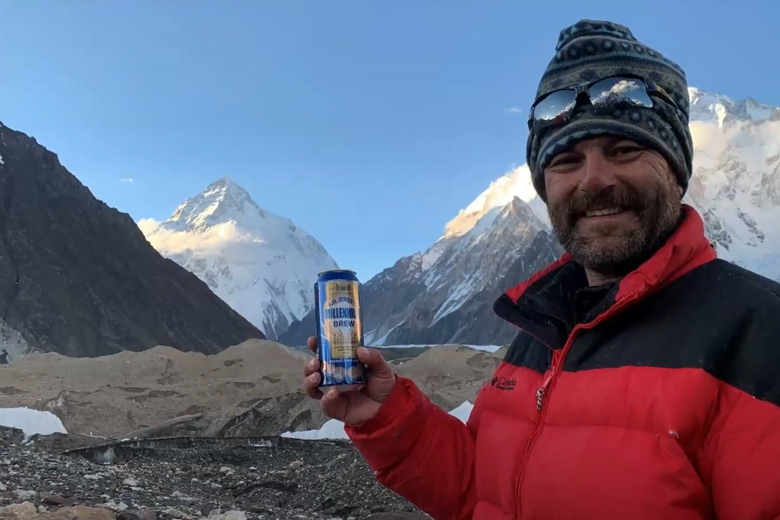
The first morning after our arrival in Concordia, the camp was covered with fresh snow. With patches of blue sky coming through and since the forecasted weather was clear, I took the opportunity for a photo op, since we made it all the way here.

K2 & Baltoro Glacier Trekking 2022 (Part 1) Skardu to Paiju

K2 & Baltoro Glacier Trekking 2022 (Part 2) Paiju to Khoburtse

K2 & Baltoro Glacier Trekking 2022 (Part 3) Khoburtse to Urdukas

K2 & Baltoro Trekking 2022 (Part 4) Urdukas to GoreⅡ

K2 & Baltoro Trekking 2022 (Part 5) GoreⅡ to Concordia

K2 emerges from the clouds, just beyond the campground. It was a moment I had eagerly anticipated, finally seeing the mountain break through the clouds.

The view of K2 got even better. At 8,611m it is the second highest mountain in the world, just after Everest. It is a majestic mountain.

This is Broad Peak (8,051m) which came into full view before K2. Broad Peak, as it is aptly named, has a wide peak. It is the 12th highest mountain in the world and is also the first mountain to be scaled for the 8,000m Summit Challenge.

Not a cloud in the sky. A short walk from the campsite, this was taken from a place where we could see Angel Sar (6,858m). Just east of here, we can see the Gasherbrum Group, and to the south, was Baltoro Kangri and Chogolisa.

Angel Sar (6,858m) is a beauty, just Northwest of K2.

Baltoro Kangri, as seen from Concordia. There are several peaks from west to east, and the highest is said to be 7,312m high.

Vigne Peak(6,195m)at left, Khumal Gri(6,851m) at right. Chogolisa (7,668m) is a flat peaked mountain, peeking from behind a wall of ice. Heading west through this valley is the famous Gondogoro-la (Pass), which leads to the Hushe Valley.

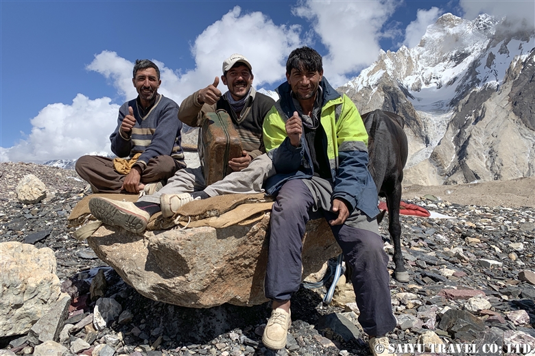
During the day, the porters relax at the campsite. They sing, dance and are just having fun. They spend the entire summer going from Askole to Concordia and Base Camp and back, never returning to their village until the end of the season. We have worked with this same crew for years, and I am so grateful to them.

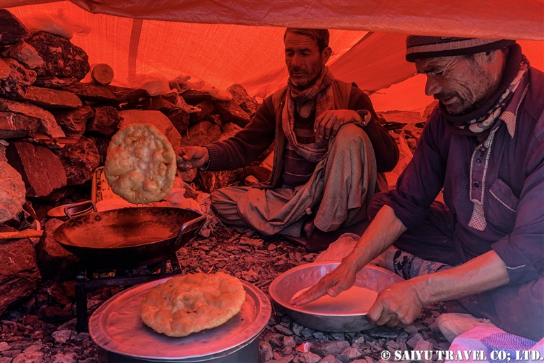
The Balti people make a fried bread called ‘Prantha.’ Do they mean “pratha?” perhaps but, anyway it is a fried bread. When it’s freshly made, it is the best.

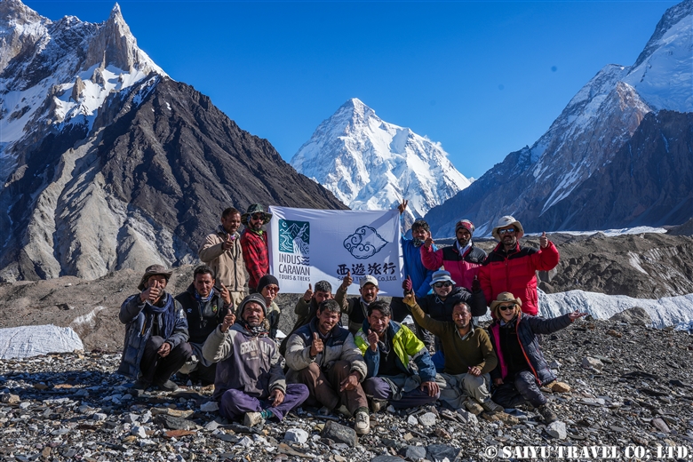
The commemorative photo spot is a must. On June 13, 2022, we arrived in Concordia, the first Baltoro Glacier trek made by Saiyu Travel since the Covid-19 Pandemic.

We are filled with appreciation to the guides, porters and for being able to get back to work. We were the second squad to reach the Concordia this season.

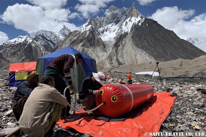
Since we are here, made time for Gamow Bag practice.

This year’s Concordia has a 4G network!  The 4G is provided by the SCO (a mobile company in the mountainous regions of Pakistan) you can pick it up from around Gore II and is being sent out from Concordia. Of course, the best part of this is that you can see the weather forecast!

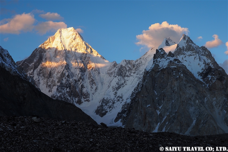
The evening sunlight setting on Gasherbrum Ⅳ(7,925m). These peaks of the Gasherbrum mountain range rise over Concordia.

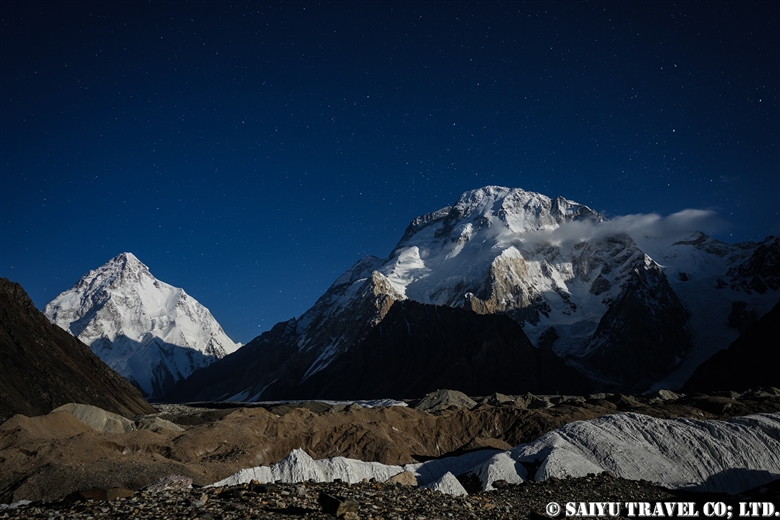
I grabbed a shot of K2 and Broad Peak, just before the moonrise.

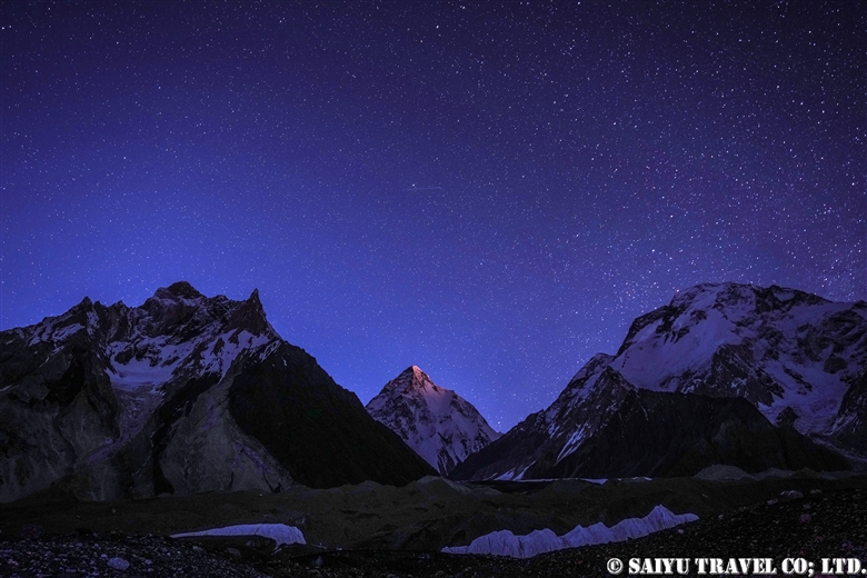
On the third night, we could finally get a scene of the moon and starry sky over K2. The moonlight illuminates K2 just as it gets dark.

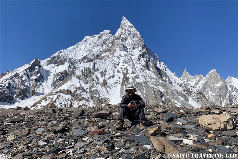
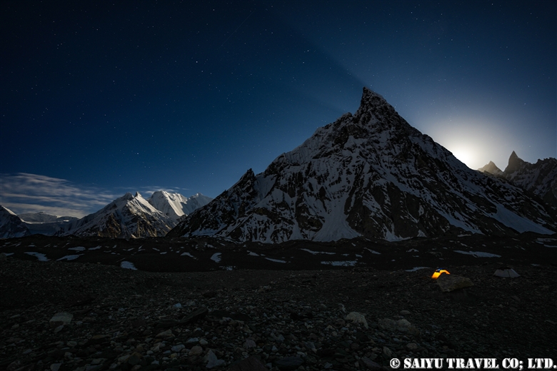
Mitre peak (6,010m) is to the south of the campsite. This is the moon rising, not the sunrise.

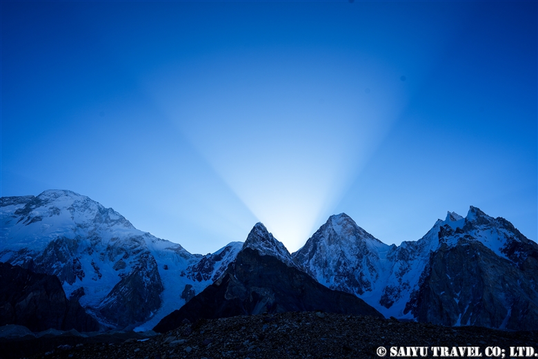
This is daybreak hitting the Gasherbrum Mountains.

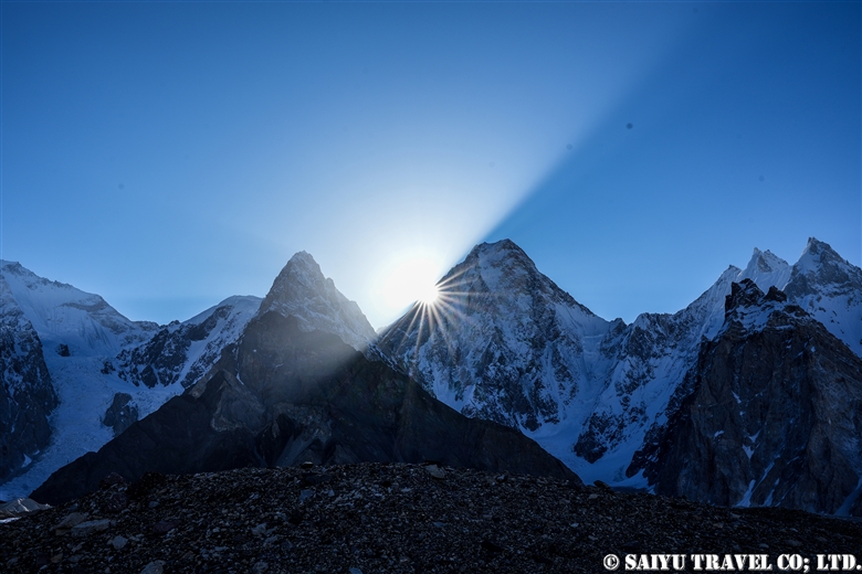
Gasherbrum IV peak shoulders the dramatic sunrise.

Welcoming the sunrise at Concordia.

Today’s weather – Clear.

The fine weather continues, and there was plenty of time for the staff to get commemorative photos. Then it was time to say bye to K2 and leave.
It was like a dream, and we left Concordia the next day.

Image & Text: Mariko SAWADA
Trek Date: Mid-JUN 2022

*The altitudes and distances traveled from site to site that are listed, are based on our own measurements and GPS equipment. Please note that these may differ from other official books or reference materials.

*Contact us, Indus Caravan for more information or to make arrangements for your Baltoro Glacier trek.

Category : - Baltoro Glacier & Concordia > - Baltoro Glacier & Concordia > ◆ Gilgit-Baltistan > ◇ Mountain of Pakistan
Tag : , , , , , , , , , , , , , , , , , ,

K2 & Baltoro Trekking 2022 (Part 5) GoreⅡ to Concordia

Finally, we made it the leg of the hike to Concordia. The camp on the glacier of Gore II is cold (in June), so we made early preparations and left quickly.

K2 & Baltoro Glacier Trekking 2022 (Part 1) Skardu to Paiju

K2 & Baltoro Glacier Trekking 2022 (Part 2) Paiju to Khoburtse

K2 & Baltoro Glacier Trekking 2022 (Part 3) Khoburtse to Urdukas

K2 & Baltoro Trekking 2022 (Part 4) Urdukas to GoreⅡ

K2 & Baltoro Trekking 2022 (Part 5) GoreⅡ to Concordia

Staying in Concordia, surrounded by the high Peaks of the Karakorum: K2, Broad Peak, Gasherbrum Mountain Range

We walked about 6 km from Gore Ⅱ (altitude 4,271m) to the 4,400m point stopping for a light meal, and then walked an additional 7.5 km to the campsite of Concordia (4,596m). It is an exciting hike, as the mountains of Concordia get closer and closer with each turn.

Morning at the Gore II camp. It’s going to be a cloudy day today, but the weather forecast says it’s going to be sunny for the entire two days of our stay in Concordia, so I’d like to expect it to be pleasant. Even so, the Masherbrum (7,821m) that emerged between the clouds in the morning sun, was really exceptional.

The porters are in a hurry. The porters and mules who we have contracted to accompany us only upto Concordia, quickly take our luggage back down. The glacier is a very harsh environment for the animals, and it is not a place to stay any longer than necessary.

The exhaled white breath of the hard-working porters.

Leaving Masherbrum behind, we head out from Camp.

A horse with our luggage (not a mule, but a horse). This year, we just redesigned the Saiyu Travel and Indus Caravan logos on the khaki green duffle bag.

Our light meal while on the glacier.

From here, you can see the Muztagh Tower (7,273m), a mountain on the border with China to the north. The name “Muztagh” is often heard in this area, but it means “mountain of ice and snow” in the Turkic language.

The Gasherbrum Mountains get closer as we approach them.

The view of the peaks of the Gasherbrum Group just before reaching Concordia.

We have to go through the campground of the Pakistani Army which is totally littered with trash and the CNKP (Central Karakoram National Park).  Then we finally reached our destination for this leg of the trip, where we can relax a bit for the next 3 nights.

We set up the Kitchen Tent and Dining Tents with Miter Peak (6,010 m) as the backdrop. It started to snow on this first night.

At nightfall, I got one shot as the snowfall subsided. Broad Peak (8,051 m) and K2 (8,611 m) are covered with clouds and the snow covering the ground. I am so looking forward to tomorrow morning!


Photo & text : Mariko SAWADA

Trek date : Mid -JUN 2022

*The altitudes and distances traveled from site to site that are listed, are based on our own measurements and GPS equipment. Please note that these may differ from other official books or reference materials.

*Contact us, Indus Caravan for more information or to make arrangements for your Baltoro Glacier trek.

Category : - Baltoro Glacier & Concordia > - Baltoro Glacier & Concordia > ◆ Gilgit-Baltistan > ◇ Mountain of Pakistan
Tag : , , , , , , , , , , , , , , , , , ,

K2 & Baltoro Glacier Trekking 2022 (Part 3) Khoburtse to Urdukas

Today we only travel about 7 km, from Khoburtse (3,834m) to the campsite in Urdukas (4,061m), which makes it a short day for trekking. Along the way, we cross two glaciers from the Urdukas Peaks, and from tonight we will finally begin camping at over 4,000 m.

K2 & Baltoro Glacier Trekking 2022 (Part 1) Skardu to Paiju

K2 & Baltoro Glacier Trekking 2022 (Part 2) Paiju to Khoburtse

K2 & Baltoro Glacier Trekking 2022 (Part 3) Khoburtse to Urdukas

K2 & Baltoro Trekking 2022 (Part 4) Urdukas to GoreⅡ

K2 & Baltoro Trekking 2022 (Part 5) GoreⅡ to Concordia

Staying in Concordia, surrounded by the high Peaks of the Karakorum: K2, Broad Peak, Gasherbrum Mountain Range

Shortly after leaving Khoburtse, we crossed the glacier from the Urdukas Peaks. The big boulders and rocks are scattered around us everywhere.

The mules are loaded down with climbing equipment, as one party passes by us one after another. When I asked the porter what is going on, he said that there are two expedition groups heading for Urdukas from Paiju. It seems the campsite will be crowded tonight.

A Balti porter who is drinking the glacier water. Throughout the trip, you will be amazed at their strength.

As we near Urdukas, the there is more vegetation, and the alpine plants were in bloom. For the rest of the trip, the campsites will all be on the glacier, so this is the last chance for the pack animals to eat fresh grass.

Even so, the flowers were in bloom near the campsite and those tough little mules were grazing on them. The mules kept arriving in droves, to eat the flowers and grass. The number of mules that arrived on this one day exceeded 200 head.

These flowers can typically be seen until early July. Not only flowers, but here, wild birds can also be seen as well. I will introduce just a few of the shots I got.

A Yellow-billed chough, Pyrrhocorax graculus. They are waiting patiently for the humans to leave the campsite with leftovers.

This is the Red-billed chough, Pyrrhocorax pyrrhocorax. They forage for nuts and insects, but here they were aiming for leftover food with the Yellow-billed choughs. Living in this harsh environment, anything we leave behind is such a treat! During the Baltoro Glacier trek, we tend to see more Yellow-billed choughs than the red-billed choughs.

In addition to the two wild crow family, which I just introduced, there is also the raven. This area’s ravens is a subspecies Corvus corax tibetanus (also Tibetan raven), which are the largest and most gorgeous raven species. From this campsite all the way to Concordia, you’ll see these three crows at every campsite along the way.

When I got this shot of the Red-fronted Rose finch, Carpodacus puniceus I was so excited. According to the distribution maps, it is a bird that lives in the high mountains around the Tibetan Plateau.

When we arrived at the campsite, we had it all to ourselves, but then soon after that, two other groups arrived one after another.

By the evening the campsite was bustling. One problem with the Urdukas campsite is that the permanent toilets are very far away. We only stayed for one night, but for groups that come from Paiju to Urdukas in one day, they tend to stay for two nights and take a full day of rest before continuing.

Today, the goat we had brought up with us was butchered, we were offered a fresh “charcoal-grilled liver” and the staff enjoyed a stewed dish of the organs. This goat meat was our source of food until the final day of our trek. By the way, the other group of climbers had brought yaks and dzo (or zho, which are yak-cow hybrids).

The view from the campsite in the evening. Baltoro Glacier with the Trango Castle and beyond that, Uri Biaho.

The west side of the Urdukas campsite just as the sun was setting. A part of the Urdukas Peaks appeared in the background, and moments later, the moon rose from here.

Photos & Text: Mariko SAWADA
Trek date: Early June 2022

*The altitudes and distances traveled from site to site that are listed, are based on our own measurements and GPS equipment. Please note that these may differ from other reference materials.

*Contact us, Indus Caravan for more information or to make arrangements for your Baltoro Glacier trek!

Category : - Baltoro Glacier & Concordia > - Baltoro Glacier & Concordia > ◆ Gilgit-Baltistan > ◇ Mountain of Pakistan > ◇ Birds of Pakistan
Tag : , , , , , , , , , , , , , , , , , , , , ,

K2 & Baltoro Glacier Trekking 2022 (Part 2) From Paiju to Khoburtse

Today is the journey from Paiju to Khoburtse. The route of the Baltoro Glacier changes every year, actually it changes constantly, because the glacier constantly moves and collapses, and the distance to travel changes, depending on that. This year we went near the middle of the glacier and climbed up to Moraine just before the Liligo camp.

K2 & Baltoro Glacier Trekking 2022 (Part 1) Skardu to Paiju

K2 & Baltoro Glacier Trekking 2022 (Part 2) Paiju to Khoburtse

K2 & Baltoro Glacier Trekking 2022 (Part 3) Khoburtse to Urdukas

K2 & Baltoro Trekking 2022 (Part 4) Urdukas to GoreⅡ

K2 & Baltoro Trekking 2022 (Part 5) GoreⅡ to Concordia

Staying in Concordia, surrounded by the high Peaks of the Karakorum: K2, Broad Peak, Gasherbrum Mountain Range

The journey is slow-going from Paiju, at an altitude of 3,420 m to Khoburtse, at an altitude of 3,834m. It is only a 15km in distance, but it takes a lot of adapting to the conditions and going carefully along. Most trekkers just head directly for Urdukas.

From the Paiju campsite, we walked north along the banks of Braldu River for 4 km and then hiked up the Baltoro Glacier.

The Braldu valley is formed by the water that flows out from the Glacier.

The Trango Towers in the background.

Great Trango Tower, 6,286m as seen from the Baltoro Glacier. The Trango Towers are famous for having one of the largest rocky cliffs in the world.

Breaktime!

The view after crossing Liligo. The Glacier and the Baltoro Cathedral and the Lobsang Spire just beyond it.

Arrived at the Khoburtse campsite. It is much smaller compared to the Paiju and Urdukas. There were no other guests so our group had the whole campsite to ourselves.

The Kitchen tent. Dinner usually starts at 6:30pm every day during trekking.

After dinner, the sunset from Khoburtse. The porters’ tents stayed lit. The clear skies over the mountains were beautiful.

On the left is Paiju Peak, and on the right is Uli Biaho.

The Khoburtse campsite is set right in the front of the Trango castle (on the right).
Tonight was another quiet night for us.


Photos & Text: Mariko SAWADA
Trek Date: Early June 2022

*The altitudes and distances traveled from site to site that are listed, are based on our own measurements and GPS equipment. Please note that these may differ from other official reference materials.

*Contact Indus Caravan for more information or to make arrangements for your Baltoro Glacier trek!

Category : - Baltoro Glacier & Concordia > - Baltoro Glacier & Concordia > ◆ Gilgit-Baltistan
Tag : , , , , , , , , , , , , , , ,

K2 & Baltoro Glacier Trekking 2022 (Part 1) From Skardu to Paiju

This is a record of the June 2022 Trekking, where we could lead our first Baltoro Glacier Trek for Saiyu Travel Japan since the start of the worldwide pandemic. The Jeep Road has changed a lot since the last 2019 tour. It used to stop at Askole, but now it has been extended between Jhola and Skam Tsok, with construction still being carried out here and there. Larger groups use the Jhola campsite, while smaller groups can also camp on the banks of the Braldu river along the way. (Note: The “Jeep Road” in Pakistan is a pretty rough road that can be traversed by the car models called Toyota Jeep, locally.)

K2 & Baltoro Glacier Trekking 2022 (Part 1) Skardu to Paiju

K2 & Baltoro Glacier Trekking 2022 (Part 2) Paiju to Khoburtse

K2 & Baltoro Glacier Trekking 2022 (Part 3) Khoburtse to Urdukas

K2 & Baltoro Trekking 2022 (Part 4) Urdukas to GoreⅡ

K2 & Baltoro Trekking 2022 (Part 5) GoreⅡ to Concordia

Staying in Concordia, surrounded by the high Peaks of the Karakorum: K2, Broad Peak, Gasherbrum Mountain Range

The big feature of this year’s Baltoro Trek is that many “climbing teams” who have been waiting for these past three years come to climb one after the other. Since the Baltoro area is so close to the Indian border, the security is tight and in addition to the visa required to enter Pakistan, people must also at the same time, obtain a “trekking” or “mountain climbing” visa. The group’s permissions are linked to this visa. We were required to submit an application and can only depart after the group’s approval. At the beginning of this season, the number of applications for this “trekking” and “mountain climbing” visa has increased sharply, so it took a considerable amount of time to obtain it. If you are planning trekking in the Baltoro area, be prepared to apply 45 days in advance.

K2 & Baltoro Glacier Trekking 2022

A car carrying our porters, who are heading to the first campsite. In June, the workload of the summit corps is quite heavy, so the porters, mules, and horses/donkeys are also quite busy.

While driving through the Shigar Valley, we passed through Hyderabad, the village where the driver lives. The driver’s wife brought us freshly harvested mulberries.

They were unbelievably sweet.

This is a photo taken near the village of Askole. Askole is also crowded with porters/unloaders for Baltoro Glacier trekking and is also famous for gem mining. The rock cave in this photo is the opening of the gem mining pit, which was also working at full swing.

From Askole, and beyond, this is the first jeep road to pass. Proceed along Braldu River which starts from the Baltoro Glacier. Along the way, there are so many steep ups and downs.

They have built a new bridge in Jhola, and after crossing it, a while later we saw the point where the construction of the road was still underway. Tonight’s campsite is on the riverbank, just a short walk from here.

The next day, we walked along the Braldu River. We will pass through the Skam Tsok campsite.

In front of us, stands the Baltoro Glacier, and on the sides partly covered by clouds the Trango Towers, the Baltoro Cathedral, and the Paiju campsite.

Paiju is a campsite abundant with water and greenery. The season had just begun, so the accommodation was fully reserved by our group.

While at the campsite, the porters were making Balti bread. This will be used as the food for the trekking on the glacier the next day.

Freshly baked bread.

This mule is in the middle of his meal. In the past, it was rare to see livestock being used in the trekking, but now it has become more mainstream to see them and horses and donkeys as well.

From tomorrow, they will get new horseshoes for the Glacier trek. It really feels like a new season has begun.

From the Paiju campsite, the mountains along the Baltoro Glacier, part of the Trango Towers on the left and in the middle, the Baltoro Cathedral. On the right are the Lobsang Spire.

Being the only ones staying overnight at the Paiju, it was a very quiet night.


Text & photo : Mariko SAWADA

Trek Date : Early JUN 2022

PS: In early July, the bridge 4 km from Askole was washed away by flood, so the trek has since been from Askole.

*Contact Indus Caravan for more information or to make arrangements for your Baltoro Glacier trek!

Category : - Baltoro Glacier & Concordia > - Baltoro Glacier & Concordia > ◆ Gilgit-Baltistan > ◇ Mountain of Pakistan
Tag : , , , , , , , , , , , , , , , , , , , , ,

Crossing the Gondogolo La Pass from the Baltoro Glacier

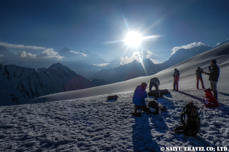
The quiet peak of Karakorum before dawn seen from Gondogolo La (pass). From the left, K2, Broad Peak, G4, G3, G2, G1.


The route over Gondogoro La (at 5,680m), considered to be the ultimate trekking route to see K2, the second highest mountain in the world. As it requires snow wall climbing gear, make sure to check the rope work skill  thoroughly.


Taking glimpses behind us at K2 and Broad Peak, every now and then, we head toward  our base camp, Ali Camp (5,010m), to get over Gondogoro La. Checking in with the Islamabad office by satellite phone, we get the weather report. Fortunately, it will be clear tonight, so without hesitation, we decide to make our climb before dawn.


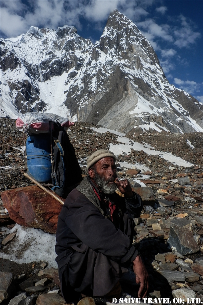
Our porters always carry the heavy equipment that we all use. This elderly man passed us quickly as we all crossed the Gondogoro La Pass, without much difficulty and waited for our mountain descent back at the camp. The local staff are always amazing through it all. Hats off to them for sure.


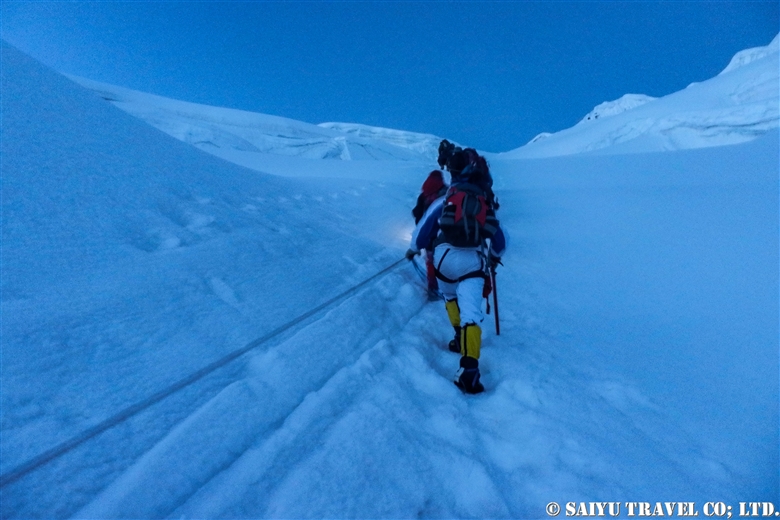
1am: Head out from base camp. Climbing up a snow wall using jumar, with an average slope of 50 degrees.


At last, 5:20 on July 6, 2012, we arrived at top of Gondogoro La!
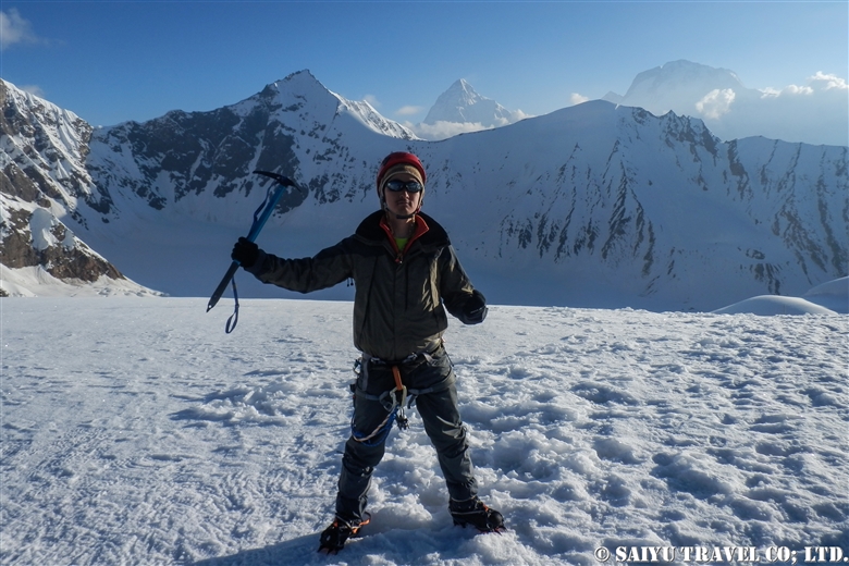
A photo of my youthful self and the ridgeline behind me are K2 and Broad Peak.


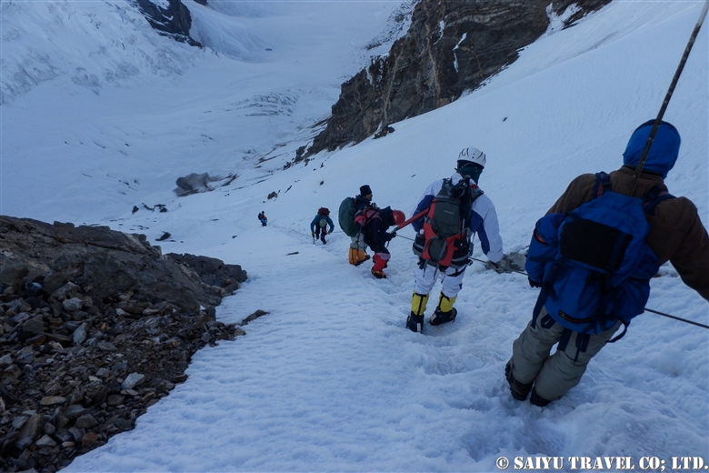
As the sun rises, the down slope becomes a little loose and the risk of avalanche and rockfall increases. We rushed to get down the mountain.


A long, steep descent is more difficult than the climb up.


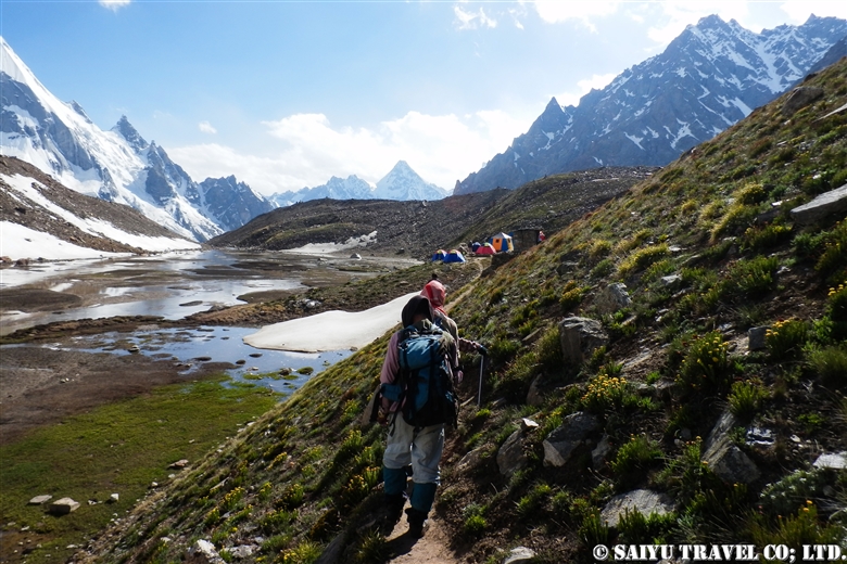
We arrived in a totally different world from the snow and ice world we just left high above. Camping in Khuspang, a lush campsite where so many alpine plants bloom.

I could finally let go of all the tension I was storing until now, and I slept like a log.


Photo & text :  Tomoaki  TSUTSUMI  from the expedition in Jun-July 2012


Category : ◆ Gilgit-Baltistan > ◇ Mountain of Pakistan > - Karakorum Range
Tag : , , , , , , , , , , , , , ,

TOP