The Khyber Pass is located between Peshawar and the border with Afghanistan. Since ancient times, it has been an important pass on the trade route between the Central Asian and Indian cultural regions. The mountain where the pass is located is called Spin Ghar (in the Pashto language) and was crossed by Alexander the Great’s army in the 4th century B.C., as well as by Xuanzang in the 7th century. During the Mughal period, it developed as part of the Grand Trunk Road, the main road from Agra, India to Kabul, Afghanistan. In modern times, it was a battlefield in the Afghan War during the British colonial period. After independence, it became an autonomous region of the Pashto tribe called the Federally Administered Tribal Areas (FATA), but that system was abolished in 2018. Foreigners visiting the area must have prior permission and be accompanied by security. When tourists talk about going to the Khyber Pass, it generally means visiting the area from the Khyber gate to the Michini check post.
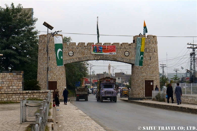
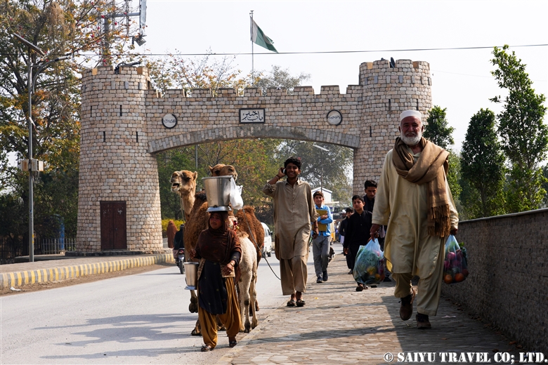
Bab-e-Khyber and Jamrud Fort
This monumental gate was built in 1963 and is located 18 km from the center of Peshawar city. There is a small park next to the gate where the history of the Khyber Pass is inscribed on a stone tablet. Khyber Gate also appears on the Pakistani 10-rupee bill.
Just past the Khyber Gate, on the right, is Jamrud Fort. It was built by the Sikhs in 1823 on top of an old fort. General Hari Singh Nalwa, a hero of the Sikhs, was killed and buried at Jamrud Fort while fighting Afghans. The fort is manned by the Pakistani army and entry is not allowed.
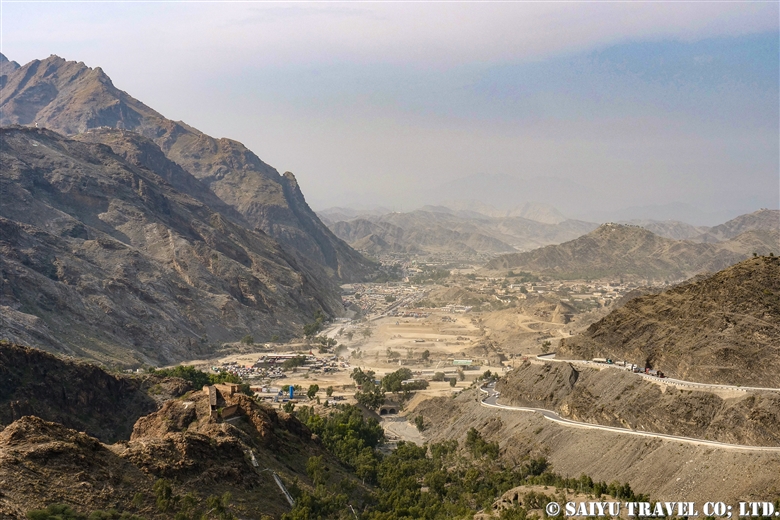
Khyber Pass Viewpoint
The photo of the Khyber Pass shown in the guidebook features a view looking back toward Peshawar from the road on the way to the border. The road is now newly widened and is lined with transport trucks coming and going from the border, but it must have once provided a dramatic sight of the Gandhara Plain spread out in front of the caravans coming from Afghanistan.

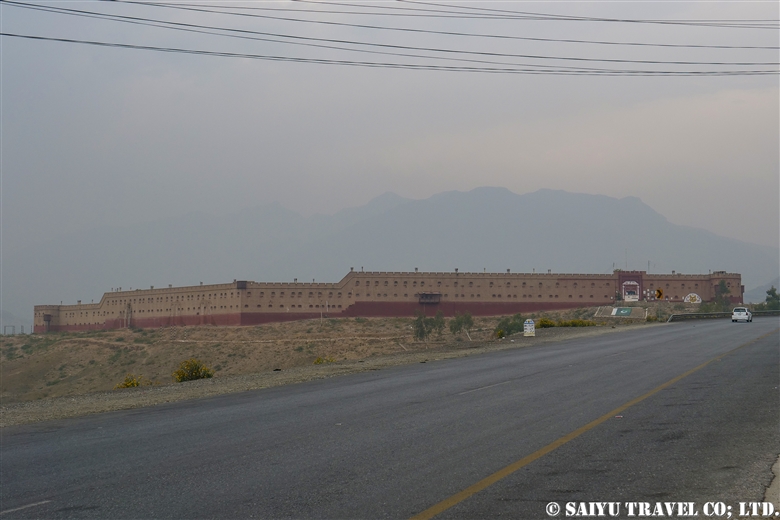
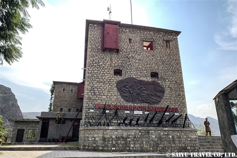
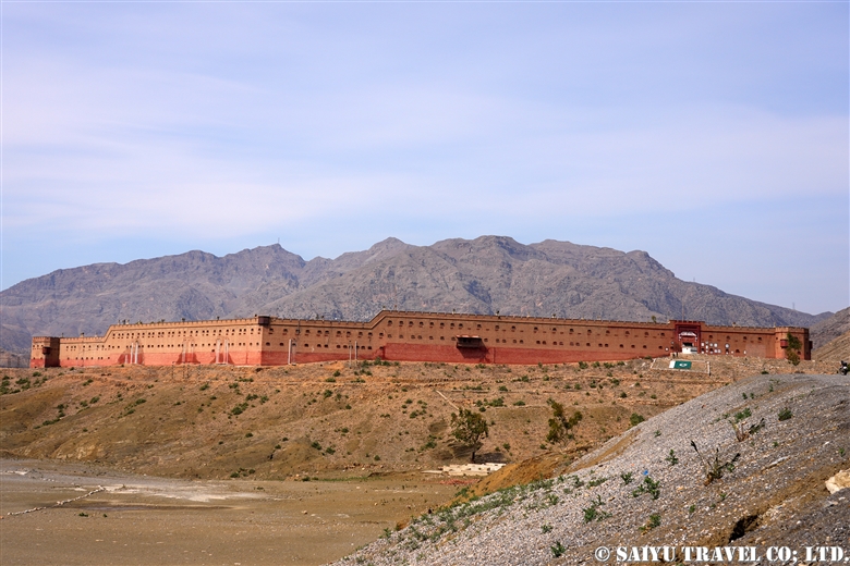
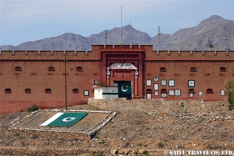
Shagai Fort
The fortress was built by the British in the 1920s to monitor the Khyber Pass route. It is currently manned and monitored by the Pakistani Army. On the other side of the fort there is a new monument and a lookout tower.
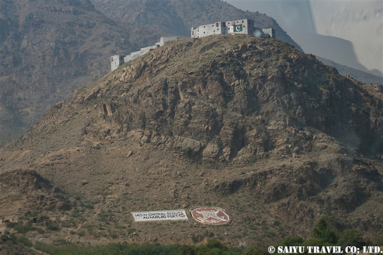
Ali Masjid
This is the narrowest part of the Khyber Pass road, flanked by mountains on both sides. It was originally so narrow that two loaded camels could just barely pass each other. Because of its strategic importance, it was the site of fierce battles in past wars. The road has been gradually widened, but even today, the lanes are separated, with the lane heading toward Peshawar being built on a cliff.
The small Ali Masjid (a mosque), as well as a madrasa can be found along the road. The Ali Masjid Fort, where the Pakistani army is stationed, is located on top of the hill.


Palatial Residence (Fort) of Ayub Afridi
Ayub Afridi is a well-known drug lord and tribal politician, known for the many interesting stories about his contacts with the United States, among other topics. Along the road is a wall of mansions with more than 100 rooms.
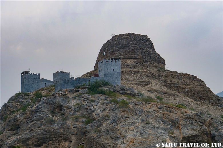
Sphola Stupa
The stupa dates back to the 2nd-3rd century Kushan period and is built on a three-tiered platform. Excavations in the early 20th century unearthed a Buddha statue, and as of 2024, the base of the temple is being restored. It is the only Gandhara Buddhist site in the Khyber Pass area.

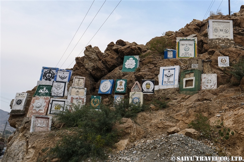
Emblem of the Military Corps
The troops of various time periods who passed through the area carved their military emblems into the rock face as a commemoration of their passage.

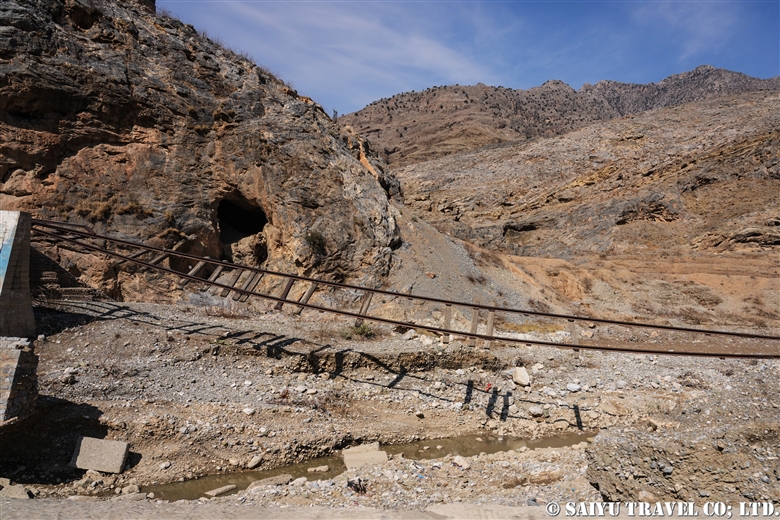
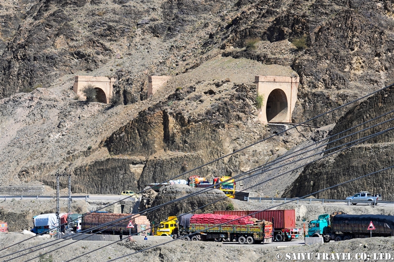
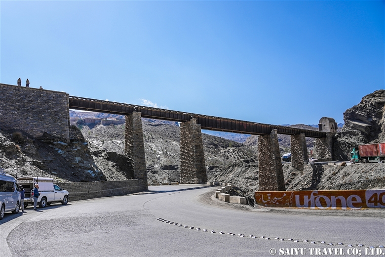
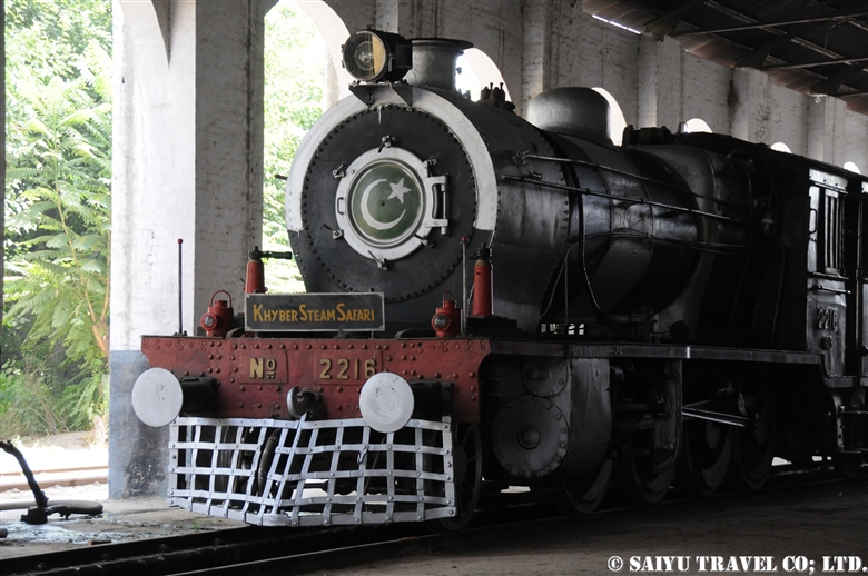
Khyber Railway
There was a time when a steam locomotive operated once a month for tourists between Peshawar and Landi Kotal. The Khyber railway has a long history, having opened in 1926 during British rule era for the purpose of transporting military supplies. The railway runs from Peshawar to Landi Kotal, a distance of 40 km with a height difference of 600 m, crossing 34 tunnels and 92 railway bridges.
The area was devastated by heavy rains and flooding in 2006, and there is absolutely no hope of restoration. Currently, only the remains of damaged tracks, tunnels, steel bridges, and stations can be seen.
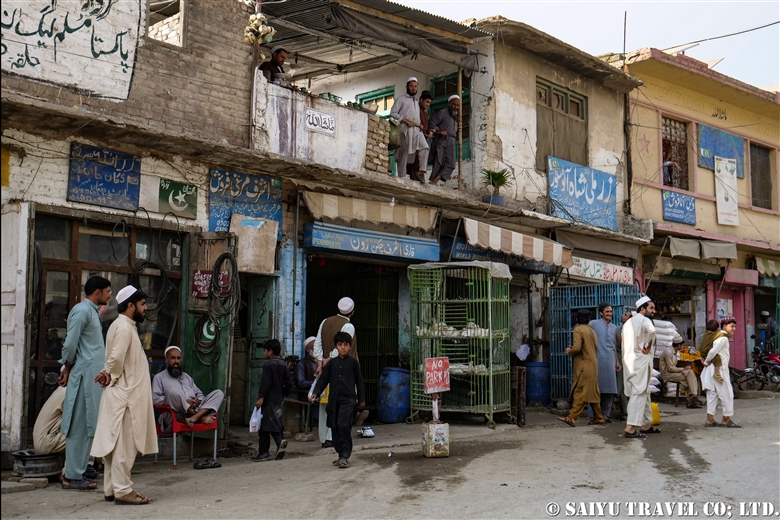
Landi Kotal
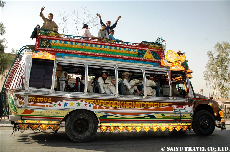
The last town on the Pakistani side is Landi Kotal. Stores are spread out over an even lower level of the town’s main street. It was once known for its smuggled goods bazaar which dealt in arms and drugs. Today, there is still a vibrant market.


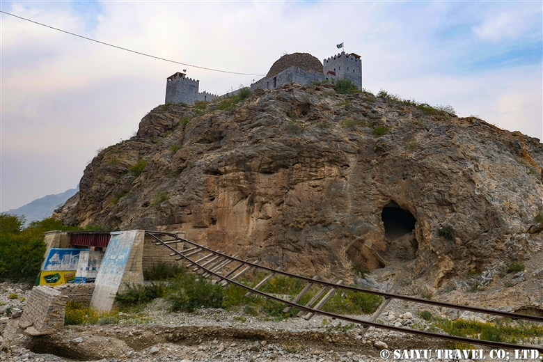
Michini Check Post
The last point on the Pakistan side that can be visited without an Afghanistan visa is the Michini Check Post, which overlooks the border town of Torkham. The border town of Torkham is 5 km downhill from here. The rocky mountains across the border are numbered from 1 to 3, and the border line between the two countries is the point where these lines are connected.

The Michini Check Post has a viewpoint where tourists can enter. From the viewpoint, there is an old building called the Taimoor Fort or Tamerlane Fort, which according to legend was used as a prison during Timur’s invasion of India.


Torkham Border
Approaching the border there is a dry port and an immigration control building. As of 2024, the Torkham border is the only open border between Pakistan and Afghanistan.


The border with Afghanistan is connected by a long corridor, and from there it is 230 km to Kabul, which takes about 6 hours by car.
Photo & Text : Mariko SAWADA
*Contact us, Indus Caravan for more information or to make arrangements for visiting Khyber Pass, Border Crossing and Afghanistan. >> Our Afghanistan tour .
*Please follow us on Youtube, Instagram & Facebook
Category : - Peshawar / Khyber Pass > ◆Khyber Pakhtunkhwa > UncategorizedTag : Michini Check post , Khyber Pass , Border crossing to Afghanistan , Shagai Fort , Torkham Border , Ali Masjid , Sphora Stupa , Landi Kotal , Khyber Pass excursion , Torkham , Permits for Khyber Pass , Afghanistan , Afghanistan tour , Afghanitan travel , Peshawar , Tour operator in Afghanistan , Khyber Gate , Travel company in Afghanistan