English / Japanese

Necropolis of Mian Nasir Mohammad Kalhoro

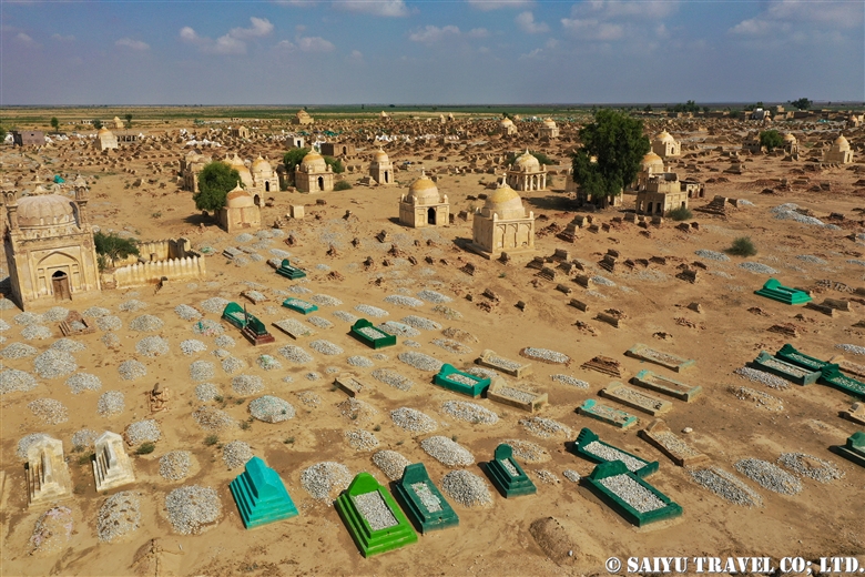
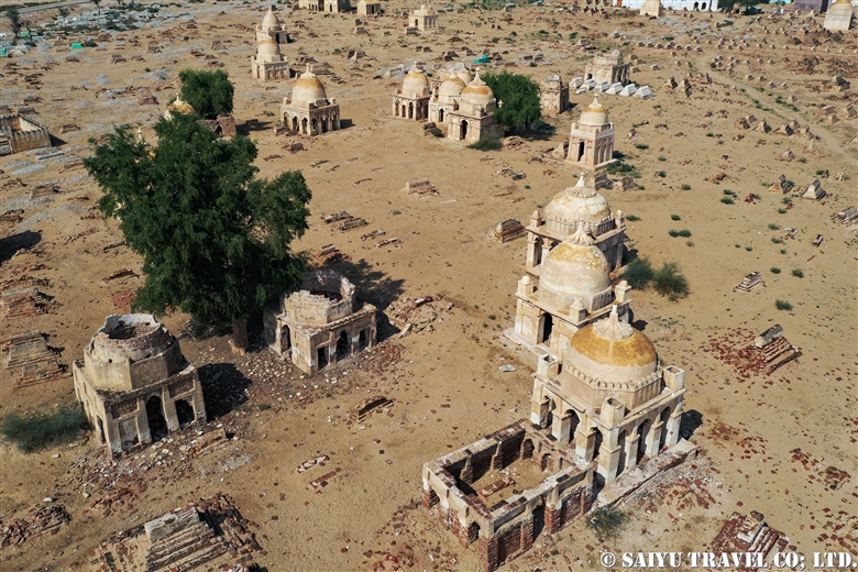
On the way along the Indus Highway, a villager showed us the second largest in Sindh, the Necropolis of Mian Nasir Mohammad Kalhoro.


This group of tombs of the 17th Century Sindh Clan, from the Kalhoro Dynasty, is made up of groups of tombs for the royal families, priests, and on the outside, surrounded by the villagers’ tombs. It makes me wonder if perhaps this is how the World Heritage Site, Makli Hills might look if it was still expanding.


The graveyard is an interesting atmosphere, but the visitors also took in a good view from the Indus Highway of the ‘inland Sindh.’ It is a nostalgic and warm place to see this side of Pakistan.


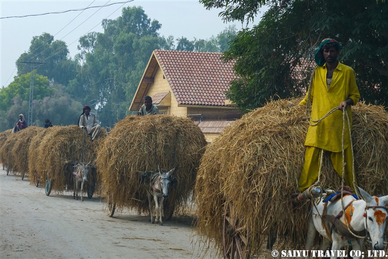
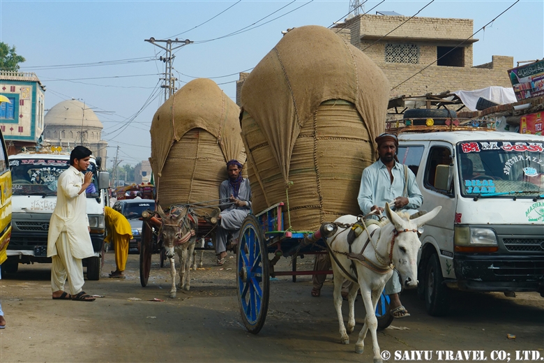
Are they carrying wheat? Between the cars and trucks, there are donkey drawn carts carrying goods.


You can only see this kind of scene during the harvest season, the wheat being carted by the donkeys.


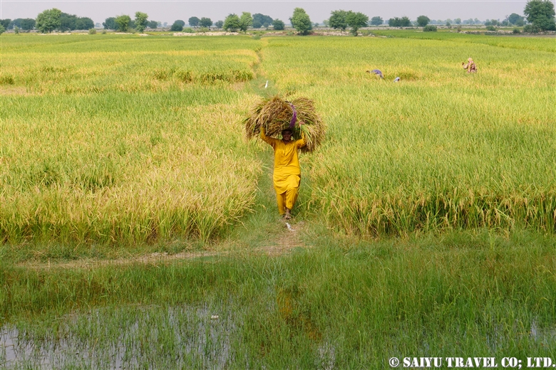
Harvesting from the fields. After the wheat harvest, the rice harvest begins.


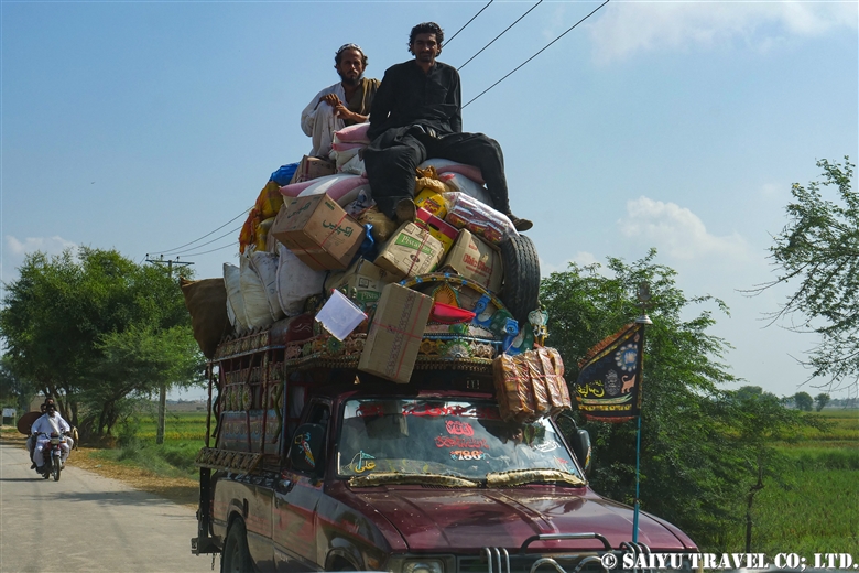
This small truck is loaded down with luggage and people as it is heading towards a village out of the city. These Sindhi villagers kindly exchange smiles with us as they pass.


Photo & Text: Mariko SAWADA

Visit: Nov 2019, Necropolis of Mian Nasir Mohammad Kalhoro, Dadu, Sind

Category : - Monument / Heritage of Sindh > ◆ Sindh > ◇ Heritage of Pakistan
Tag : , , , , , , , , , , ,

(video) Rohtas Fort – Legacy of Sher Shar Suri

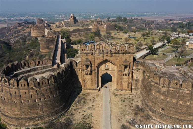
Rohtas Fort is one of the six World Heritage Sites in Pakistan.

A fortress built by Sher Shah (Founder of Sur Empire, a short-lived empire from 1539 to 1555)  who built the transportation networks that served as the foundation for Mughal empire.

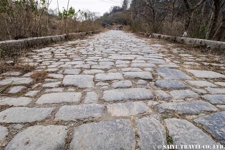
Sher Shah built ” The Grand Trunk Road “between Kabul and the Punjab Plain and built Rohtas Fort on it’s middle way.

Aerial view of Lotus Fort by dronefootage.


Video &  text : Mariko SAWADA

Visit : Feb 2020, Rohtas Fort, Punjab

Category : = Video Clip Punjab > ◆ Video Breathtaking Views of Pakistan > - Monument / Heritage of Punjab > ◆ Punjab > ◇ Heritage of Pakistan
Tag : , , , , , , , , , , , , ,

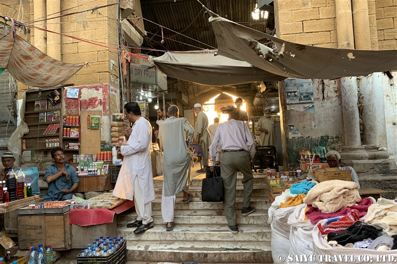
The largest city in Pakistan, Karachi’s Empress Market

Karachi is not the capital city, but it is the largest city in Pakistan with a population of 16 million but it is said to unofficially be home to 20 million people. In the past, Karachi was an unsafe place due to ethnic conflicts and crime, but in recent years that has changed and things are starting to settle down.

It has transformed itself from a town that was dirty, poor and a place you didn’t want to look at to a really fashionable place with elite neighborhoods. If you compare it to Islamabad, the people are more open minded and the daily cost of living is cheaper so the people who live in the rural areas like  Hunza would rather come to Karachi.
Karachi’s historic and exotic bazaar is the Empress Market.


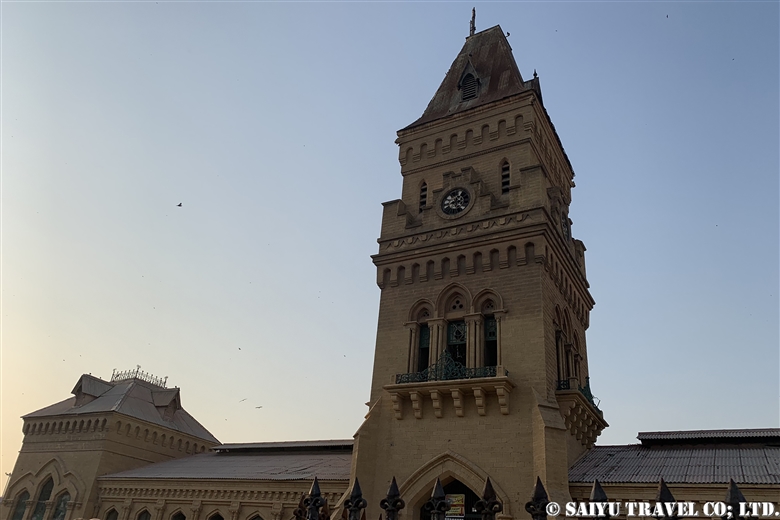
The name “Empress” comes from the market being built between 1884 and 1889, during the reign of the British Indian Empire, so it was named in honor of Queen Victoria.
Located in Saddar, the open air building and clock tower are visible from afar.

The historic architecture is beautiful backdrop for the market.


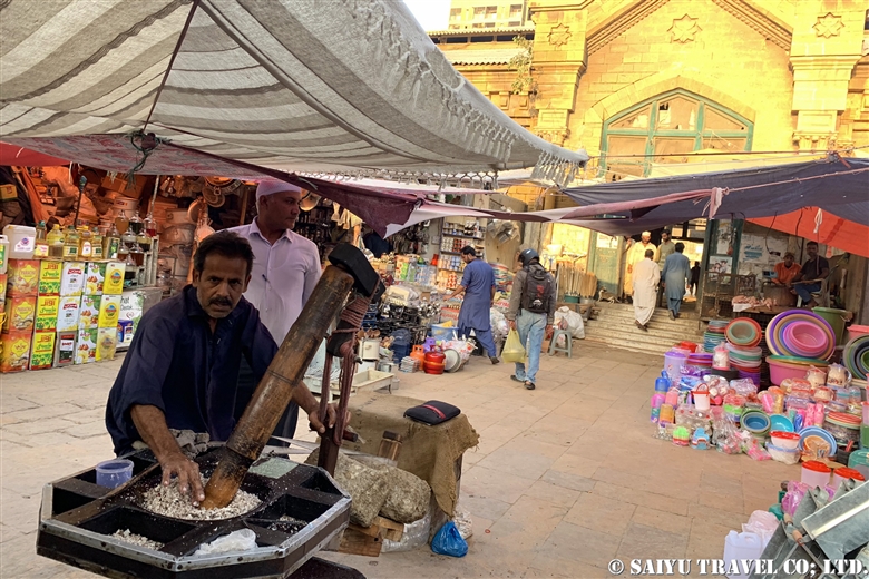
This specialist makes all kinds of oils from various things like coconuts and sunflower seeds.


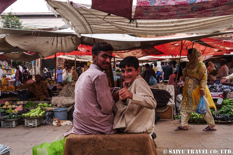
Some young boys in the vegetable market.


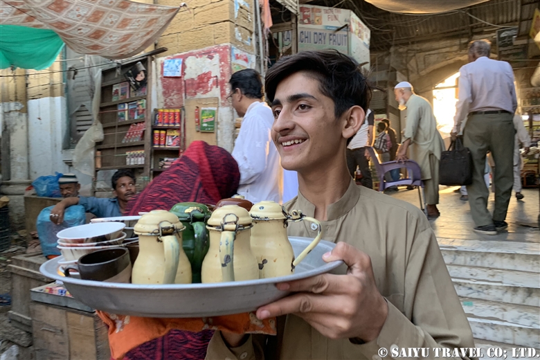
A boy delivers us some Chai tea from the back of the market.


A man cuts pieces of meat off for a kitten. Near the meat market, there are so many cats.

That reminds me that I saw an article in 2015 saying that illegal wildlife sales were happening in this market. Just a few days ago, I saw people catching raptors illegally on the Balochistan coast and trying to sell them to the rich Arabs. It would be nice if the Pakistani Wildlife Department would work harder to stop these activities.


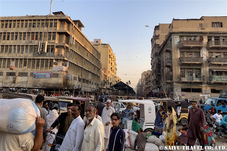
All around the market, there is the hustle and bustle of traffic in Saddar.

If you compare it to before, the security is much better, but it’s still important to be careful about keeping your valuables and cell phones safe.


Photo & Text: Mariko SAWADA
Visit: Feb 2020, Empress Market, Karachi, Sindh

Category : - Karachi > ◆ Sindh
Tag : , , , , , , , , , , , ,

Gadani Ship Breaking Yard

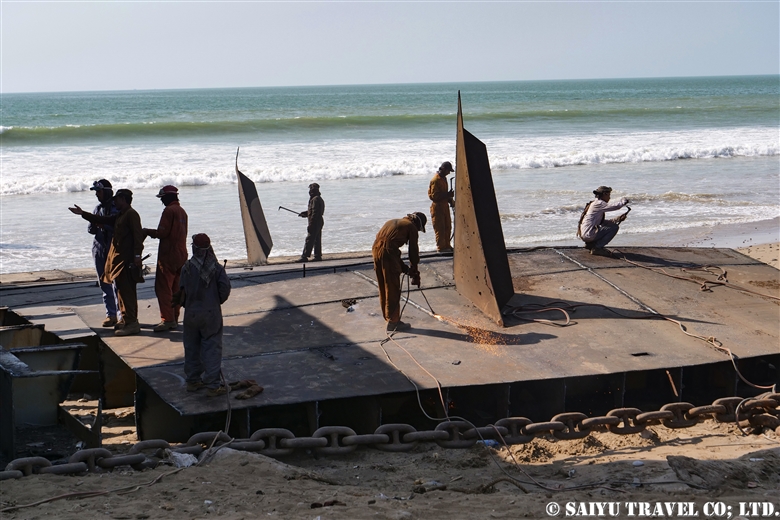
Have you ever wondered what happens to ships at the end of their service? …used to be that they would sink into the sea in the past, but now parts are often being dismantled and reused where possible. In postwar Japan, there was a rush to build ships, but these warships became unnecessary and various countries were dismantling them. Now the countries dismantling them are mostly in SE Asia. In Gadani they practice a technique called beaching. During the high tide, the boats will be hauled up on the sandy beach and then cut down for the steel and other recyclable parts.

According to the past records, the shipyard takes up about 10 kilometers of the Gadani shoreline and in the 1980’s there were 30,000 people working there, making it the largest in the world.
In 2016, there was a huge accident causing many casualties, so many new laws and regulations requiring insurance for the workers was enforced by the new government. When we visited, there were only a few shipyard businesses operating at that time.


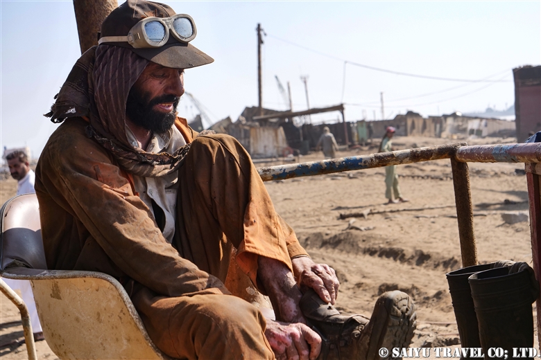
At 2 PM, after his lunch break, this worker is getting back to work.


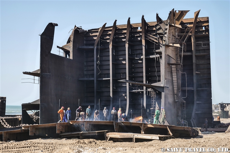
Huge coastal oil tankers and cruise ships are taken apart using manual labor.


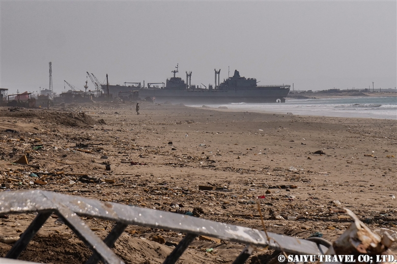
We observed from afar so as not to get in the way as they worked.


The shore of Gadani…several ships on the exhausted shore.

When we visited the shipyard, there were demolition yard workers who seemed to be local Baloch people, as well as Pashtuns from far away Swat Valley. These hard-working Pashtun men left a lasting impact as they looked so strong, bright and masculine in such a harsh working environment.


Photo & Text : Mariko SAWADA
Visit: Nov 2019, Ship breaking yard of Gadani, Balochistan
Category : ◆ Balochistan
Tag : , , , , , , , , , ,

Mohenjodaro

This is the ruins of the Indus Valley Civilization, the city of Mohenjo-daro (also Moenjodaro).

It is the site of the largest urban archeological settlement, with its most active period between 2500 to 1800 BC. It is believed that up to 40,000 people inhabited this area, in the east is a fortified section (There is a Gandhara stupa, Ritual bath believed to have been used for religious ceremonies, bathing or purifying, and for political gatherings) and divided on the western side (there were houses for the nobles, shops and commoners homes also). So far, only 10 percent of the area has been excavated, and scattered all around are unexcavated mounds.
Meaning “Mound of the Dead people” in Sindhi the local language, back in the old days, this burial place was a site that locals were afraid to come close. In 1921 an Indian archeologist excavated the site calling it the “2nd and 3rd Century Gandhara” but upon exploring it, they had uncovered a city ruins of the Indus Valley Civilization, much older than they thought.

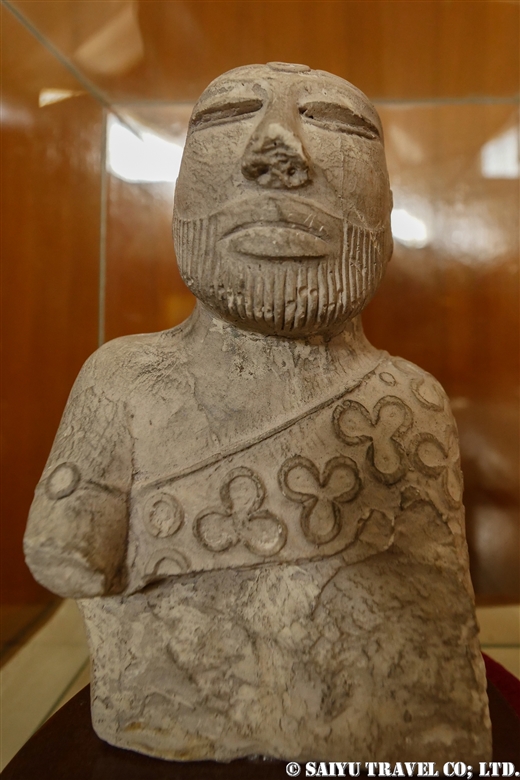
Extensive excavations were carried out by the Archeological Survey of India (A.S.I)  during the British India period until 1947. In 1980 it was designated a World Heritage Site. It is still unclear what might have caused the decline of the city. During the survey, a seal was discovered, but because the text of the Indus script that is engraved on the seal has not been deciphered yet, the true name of the town is unknown.


This Mohenjodaro  SD Area’s Gandhara Stupa, which dates back to 2nd or 3rd Century AD. There is a monastery surrounding the area which is built using bricks from the Indus Valley Civilization.


The famous “Great bath” area is 12m x 7m and 2.5m deep, and there are remain of  waterproofing on the elaborate wall made of bricks. It is said  that some religious ceremony was held here.  The stepped ghats (terraces) descending to the surface of the water are supposed to lead to Hindu features later.


A sewage system in the SD Area. It is covered with limestone rocks. Some of the DK area is built entirely underground.


This is also the sewage system in the SD area. Water from the Great Bath and other dwellings are directed through this channel to the Indus river. During that time, the Indus River ran very close to the town of Mohenjo-daro.


In the corner of this DK area home, is a “Rubbish Bin.” Similar efforts for “Trash collection” areas are also seen in the SD areas as well. Unfortunately, this concept of managing their garbage wasn’t carried into modern pakistan.


In the Urban DK area, an aristocratic house was a two story building, with access to the well even from the second floor.


“The Old Street” as it is called is the Main Street. On both sides it was lined with shops.

Recently, many domestic tourists of Pakistan have increased in visiting this site. Particularly at sunset, you will see many people.

Unfortunately, the time I visited Mohenjo-daro it was too cloudy to catch a good sunset. But my personal recommendation is to visit early in the morning, when you can enjoy “the deserted city of Mohenjo-daro.” without other tourists.

Photo & Text: Mariko SAWADA
Visit: Feb 2020, Nov 2019,  Mohenjo-daro, Sindh

*For inquiries and consultation, please go to Indus Caravan

*Please follow us on YoutubeInstagram & Facebook

Category : - Mohenjodaro > - Monument / Heritage of Sindh > ◆ Sindh > ◇ Heritage of Pakistan
Tag : , , , , , , , , , , , , , ,

(video) Hidden Jewels on the Makran Coast – Captivating Mud Volcano

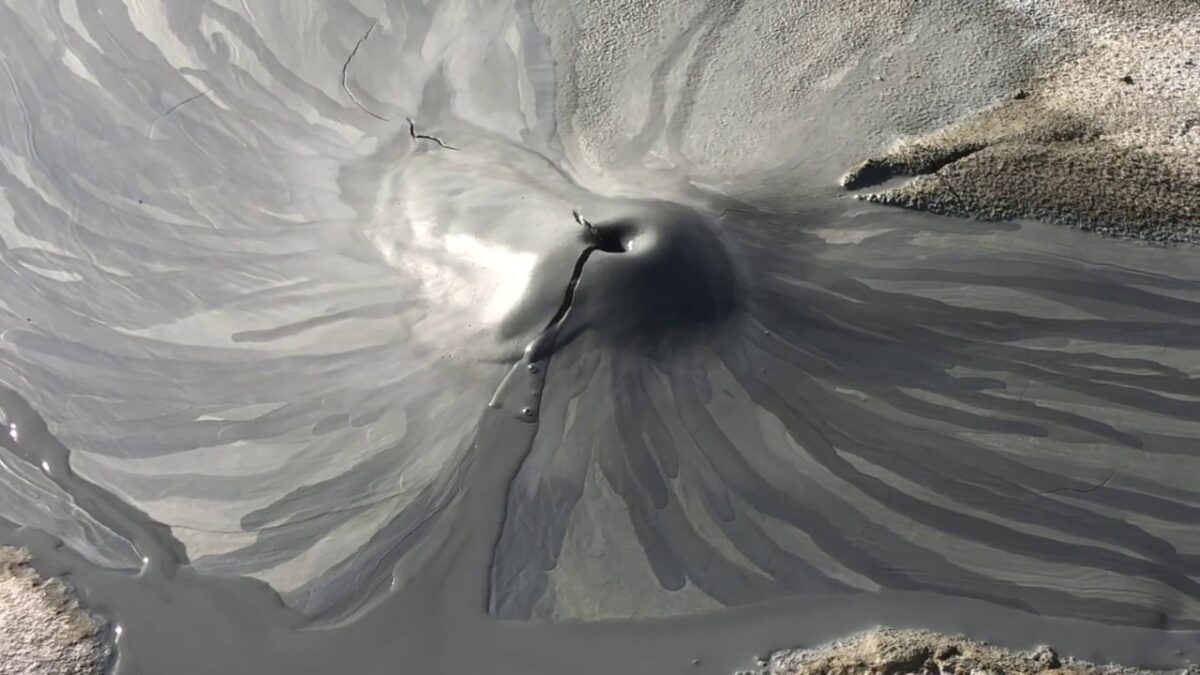
We could travel to more remote areas of the breathtaking shoreline along the Makran Coast. In the winter of 2019, the active Mud Volcanoes were unforgettable. It was amazing to see the mud bubbling up at your feet! I have seen Mud Volcanoes before, but this was a new experience all together!

Video & Text : Mariko SAWADA
Visit :Nov 2019, Makran Coast, Balochistan

Category : = Video clip Balochistan > ◆ Video Breathtaking Views of Pakistan > - Mud Volcano > - Hingol National Park > ◆ Balochistan > - Makran Coast
Tag : , , , , , , , , , , , , , ,

(video) Bird’s Eye View of Princess of Hope & Buzi Pass

Traveling from Kund Malir to Ormara, just off of the Makran Coastal Highway you will find the Buzi Pass.
Just near the Kund Malir Beach, the famous “Princess of Hope” will greet you. Even though I cannot see the princess in the shape, if you happen to be there on a weekend in the afternoon, you will see many local tourists surrounding the Princess.
Enjoy the magnificent view of Buzi Pass and nature’s art landscaping using erosion.

Video & Text : Mariko SAWADA
Visit :Nov 2019, Makran Coastal Highway, Balochistan

Category : = Video clip Balochistan > ◆ Video Breathtaking Views of Pakistan > - Mud Volcano > - Hingol National Park > ◆ Balochistan > - Makran Coast
Tag : , , , , , , , , , , , , , ,

(video) Deep Inside Hingol Narional Park – Hidden Landscapes of Balochistan 

Deep Inside Hingol Narional Park – Hidden Landscapes of Balochistan

Hingol National Park’s remote offroad backcountry exploration reveals the world of Mud Volcanoes.

Starting in the winter of 2018, after my third visit, I could finally make it to “Mars Point” which is named unofficially by our staff. Even though of course, none of us have ever been to Mars, but standing here in this landscape makes you feel like “This is not Earth!”

Thank you for the came in our video, Mr. Toshiki Nakanishi (professional photographer).


Video (Drone footage) & Text : Mariko SAWADA
Visit :Nov 2019, Hingol National Park, Balochistan

Category : = Video clip Balochistan > ◆ Video Breathtaking Views of Pakistan > - Mud Volcano > - Hingol National Park > ◆ Balochistan > - Makran Coast
Tag : , , , , , , , , , , , , , ,

(video) Northern Pakistan, Autumn the Hunza Valley, a hidden paradise

Northern Pakistan, Autumn the Hunza Valley

In the past, the main tourist season of Pakistan was mainly in the  summertime, but now many people are travelling to see the apricot blossoms in the spring or to see the autumnal colors of the fall season.

And it is quite remarkable.

This drone footage is nice, but the view from the hotel terrace is indeed just as spectacular and the mountains and orchards make you feel like you are in a real hidden paradise.

The autumn comes a little later each year, due to the unfortunate effects of climate change. However, in Hunza and in the upper reaches of the Hunza, each village is at its own elevation and exposure to sunlight is different, causing just enough variety of options, to be sure to catch the beautiful scenery in one of them.

Villagers also prepare for the winter during this time. Potatoes are distributed and the livestock return from the highland pastures back down to the villages.


Video & text : Mariko SAWADA

Visit : Oct 2018, Hunza, Upper Hunza,  Gilgit-Baltistan

Category : = Video Clip Gilgit-Baltistan > ◆ Video Breathtaking Views of Pakistan > ◆ Gilgit-Baltistan > - Hunza Valley > - Gojar > - Morkhun > - Passu
Tag : , , , , , , , , , , , , , , , , , , ,

Autumn in the Kalash Valley

After not having been able to visit in a few years, I was able to return to the valley of the Kalash people, to a village called Bumburet. Mid-October proved to be a truly beautiful time to visit with the fall colors and corn harvest taking place.

On October 16, 2019, the Royal Couple Prince William and his wife visited Kalasha Valley where they enjoyed seeing traditional dances. The social media and news was flooded with “The Royal Couple” and “Kalasha” where trending amongst the Pakistani people.

> Kalash Valley “Where did the Kalash people come from?”

>Religion of Kalash Valley


Taking a turn off the main road, and crossing the bridge brings you into Ayrun village. It is like traveling back in time. You will see as you enter into the village, narrow fields and the beautiful traditional Pakistan. You will eventually come to the intersection of Bumburet and Rumbur Villages.


The road into Bumburet village hasn’t changed. It is still the small dirt road that has pull-offs to allow two small cars to pass each other.
However, as we entered into the village, I was a little shocked at the changes I saw. The women we saw were dressed in the traditional Karasha clothing but about half of them were also wearing the shalwar kameez (national dress of Pakistan). And the number of guesthouses was a bit overwhelming.

Where did the traditional style houses go? In recent years, an increase in domestic tours and a shortage of lodges for the tourists to stay, naturally meant that the number of guesthouses increased suddenly. Most of the managers of these guesthouses are from the outside. I hoped they would build them in the traditional style to match the landscape and keep the flavor of the original village.


Walking on a path between the corn fields, I went to visit an acquaintance. The Kalasha children I met on the way.


This is the School  dress of the Kalasha young ladies. There seems to be more girls wearing scarves then before.


Just off the main road through the village I could see this beautiful figure taking a walk.


Children playing next to a cornfield where their parents are busy harvesting.


No on can stop change that comes with progress, but I hope that these beautiful sights can continue into the future.


On the way out from the Kalasha Valley, we could see the village of Ayun sitting at the base of Tirich Mir. The highest peak of Hindu Kush is Tirich Mir (or Terichmir stands at 7,708 meters) was bathed in the hues of the setting sun.


Photo & Text : Mariko SAWADA
Visit : Oct 2019, Bomboret Village, Kalash Valley, Khyber Pakhtunkhwa

Category : - Kalash Valley > ◆Khyber Pakhtunkhwa
Tag : , , , , , , , , , , , , , , , , , , , , , , , ,

TOP