English / Japanese

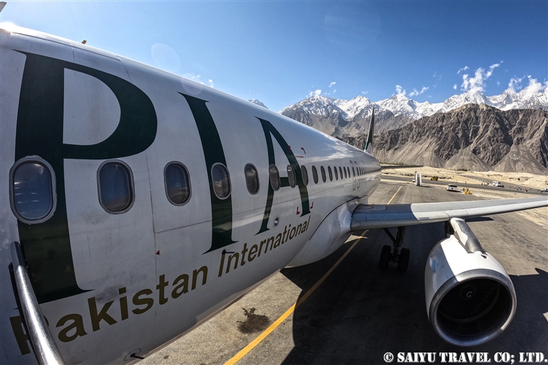
View of Nanga Parbat from Flight PK451!

The Pakistan Airlines flight from Islamabad to Skardu on good weather days are renowned for their great views of the world’s 9th highest peak, Nanga Parbat which stands at 8,126 m (26,660 ft).

This video was taken on a sunny day in October during our visit as we flew on flight PK451. I took the video with my iPhone. I have been on this flight a number of times before, but on this day in particular, Nanga Parbat felt closer than ever before!


Nanga Parbat from PK451 (Aerial View)

The video linked below was taken with a Go Pro 10 by Amin Gazi Karim of the Indus Caravan who was on the same flight with us. His short reel highlights moments from the entire flight from flying towards Nanga Parbat to our landing in Skardu.

Skardu is now a popular destination among domestic Pakistani tourists, with flights from Karachi and Lahore during the summer season, with three arrivals a day on the weekends. Compared to in the past, there have been improvements on the flight operation rates.

The peak of Nanga Parbat taken from the airplane. There are often clouds on the peak, so we were lucky to have a really clear view.

As we approach Skardu, the snow-capped mountains and valleys begin to appear.

The flow of the Indus River has carved out the Skardu valley. Skardu Airport is right along the riverbank.

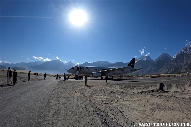
Landed at Skardu Airport. With the aim of it becoming an International Airport, there are various projects ongoing to expand it and maintenance is underway. In fact, it is located right on the boarder with India, and the military also uses the airport regularly, so there are plans for a new runway.

On November 30, 2021  Pakistan Airlines closed their branch in Japan. This airline that has connected Tokyo to Islamabad for nearly 30 years, will be gone and makes me so sad.

Thanks to Pakistan International Airlines and everyone who supported flight to Tokyo.


Image & text : Mariko SAWADA

Visit :Oct 2021, taking flight PIA 451 from Islamabad to Skardu

Category : = Video Clip Gilgit-Baltistan > ◆ Video Breathtaking Views of Pakistan > ◆ Gilgit-Baltistan > - Skardu Valley > ◇ Mountain of Pakistan > - Nanga Parbat / Himalaya Range
Tag : , , , , , , , , , , , , , , ,

Kalash Valley’s Bumburet and Rumbur

This is a video that highlights the scenery of the Kalash Valley when we visited in October. In the past when we visited Bumburet village, it was during the tourist season and quite crowded with domestic tourists.

However, by the middle of October, there were very few visitors at this time of year and the village was quiet.


KALASH VALLEY Bumburet & Rumbur|カラーシャの谷(ボンボレット&ランブール)


Image : Mariko SAWADA

Visit : Oct 2021, Bomboret & Rambur, Kalash valley, Khyber Pakhtunkhwa
Category : = Video Clip KPK > ◆ Video Breathtaking Views of Pakistan > - Kalash Valley > ◆Khyber Pakhtunkhwa
Tag : , , , , , , , , , , , , , , , , , , , , , ,

The Himalayan Brown Bear Before Hibernating: The Deosai Plateau in October

I photographed this Himalayan brown bear in mid-October on the Deosai Plateau. Once October rolls around, the snowy season comes to the grasslands. With the first snowfall, the wild animals are signaled that winter has arrived and their preparations hasten. For example, the long-tailed marmots will surprisingly, all start hibernating at the same time! Just until yesterday, they were out, basking in the sun, but I didn’t see any of them today at all!

This is the wintery scene of the Deosai, near the Barapani camp. According to the National Park staff, the Himalayan brown bears will prey on the long-tailed marmots especially in month of September because they are plump with their winter fat by this time. All the animals are preparing for the long hibernation. Once the marmots stop emerging and enter their hibernation period, the bears will also move from the highlands of about 4,200m (about 13,780ft) to a slightly lower altitude valleys for their own hibernation.

We could see the Himalayan brown bears near the road around Barapani camp!

↓↓↓ A video of the Himalayan brown bears!

Himalayan Brown Bear in Autumn|デオサイ高原のヒマラヤヒグマ

The bears get so large and plump just before hibernating. Just looking at them, fills me with happiness.

This bear has found a comfy spot to sit in the grassland.

The surrounding mountains are already covered in snow. According to our Park staff, it will probably be the last time we will see the brown bears on the Plateau, until next summer.

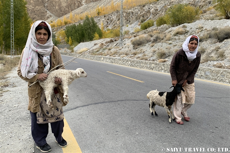
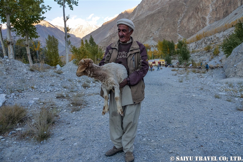
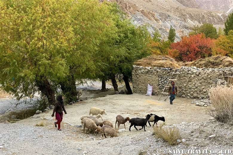
After the second snow, the Park staff also packed up their base camps and headed back to Skardu. The sheep and goat herders have already descended into the Valley, and winter on the Deosai plateau is setting in.

The long-tailed marmots will hibernate, but the red fox stays active in order to survive the long winter. Even long after the people have gone, I have still seen foxes along the road during our visits.

The number of domestic Pakistani tourists that come to Deosai National Park is increasing and the management of garbage disposal at the campsites is becoming problematic. In 2018 there was a very shocking report that 80% of the content in the bear droppings was plastic. After that, it was reported that the staff of the Park started to make efforts to do cleanups once a week. In addition, it is common to see brown bears in the campsite’s trash areas, so taking more proactive countermeasures is needed.

This awareness sign about the problem has a photo of the bear taken in the summer time. Even in the summer, it is looking so fluffy!


Image  & Text : Mariko SAWADA

Observation : Oct 2021, Deosai National Park, Gilgit-Baltistan

Category : = Video Clip Gilgit-Baltistan > ◆ Video Breathtaking Views of Pakistan > ◆ Gilgit-Baltistan > - Himalayan Brown Bear > - Deosai National Park
Tag : , , , , , , , , , , , , , ,

Sarfranga cold desert, emerging from the sea of clouds: Skardu

The morning after it rained and snowed in Skardu. The valley all along the Indus River was bathed in fog.

Located on the banks of the Indus River in Skardu, is the Sarfranga Cold Desert. The name is based on it being at 2,500m (8,200 ft), as a high-altitude desert surrounded by high mountains. The sand along the river, forms beautiful dunes.

The sand dunes remind me of the scenery of the Sahara Desert or the Namib Desert, with the periphery of the sand dunes surrounded by peaks higher than 5,000m above sea level. Making it feel so mysterious.

Sarfranga cold desert emerging from the sea of clouds Skardu|スカルドゥ サルフランガ寒冷砂漠

This drone video was taken in the cold desert, while I was standing in the fog, operating the drone. Once the drone rose above the fog, you could see the landscape open up beautifully.

This is the scene of the fog settled over the Sarfranga dunes, as seen from the road to the Shigar Valley. The large Pakistani flag was drawn on the side of the rocky mountain.

The valley of the Indus River which flows from the Indian boarder was covered in fog.

The tips of the dunes emerging from the fog was strikingly beautiful.


Image & text : Mariko SAWADA

Visit : Oct 2021, Sarfranga Desert, Skardu, Gilgit-Baltistan

Category : = Video Clip Gilgit-Baltistan > ◆ Video Breathtaking Views of Pakistan > ◆ Gilgit-Baltistan > - Skardu Valley > - Shigar Valley
Tag : , , , , , , , , , , , , , , , , ,

Crossing the Shandur Pass in the Autumn

In late October, Northern Pakistan’s poplar trees turn a golden hue, making it the most beautiful season of the year. Travel from Gilgit to Shandur Pass through the Ghizer District is spectacular. With less traffic in the valley, the view along the road is one of the best.

On this day, we left Gupis to travel towards Chitral. There were rows of golden poplar trees reflecting the sun against the clear autumn sky. However, as we kept stopping to get photos of the dynamic landscape, our progress getting to Chitral was quite slow.

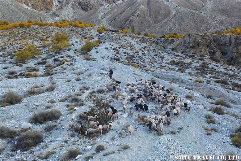
As we made our way uphill to Phandar, we found a herd of yaks that were being gathered together. Due to snow in the higher elevations, they were being brought down and were being herded together to be taken to their pasture lands.

A view of the bridge near Phandar. In the past, many of the suspension bridges like this were made of stone, wood and wire. But they are steadily being replaced by concrete bridges made by China. As a photographer, it is sad to see these kinds of bridges getting phased out.

Eventually, we started up the Shandur Pass. We saw a donkey caravan passing us as they were heading down, loaded with fuel for their fires during the cold winter. Their heavy load was packed with materials for firewood, including dried cow and yak droppings

Shandur Pass at the altitude of 3,700m (12,140 ft). The Gilgit-Baltistan and Khyber-Pakhtunkhwa boarder is here. At the check post, all the foreigners will be asked to confirm their documents here.

When mentioning Shandur Pass, it is worth noting that it is famous for the “World’s highest altitude Polo Competition” the Shandur Polo Festival, which takes place in the summertime. The stadium was also covered by the snow.

This is a lake covered in ice on the Shandur Pass. This part of the road is extremely difficult to pass where the melting snow and sand mixes together into a muddy mess, causing a chaotic scene. 。

The steady, dependable vehicle of choice on these rough back country roads, is what is locally called the “Toyota Jeep.” These Toyota Land Cruisers from the 1970’s and 80’s are the go-to vehicle and have been retrofitted with the “Northern Pakistan Kit” both inside and out, which is designed to take a beating, but to get you to your destination.

These older jeep-type cars have been declining recently as newer land cruiser models become more popular, which is coming from Afghanistan into Gilgit-Baltistan and Khyber Pakhtunkhwa (Non Custom Paid Cars).

Even so, when it comes to driving in the snow, these rugged cars have a track record for being the most dependable. I’m so glad to know that even now, such an old Japanese car is still so heavily relied upon in the mountains of Pakistan. It is playing a vital role of connecting a remote village and delivering the supplies they need.

As we made our way down from the Shandur Pass, at the foot of the mountains, we stopped for a late lunch in the village of Laspur. We had lentils, curry made of freshly harvested potatoes, chicken curry, rice pilaf and naan.

In Laspur, this father and his daughter were running the wonderful “chaihana”. I was enchanted by the smile of this young lady.

We continued on our journey, taking the rough road to Mastuj, and then on to Chitral. By the time we arrived in Chitral, it was already dark.


Image & text : Mariko SAWADA

Visit  :Oct 2021, Gupis, Phandar, Shandur Pass – Gilgit-Baltistan & Khyber pakhtunkhwa

Category : ◆ Gilgit-Baltistan > - Shandur Pass > - Ghizer / Shandur Pass
Tag : , , , , , , , , , , , , , , ,

(Video) The Picturesque Mud Volcanoes of Balochistan

This is an aerial video of our tour members on the Mud Volcanoes while visiting Balochistan. Mud volcanoes are ever-changing in their appearance, sometimes being active and other times being inactive. I wonder, what side they will show us next season? Looking forward to finding out!


MUD VOLCANO BALOCHISTAN


Videography: Mariko SAWADA
Visit : Feb 2020, Kund Malir, Balochistan, Pakistan

Category : = Video clip Balochistan > - Mud Volcano > ◆ Video Breathtaking Views of Pakistan > - Hingol National Park > ◆ Balochistan
Tag : , , , , , , , , , , , , , ,

(Tour Vlog) Snow Leopard Spring Expedition 2021

This is the Vlog for the Snow Leopard Spring Expedition, April, when we had a great sighting of a snow leopard. We were on the recently melted snowy slopes near the Khunjerab Pass there the animals waking up from their long hibernation appeared. There were long-tailed marmots, along with predators like red foxes and the birds of prey from above, as well as herds of yak moving north, making their way to the highlands…and of course, the snow leopards. It is such an irresistible season for wildlife lovers.


Tour Vlog SNOW LEOPARD EXPEDITION SPRING2021


Considering all the hardships we have faced so far, I was filled with gratitude for this tour.


Videography: Mariko SAWADA
Observation: April 2021, Khunjerab National Park, Gilgit-Baltistan

*Contact us, Indus Caravan for more information or to make arrangements for observing wildlife of Pakistan.

*Youtube    Facebook   Instagram  << Please check our update activity !

Category : - Snow Leopard > = Video Clip Gilgit-Baltistan > ◆ Video Breathtaking Views of Pakistan > - the Karakoram Highway > ◆ Gilgit-Baltistan > - Khunjerab National Park > ◇ Wildlife of Pakistan
Tag : , , , , , , , , , , , , , , ,

(Video) The Pakistan Railway Journey : From Peshwar to Rawal Pindi!

Taken from the train, going from Peshwar to Rawal Pindi, this video summaries the scenery during our journey on the Pakistan Railway.
Previously, I posted a blog about the highlights of the “Crossing the Indus River by Pakistan’s Tain,” but this time I could make video, summarized into 2 minutes and 43 seconds, starting from the town of Peshwar to the arrival of Rawal Pindi, including the tunnel along the way.

The Pakistan Railway was built as part of the colonial management during the British Empire’s colonization of the Indian Empire, with 7,791 kilometers of track that runs from Torkham, on Afghanistan’s boarder, to Karachi. From the time of independence to the present day, the nostalgic feeling of the colonial era buildings and operations are maintained for a good Railway journey in which we can still enjoy “The Pakistan Railway.”


The Pakistan Railway Journey, From Peshawal to Rawal Pindi


Videography: Mariko SAWADA
Boarded on: Feb 2020, the Pakistan Railway between Peshawar (Khyber Pakhtunkhwa) to Rohri (Sindh)

*Contact us, Indus Caravan for more information of Railway trip.

*Please follow us on YoutubeInstagram & Facebook

Category : = Video Clip KPK > = Video Clip Punjab > - Monument / Heritage of Punjab > - Peshawar / Khyber Pass > ◆ Video Breathtaking Views of Pakistan > ◆Khyber Pakhtunkhwa > ◆ Punjab > ◇ Pakistan Railways
Tag : , , , , , , , , , , , , ,

Punjab Urial (Salt Range)

This is a report of Punjab Urial, which lives in the hills of the Salt Range, Punjab.

The Urial is a mammal of the genus Ovis of the order Artiodactyla. This is a wild sheep species where the male’s horns are thick and curve back in large arcs over their head, and a long tuft of hair under the neck. In South to Central Asia, they inhabit mountainous areas. In the past, they were considered the same species as the Ladakh Urial, but in the 2016 issue of “Bovids of the World,” the Punjab Urial of Pakistan became an independent species.

This is an endemic species to Pakistan and inhabits only the Salt Range and Kala Chitta Range, between the Jhelum and Indus Rivers in Punjab.

The Punjab Urial habitat includes gentle rocky slopes and thick with shrubs.

This was our visit to the Potohar Community Reserve. Currently, Punjab state has 5 CBO (Community Based Organizations), and this was the smallest one. Established in 2017, the hunting of Urial was banned on the Reserve so since then, the small population has been steadily increased.

CBO’s are private Reserves which offer an auction (mainly focused on foreign hunters), to allow hunting rights to the older male Urial with large horns. The proceeds are said to be divided in the community and used for conservation management. The so-called “Trophy Size” Urial are males that have horns between 28 – 31 inches (71-79 cm). According to the ranger who was with our group, this system has helped improve the situation over all for Urial. These older males are 12 to 13 years old and will die at around 14, even if they are left alone, so the hunting auction is helpful to the community and will support the conservation of the other Urials.

As a side note, in 2020, 3 hunter permits where assigned to each CBO, with a total of 15 annual hunting permits issued throughout Punjab. The price at the auction goes up to $15,000 to $16,000 USD per head. Certainly, this income for the community is a significant amount. At Pothar CBO, 16 rangers were working to crack down on the poaching activities and the Urial are being protected.

A heard of Punjab Urial. It was not that large of a group, it seems only 6-8 Urial are usually in each heard.

These are the female Urial. Their horns are small and straight.

This is a young male Punjab Urial.

This male watching us from behind the shrubs is a “trophy size” male. Unlike the females and young males, these large-horned males are much more fearful of people. Like they know that they are sought after.

For a brief moment, the “trophy sized” horned male allowed us to see him.

He was such a magnificent example of the Punjab Urial, with the large, curved horns and long tufts of hair on his neck.

And in no time, it was gone. This encounter helped us realize the effects of high hunting pressure that had been taking place as a result of the poaching that was taking place until very recently. Things might change, as we have seen with the Markhor and the Ibex in these northern mountainous regions of Pakistan, as the Urial populations grow and the limited, controlled hunting takes place.

The Punjab Urial populations were reduced by livestock that were overgrazing the habitat and by the highway dividing up the wild Urial herds. But now that the auction system was introduced, the protection has improved for the Urial.

The ranger who was with us, told me that I was the first foreigner who was not a hunter, to come to this Reserve.


Photo & text: Mariko SAWADA
Observation: Dec 2020, Potohar CBO, Punjab
Reference: Bovids of the World (Princeton Field Guides)

*Contact us, Indus Caravan for more information or to make arrangements for observing wildlife of Pakistan.

*Youtube    Facebook   Instagram  < Please check our update activity !

Category : ◆ Punjab > - Salt Range / Soon Valley > - Urial > ◇ Wildlife of Pakistan
Tag : , , , , , , , , , , , , , , , , , , ,

Salt Range: Himalayan Rock Salt Mine’s Mountain Range

Most of the rock salt distributed in the world as “Himalayan Rock Salt” and “Pink Salt” is produced in the salt mines of Pakistan. Among them, the Khewra Salt Mine is famous, as it is also known as a tourist destination where people can see inside the mine and see the underground mosque that is carved into the pink rock salt.

For this visit, we did not go there to see the popular tourist destination, but instead, to have the opportunity for searching for the Punjab Urial, wildlife which lives in the “Salt Range” the mountainous range near the salt mines.

The Salt Range is the southern tip of the Himalayas in Pakistan’s Punjab area, between the Pothohar Plateau in the south, to the Jhelum River in the north.

Himalayan rock salt is produced from a thick evaporite layer, dating back from the Ediacaran period to the early Cambrian (600-540 million years ago) in the fold and thrust belt of the salt range. The layers of the Cambrian and Eocene sedimentary rocks that were pushed up onto the newer age sedimentary rocks and eroded away, revealing the salt range.

The fossils of the ancient seas were unearthed as a result of the collision between the Indian continent and Eurasian continent, showing us how magnificent and historically significant these area is.

This is one of the many rock salt mines found on the Pothohar Plateau.

There is a particular story about the salt range that captures the imagination. Legend has it that Alexander the Great’s army discovered this salt range. During his expedition in India, in 326 BC, it is said that Alexander the Great’s war horse was licking the ground and that was how they realized the salt was there. In fact, the Battle of Hydaspes, which was a battle between Alexander the Great’s army and the Indian King, is on the banks of the Jhelum River (the Ancient Greeks called it Hydespas) and they had to have passed this salt range.

The surface around the entrance to one of the salt mines is encrusted with salt crystals.

The truck enters the quarry. According to the truck driver, the mining site is more than 2 kilometers away, so it needs to be carried out by truck.

This is one of the trucks that came out, loaded with salt. It must be a considerable weight, so it needs to go slowly on these unpaved roads.

The history of the rock salt mines began around 1200 AD, and the rock salt trade was active during the Mughal Empire. In 1872, under the British colony, the main tunnel of the Khewra Rock Salt Mine was built and made into a full-scale operation.

We walked into just one of the many mines of the salt range.

This is Himalayan rock salt that has been crushed into small pieces and commercialized for rock salt mills. In the past, there were no fancy hand-held mills, so rock salt was commonly sold as a powder or rock blocks, but now it is commonly sold as a set with smaller crushed salt and a mill in a fashionable package. It is a popular souvenir for foreign tourists because it is cheap and used in their daily lives. However, be careful because it is heavy for traveling.

This is the traditional use of Himalayan rock salt in northern Hunza. The chai is served salted instead of sweetened with sugar, in the Hunza region. The block of rock salt is used to stir it into the cup of hot chai.

This piece of salt was carried all the way from the Punjab salt range, to the villages of the Karakoram mountains, and the rock salt is indispensable for daily use in their hot chai.


Image & text: Mariko SAWADA
Visit: Dec 2020, Potohar, Punjab

Category : ◆ Punjab > - Salt Range / Soon Valley
Tag : , , , , , , , , , , , , , ,

TOP